Water Data Report 1997
				402126083040400. LOCAL NUMBER, DL-3


LOCATION.--Lat 40021'26", long 83004'04", Hydrologic Unit 05060001, east bank of Olentangy River at toe of
   Delaware dam.
   Owner: U.S. Army Corps of Engineers.
AQUIFER.--Limestone of Devonian Age.
WELL CHARACTERISTICS.--Drilled test artesian well, diameter 12 in., depth 135 ft, cased.
INSTRUMENTATION.--Type F continuous recorder.
DATUM.--Elevation of land-surface datum is 900 ft above sea level, from topographic map.
   Measuring point: Floor of instrument shelter 2.60 ft above land-surface datum.
REMARKS.--Station operated by Ohio Department of Natural Resources, Division of Water.
PERIOD OF RECORD.--October 1948 to current year.
EXTREMES FOR PERIOD OF RECORD.--Maximum daily low, 37.04 ft below land-surface datum, Nov. 1, 1948, Dec. 2, 3, 1948;
   minimum daily low, 20.43 ft below land-surface datum, Jan. 27, 1959.


	DEPTH BELOW LAND SURFACE (WATER LEVEL) (FEET), WATER YEAR OCTOBER 1996 TO SEPTEMBER 1997
					DAILY MAXIMUM VALUES

 DAY       OCT      NOV      DEC      JAN      FEB      MAR      APR      MAY      JUN      JUL      AUG      SEP

   1     32.65    33.33    32.05    32.18    32.38    32.26    32.65    32.17    31.75    32.62    33.24    33.23
   2     32.68    33.40    31.97    32.49    32.58    32.64    32.67    32.17    31.21    32.63    33.24    33.23
   3     32.63    33.43    31.92    32.63    32.70    32.63    32.65    32.14    31.05    32.66    33.21    33.03
   4     32.51    33.41    31.62    32.64    32.70    32.61    32.66    32.15    31.05    32.73    33.19    32.93
   5     32.47    33.27    32.25    32.75    32.20    32.60    32.65    31.79    31.03    32.75    33.12    32.89

   6     32.39    33.15    32.50    32.82    31.58    32.30    32.62    31.91    31.01    32.77    33.28    32.84
   7     32.36    33.16    32.62    32.68    31.95    31.25    32.72    31.99    31.02    32.78    33.36    32.82
   8     32.36    33.15    32.70    32.67    32.47    30.63    32.73    31.94    31.02    32.78    33.36    32.82
   9     32.35    33.15    32.80    32.55    32.60    30.52    32.79    31.85    31.02    32.77    33.37    32.80
  10     32.45    33.17    32.80    32.45    32.65    30.59    32.80    31.89    31.01    32.75    33.35    32.81

  11     32.51    33.17    32.25    32.57    32.75    31.01    32.77    31.92    31.03    32.73    33.35    32.82
  12     32.53    33.19    32.31    32.60    32.93    31.50    32.72    31.77    31.02    32.75    33.37    32.86
  13     32.53    33.19    32.07    32.62    33.01    31.75    32.73    31.77    31.05    32.83    33.27    32.87
  14     32.57    33.25    31.75    32.85    32.91    31.75    32.77    31.93    31.25    32.85    33.26    32.86
  15     32.58    33.26    31.66    32.99    33.05    31.78    32.76    31.99    31.46    32.92    33.24    32.85

  16     32.56    33.25    32.31    33.16    33.10    31.85    32.73    32.11    31.62    32.95    33.28    32.84
  17     32.57    33.22    32.31    33.18    33.21    31.67    32.64    32.10    31.82    32.98    33.25    32.83
  18     32.61    33.16    31.84    33.21    33.21    31.98    32.63    32.05    31.82    33.05    32.92    32.83
  19     32.96    33.19    31.24    33.21    33.13    32.24    32.50    31.95    31.99    33.09    32.80    32.81
  20     33.08    33.22    31.47    33.34    33.10    32.38    32.48    31.87    32.10    33.09    32.81    32.86

  21     33.14    33.28    32.45    33.34    32.71    32.40    32.45    31.82    32.14    33.10    32.89    32.85
  22     33.16    33.32    32.24    33.28    32.65    32.51    32.38    32.00    32.28    33.11    32.92    32.84
  23     33.19    33.15    32.25    33.17    32.66    32.58    32.35    32.12    32.33    33.08    32.95    32.83
  24     33.24    32.90    32.09    32.80    33.12    32.51    32.31    32.27    32.36    33.11    32.99    32.81
  25     33.27    32.80    31.96    32.56    33.12    32.39    32.35    32.40    32.37    33.13    33.04    32.79

  26     33.27    32.65    31.92    32.56    33.05    32.45    32.35    32.37    32.38    33.12    33.07    32.83
  27     33.21    32.18    31.82    32.50    32.98    32.29    32.23    32.26    32.46    33.14    33.06    32.83
  28     33.26    32.02    31.90    32.49    32.36    32.30    32.21    31.67    32.54    33.14    33.11    32.79
  29     33.27    32.02    32.10    32.30      ---    32.36    32.25    31.87    32.60    33.20    33.14    32.78
  30     33.34    32.05      ---    32.23      ---    32.36    32.10    32.39    32.61    33.22    33.15    32.85
  31     33.34      ---    32.20    32.25      ---    32.58      ---    32.23      ---    33.23    33.18      ---

 MAX     33.34    33.43    32.80    33.34    33.21    32.64    32.80    32.40    32.61    33.23    33.37    33.23

 CAL YR 1996   LOW 33.46
 WTR YR 1997   LOW 33.43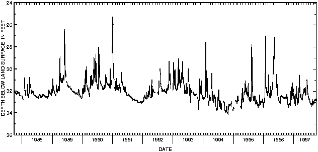

![]() U.S. Department of the Interior |
U.S. Geological Survey
U.S. Department of the Interior |
U.S. Geological Survey
URL: http://pubsdata.usgs.gov/pubs/wdr/1997/oh-97-2/sw97/delaware.html
Page Contact Information: GS Pubs Web Contact
Page Last Modified: Friday, 09-Nov-2018 11:45:53 EST
