Water Data Report 1997
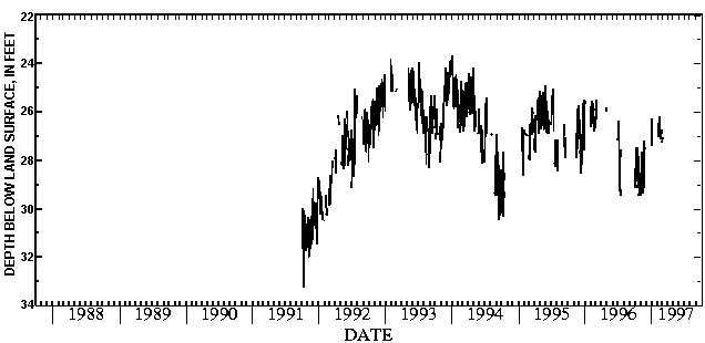
401826083255200. LOCAL NUMBER, U-4 LOCATION.--Lat 40018'26", long 83025'52", Hydrologic Unit 05060001, 2.6 mi southeast of Raymond. Owner: State of Ohio. AQUIFER.--Limestone of Silurian Age. WELL CHARACTERISTICS.--Drilled test artesian well, diameter 12 in., depth 350 ft, cased to 37 ft. INSTRUMENTATION.--Digital recorder--60-minute punch. DATUM.--Elevation of land-surface datum is 1,040 ft above sea level, from topographic map. Measuring point: Floor of instrument shelter 3.00 ft above land-surface datum. PERIOD OF RECORD.--January 1973 to current year. EXTREMES FOR PERIOD OF RECORD.--Maximum daily low, 25.79 ft below land-surface datum, Dec. 11, 1991; minimum daily low, 19.32 ft below land-surface datum, Feb. 24, 1975. DEPTH BELOW LAND SURFACE (WATER LEVEL) (FEET), WATER YEAR OCTOBER 1996 TO SEPTEMBER 1997 DAILY MAXIMUM VALUES DAY OCT NOV DEC JAN FEB MAR APR MAY JUN JUL AUG SEP 1 24.04 24.18 22.85 22.51 22.65 21.95 22.24 22.72 21.90 22.75 --- 24.27 2 24.20 24.23 22.60 22.42 22.74 21.87 22.29 22.76 20.85 22.74 --- 24.27 3 24.55 24.34 22.67 22.43 22.80 21.58 22.29 22.67 20.00 22.74 --- --- 4 24.55 24.35 22.98 22.47 22.72 21.70 22.23 22.16 20.27 22.84 --- --- 5 24.35 24.36 23.00 22.43 21.89 21.75 22.25 22.24 20.54 22.93 --- --- 6 24.30 24.32 22.89 22.50 22.07 21.59 22.24 22.26 20.72 23.00 --- --- 7 24.15 24.33 22.89 22.62 22.18 21.50 22.10 22.32 20.83 23.03 --- --- 8 24.05 24.28 22.94 22.74 22.35 21.53 22.30 22.42 20.99 23.07 --- --- 9 24.20 24.15 22.98 22.69 22.40 21.65 22.36 22.36 21.18 23.05 --- --- 10 24.40 24.15 23.15 22.53 22.40 21.75 22.44 22.20 21.33 23.11 --- --- 11 24.55 24.19 23.20 22.82 22.40 21.60 22.50 22.27 21.49 23.15 --- --- 12 24.45 24.23 23.10 23.01 22.62 21.37 22.52 22.31 21.55 23.17 --- --- 13 24.45 24.31 23.09 23.05 22.61 21.66 22.48 22.26 21.65 23.16 --- --- 14 24.40 24.39 22.85 23.05 22.62 21.76 22.45 22.18 21.73 23.18 --- --- 15 24.55 24.41 22.70 22.98 22.69 21.76 22.24 22.19 21.74 23.27 --- --- 16 24.45 24.40 22.83 22.93 22.81 21.35 22.38 22.23 21.74 23.37 --- --- 17 24.40 24.39 22.87 22.96 22.75 21.63 22.49 22.26 21.73 23.40 --- 24.45 18 24.35 24.43 22.82 23.06 22.63 21.65 22.50 22.43 21.78 23.41 --- 24.50 19 24.20 24.42 22.79 23.00 22.52 21.67 22.51 22.47 21.98 23.47 --- 24.48 20 24.20 24.38 21.89 23.13 22.47 21.70 22.43 22.40 22.04 23.54 --- 24.58 21 24.25 24.34 21.97 23.14 22.15 21.60 22.43 22.39 22.03 23.54 --- 24.62 22 24.30 24.27 22.19 23.03 22.42 21.55 22.45 22.38 22.01 23.55 --- 24.62 23 24.30 24.21 22.46 22.62 22.55 21.55 22.43 22.45 22.10 23.50 --- 24.57 24 24.10 24.22 22.51 22.56 22.57 21.71 22.42 22.55 22.10 23.56 --- 24.58 25 24.30 24.24 22.55 22.55 22.55 21.83 22.48 22.61 22.21 23.55 --- 24.48 26 24.45 24.29 22.57 22.71 22.40 22.00 22.46 22.61 22.27 23.53 --- 24.58 27 24.50 24.37 22.54 22.71 21.89 22.04 22.45 22.59 22.34 23.60 --- 24.59 28 24.55 24.37 21.95 22.55 21.98 21.93 22.48 22.53 22.34 23.65 --- 24.54 29 24.55 24.30 --- 22.55 --- 22.02 22.47 22.41 22.50 23.74 24.08 24.51 30 24.50 23.33 --- 22.53 --- --- 22.60 22.30 22.74 23.81 24.10 24.67 31 24.45 --- 22.52 22.45 --- 22.15 --- 22.29 --- 23.87 24.20 --- MAX 24.55 24.43 23.20 23.14 22.81 22.15 22.60 22.76 22.74 23.87 24.20 24.67 CAL YR 1996 LOW 24.55 WTR YR 1997 LOW 24.67402010083321900. LOCAL NUMBER, U-5 LOCATION.--Lat 40020'10", long 83032'19", Hydrologic Unit 05060001, east of East Liberty. Owner: Honda of America. AQUIFER.--Limestone of Silurian Age. WELL CHARACTERISTICS.--Drilled observation well, diameter 6 in., depth 145 ft, cased to 98 ft. INSTRUMENTATION.--Type F continuous recorder. DATUM.--Elevation of land-surface is 1085 ft above sea level, from topographic map. Measuring point: Floor of instrument shelter 4.00 ft. above land-surface datum. REMARKS.--Station operated by Ohio Department of Natural Resources, Division of Water. PERIOD OF RECORD.--October 1991 to current year. EXTREMES FOR PERIOD OF RECORD.--Maximum daily low, 33.25 ft below land-surface datum, Oct. 10, 1991; minimum daily low, 23.70 ft below land-surface datum, Jan. 4, 1994. DEPTH BELOW LAND SURFACE (WATER LEVEL) (FEET), WATER YEAR OCTOBER 1996 TO SEPTEMBER 1997 DAILY MAXIMUM VALUES DAY OCT NOV DEC JAN FEB MAR APR MAY JUN JUL AUG SEP 1 28.37 29.48 --- 26.62 --- 27.26 --- --- --- --- --- --- 2 28.65 29.42 --- 26.95 --- 27.05 --- --- --- --- --- --- 3 28.86 29.11 --- 27.40 --- --- --- --- --- --- --- --- 4 28.95 28.87 --- 27.18 --- --- --- --- --- --- --- --- 5 29.15 29.12 --- 26.27 --- --- --- --- --- --- --- --- 6 28.63 29.22 --- --- --- --- --- --- --- --- --- --- 7 27.47 29.16 --- --- --- --- --- --- --- --- --- --- 8 28.29 28.91 --- --- --- --- --- --- --- --- --- --- 9 28.54 28.61 --- --- 27.06 --- --- --- --- --- --- --- 10 28.80 27.65 --- --- 26.47 --- --- --- --- --- --- --- 11 28.89 28.37 --- --- 26.74 --- --- --- --- --- --- --- 12 28.47 28.74 --- --- 26.91 --- --- --- --- --- --- --- 13 27.45 28.88 --- --- 27.06 --- --- --- --- --- --- --- 14 28.18 29.08 --- --- 27.00 --- --- --- --- --- --- --- 15 28.72 29.29 --- --- 26.91 --- --- --- --- --- --- --- 16 28.96 29.36 --- --- 26.17 --- --- --- --- --- --- --- 17 29.14 29.03 --- --- 26.42 --- --- --- --- --- --- --- 18 29.17 28.57 --- --- 26.99 --- --- --- --- --- --- --- 19 28.67 29.04 --- --- 27.15 --- --- --- --- --- --- --- 20 27.82 29.15 --- --- 27.09 --- --- --- --- --- --- --- 21 28.66 28.86 --- --- 26.98 --- --- --- --- --- --- --- 22 28.90 28.17 --- --- 27.07 --- --- --- --- --- --- --- 23 29.08 27.63 --- --- 26.95 --- --- --- --- --- --- --- 24 29.19 27.19 --- --- 26.73 --- --- --- --- --- --- --- 25 29.48 27.56 --- --- 26.90 --- --- --- --- --- --- --- 26 29.12 27.85 --- --- 26.93 --- --- --- --- --- --- --- 27 28.50 --- --- --- --- --- --- --- --- --- --- --- 28 28.69 --- --- --- --- --- --- --- --- --- --- --- 29 28.90 --- --- --- --- --- --- --- --- --- --- --- 30 29.36 --- --- --- --- --- --- --- --- --- --- --- 31 29.39 --- --- --- --- --- --- --- --- --- --- --- MAX 29.48 29.48 --- 27.40 27.15 27.26 --- --- --- --- --- --- CAL YR 1996 LOW 29.48 WTR YR 1997 LOW 29.48

![]() U.S. Department of the Interior |
U.S. Geological Survey
U.S. Department of the Interior |
U.S. Geological Survey
URL: http://pubsdata.usgs.gov/pubs/wdr/1997/oh-97-2/sw97/union.html
Page Contact Information: GS Pubs Web Contact
Page Last Modified: Friday, 09-Nov-2018 14:36:58 EST
