The following list contains currently operated stage-only stations on streams within the State
of Georgia and its border with adjacent States. Click on the station name for a station summary
page in PDF format. Click on Datafile for a text file of
the historical data for that station.
Station
number | Station name and link to station
summary page
| Latitude | Longitude | Datafile
Link | Map Link |
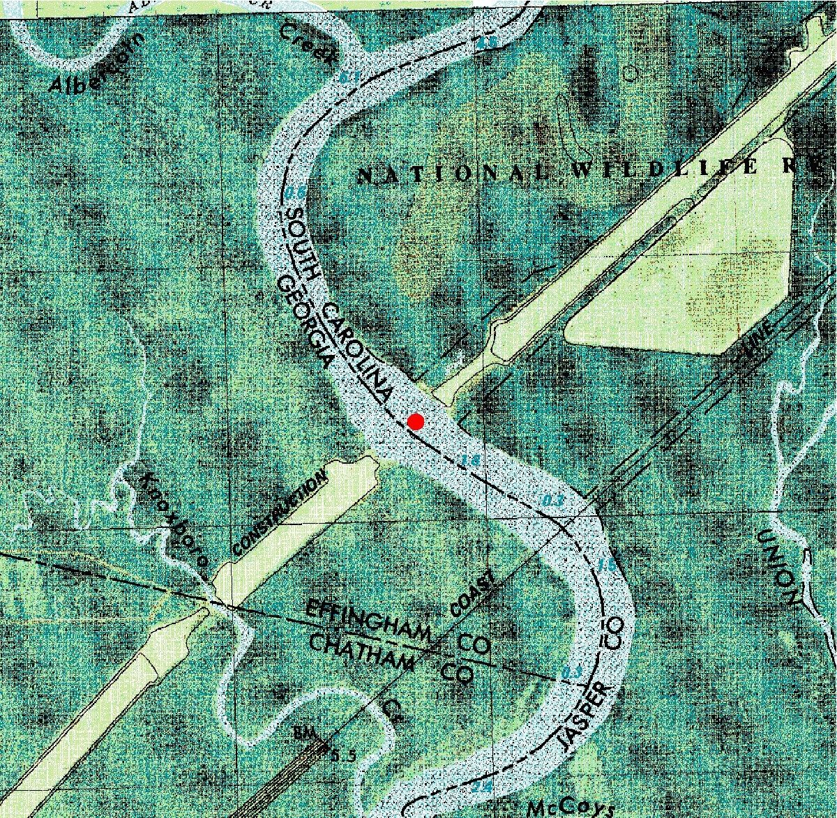
| 02198840 | Savannah River (I-95) near Port Wentworth, Ga. |
32°14'08" | 81°09'05" | Datafile | Map |
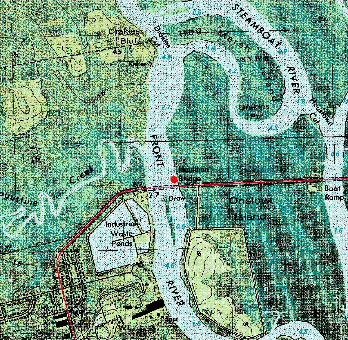
| 02198920 | Savannah (Front) River (U.S.17) at Port Wentworth, Ga. | 32°09'57" | 81°09'14" | Datafile | Map |
| 02198977 | Savannah River (Broad St) at Savannah, Ga. | 32°05'02" | 81°05'45" | Datafile | Map |
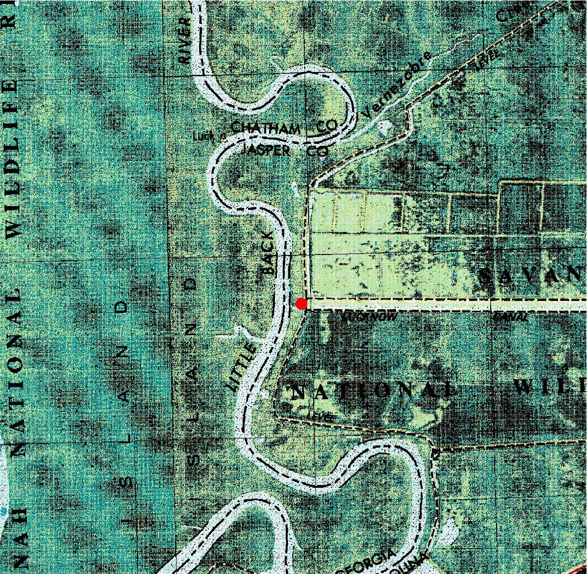
| 02198979 | Little Back River (Lucknow Cn) near Limehouse, S.C. | 32°11'05" | 81°07'02" | Datafile | Map |
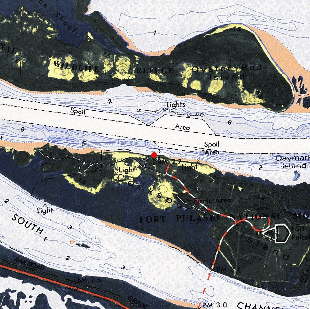
| 02198980 | Savannah River at Fort Pulaski, Ga. | 32°02'02" | 80°54'12" | Datafile | Map |
| 02226178 | East River at Mayors Point Terminal at Brunswick, Ga. | 31°08'38" | 81°29'49" | Datafile | Map |
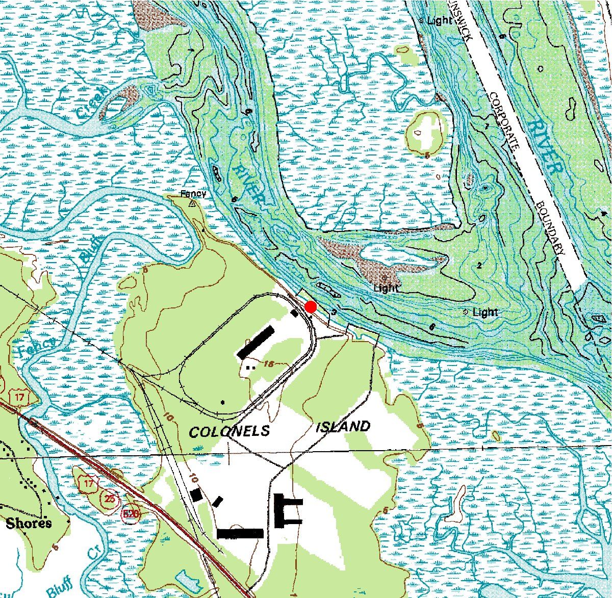
| 022261792 | S. Brunswick River at Colonels Island near Brunswick, Ga. | 31°07'55" | 81°32'13" | Datafile | Map |
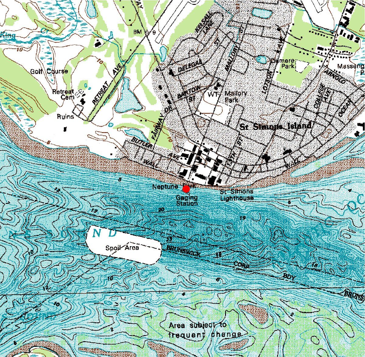
| 02226180 | Brunswick River at Village Pier at St. Simons Island, Ga. | 31°19'06" | 81°16'59" | Datafile | Map |
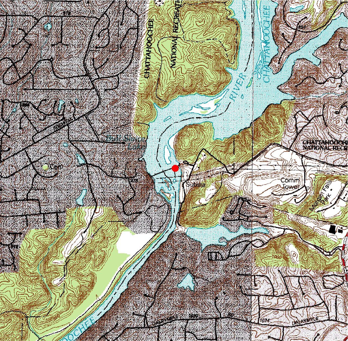
| 02335810 | Chattahoochee River at Morgan Falls Dam at Sandy Springs, Ga. | 33°58'06" | 84°22'58" | Datafile | Map |
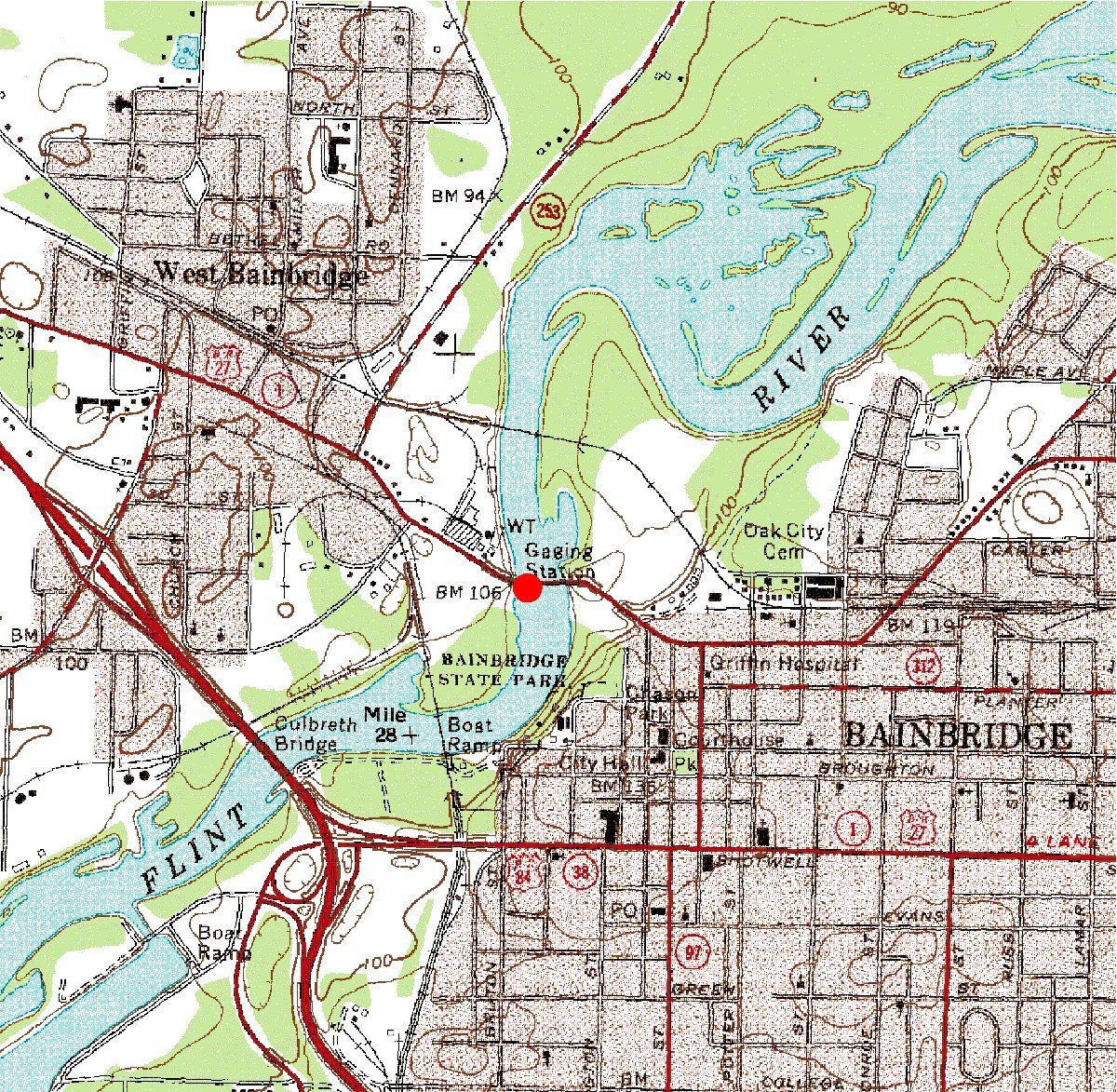
| 02356000 | Flint River at Bainbridge, Ga. | 30°54'41" | 84°34'48" | Datafile | Map |
| 02388530 | Oostanaula River (5th Ave Aux) at Rome, Ga. | 34°15'24" | 85°10'18" | Datafile | Map |
| 02394670 | Etowah River at State Route 61 near Cartersville, Ga. | 34°08'34" | 84°50'20" | Datafile | Map |
