Water Resources Investigations 98-4139
By Kathleen K. Fowler and Leslie D. Arihood
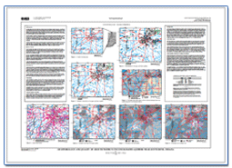
IntroductionThe water supply for the City of South Bend, Indiana, and much of surrounding St. Joseph County is provided by 36 municipal and community well fields. Some of these well fields are located near known or potential sources of ground-water contamination that could affect ground-water supplies in the near future. As population and industry grow, it will be necessary to find additional sources of water and determine their quantity and quality. Geohydrologic and water-quality data are available to identify areas for developing additional ground-water supplies, but these data have not been compiled into one source accessible to area water-resource managers. This report presents a compilation of these geohydrologic and water-quality data for the ground-water system in and near South Bend that can be used to identify potentially favorable areas for developing additional ground-water supplies for municipal use. The data were compiled by the U.S. Geological Survey, in cooperation with the South Bend Water Works, for a study area of approximately 535 square miles that includes all of St. Joseph County and the eastern part of La Porte County. A map format has been used to facilitate comparison between geohydrologic and water-quality information Previously published geologic maps and cross sections describe the geologic setting and aquifer deposits of the study area (Fenelon and others, 1992), the hydrogeology of northeastern St. Joseph County (Bayless and Arihood, 1996), and the ground-water quality of northeastern St. Joseph County (Fenelon and others, 1995). Beaty (1990) and Clendenon and Beaty (1987) produced water-resource-availability reports for the St. Joseph and Kankakee River Basins. |
To print plates 1,2, and 3 from Adobe Acrobat: The plates are 42" x 30" when printed "full size". To print them full size you will need to have access to a "plotter" or some other large format printing device.
1. Go to printer setup. To print them on whatever size paper is available: For additional information contact: Part or all of this report is presented in Portable Document Format (PDF); the latest version of Adobe Reader or similar software is required to view it. Download the latest version of Adobe Reader, free of charge. |
Suggested citation:
Fowler, K.K., and Arihood L.D., 1998, Geohydrology and quality of ground water in unconsolidated aquifers near South Bend, Indiana 1998: U.S. Geological Survey Water Resources Investigations Report 98-4139.

![]() U.S. Department of the Interior |
U.S. Geological Survey
U.S. Department of the Interior |
U.S. Geological Survey
[an error occurred while processing this directive]
URL: https://pubsdata.usgs.gov
Page Contact Information: Contact USGS
Page Last Modified: Wednesday, 07-Dec-2016 13:30:38 EST
