![]()
 |
Glacial Geology and Aquifer Characteristics of the Big River Area, Central Rhode IslandWater-Resources Investigations Report 01-4169 |
The Rhode Island Water Resources Board (RIWRB), which is responsible for developing the State's major water resources, is concerned that continued growth in demand for water in Rhode Island will severely stress water supplies. In the early 1960s, the State proposed construction of a surface-water reservoir in the Big River Basin in central Rhode Island to meet the growing water demands, but, to date (2001) the U.S. Environmental Protection Agency has not given approval for construction of this reservoir. As an alternative, the RIWRB would like to identify sites in the Big River area stream-aquifer system where high-yield supply wells can be constructed to meet future water demands. A cooperative study was initiated during the summer of 1995 by the U.S. Geological Survey (USGS) and the RIWRB to evaluate ground water as a source of water supply in the Big River area.
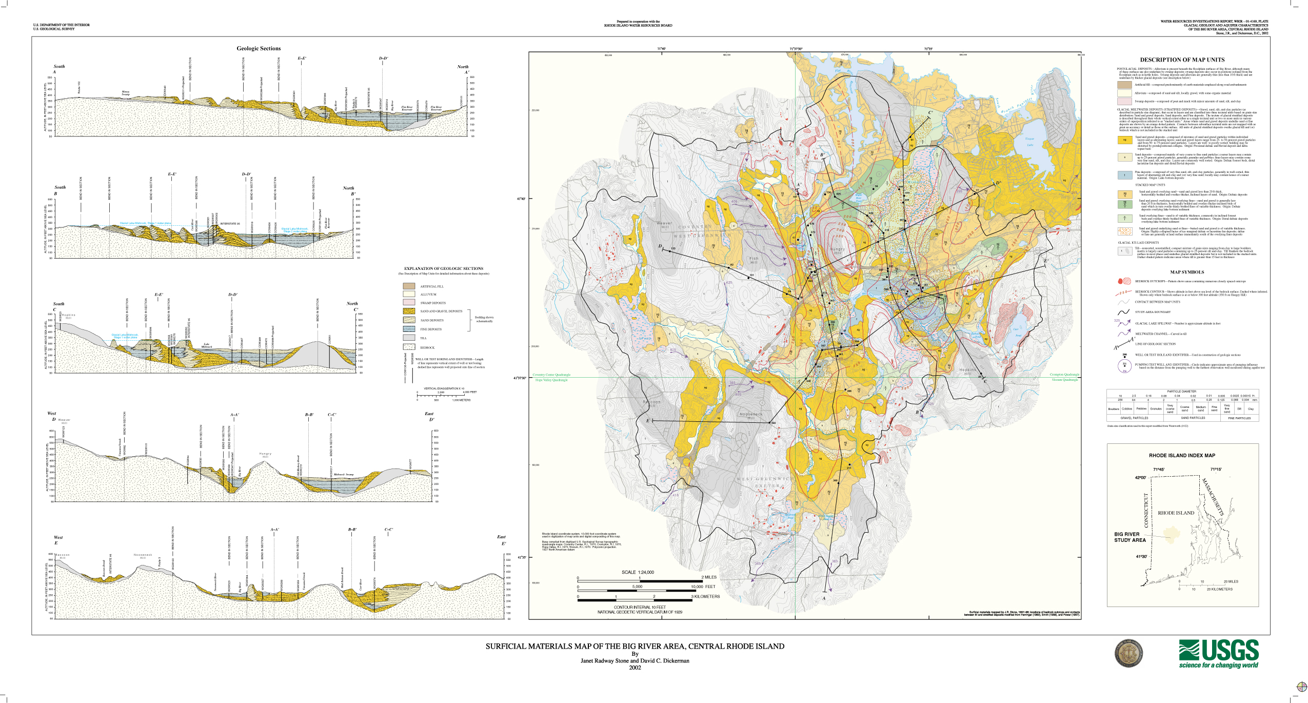
This report presents the initial results of a multi-year investigation of the three-dimensional characteristics of the surficial aquifer system based on geologic and geophysical field studies, and provides information needed to protect, develop, and manage the Big River area stream-aquifer system. The Big River area includes the entire Big River drainage basin and part of the Mishnock River drainage basin (fig. 1) and covers approximately 35 mi2, including parts of the towns of Coventry, Exeter, and West Greenwich. Most of the Big River area is in Kent County, with a small part in Washington County; it encompasses parts of the Coventry Center, Hope Valley, Crompton, and Slocum 7.5-minute quadrangles.
This investigation includes a characterization of the geologic framework and an evaluation of the hydraulic properties of the stream-aquifer system. The Big River area stream-aquifer system is the surficial aquifer and the network of rivers, brooks, lakes, and ponds that overlie and are in hydraulic connection with the aquifer. The surficial materials units of the Big River area and the accompanying bedrock-surface contours (pl. 1) were delineated on the basis of data collected during field mapping, seismic-refraction surveys, ground-penetrating radar surveys, logs from all available wells and test holes, and results of previous investigations.
Some streams in the study area lose surface water naturally to the underlying sand and gravel aquifer, whereas others lose water to the aquifer by induced infiltration of streamflow caused by ground-water withdrawals. Most large ground-water withdrawals are from public-supply wells in the sand and gravel aquifer in the Mishnock River Basin. Minimal ground-water withdrawals take place in the Big River Basin, because most of the land is designated as open space and protected from development by State law. The primary use of surface water in the study area is for recreation. Water from the Flat River Reservoir, the largest surface-water body in the study area, is used only for recreational purposes.
Introduction
Acknowledgments
Previous Studies
Topography and Drainage
Bedrock
Glacial Geology
Distribution of Surficial Materials
Till
Meltwater Deposits
Glacial Lakes and Ice-Margin Position during Deglaciation
Postglacial Deposits
Aquifer Characteristics
Till
Stratified DepositsHydraulic Properties of the Sand and Gravel Aquifer
Aquifer Tests
References
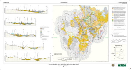
Surficial Materials Map of the Big River Area, central Rhode Island
This report is presented in Portable Document Format (PDF).
To
view and print PDFs, you might need to download Adobe Acrobat
Reader, available as freeware.
Users with visual
disabilities can visit the Adobe Accessibility site for conversion
tools and information to help make PDF files more accessible.
Outside Cover (sleeve) (251 KB) -- 1 page
Title Page and Table of Contents (126 KB) -- 3 pages
Body of Report (879 KB) -- 12 pages
Whole Report (1 MB) -- 16 pages
This report also includes a 29X53-inch map plate presented as a PDF file. It is also presented as an 11X17-inch JPG file.
| Plate -- PDF (4.7 MB) -- one
29X53-inch sheet Plate -- JPG (2 MB) -- one 11X17-inch tabloid page |
 |
| AccessibilityFOIAPrivacyPolicies and Notices | |
 |
|