USGS banner, with link to U.S. Geological Survey home page

Water-Resources Investigations Report 02-4030
Streamflow and Water-Quality Data for
Selected Watersheds in the Lake Tahoe Basin,
California and Nevada, through September 1998

table of contents iconTable of Contents
home page iconReport Home Page

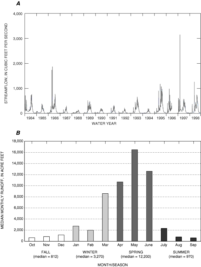
Figure 12. Plots for Upper Truckee River at South Lake Tahoe, a representative LTIMP gage station: (A) Annual discharge for water years 1984-98, and (B) Median monthly and seasonal runoff for water years 1988-98.

Plots for Upper Truckee River at South Lake Tahoe, a representative LTIMP gage station: (A) Annual discharge for water years 1984-98, and (B) Median monthly and seasonal runoff for water years 1988-98.