
In cooperation with the National Park Service
Baseline Assessment of Instream and Riparian-Zone Biological Resources on the Rio Grande in and Near Big Bend National Park, Texas
By J. Bruce Moring
U.S. Geological Survey
Water-Resources Investigations Report 02–4106
Document Accessibility: Adobe Systems Incorporated has information about PDFs and the visually impaired. This information provides tools to help make PDF files accessible. These tools convert Adobe PDF documents into HTML or ASCII text, which then can be read by a number of common screen-reading programs that synthesize text as audible speech. In addition, an accessible version of Acrobat Reader 5.0 for Windows (English only), which contains support for screen readers, is available. These tools and the accessible reader may be obtained free from Adobe at http://access.adobe.com/.
Contents
Abstract
Introduction
Methods of Assessment
Site Selection and Establishment
Stream-Habitat Assessment
Fish-Community Assessment
Benthic Macroinvertebrate Assessment
Data Management and Analysis
Results of Assessment
Stream Habitat
Fish Community
Benthic Macroinvertebrates
Summary
Selected References
FIGURES
1. Map showing baseline biological assessment sites in and near Big Bend National Park, Texas
26. Planimetric reach maps for:
2. Rio Grande above Colorado Canyon
3. Rio Grande below Santa Elena Canyon
4. Rio Grande at Johnson Ranch
5. Rio Grande above Boquillas Canyon
6. Rio Grande below Maravillas Creek (Black Gap Wildlife Refuge)
7. Graph showing reach sinuosity for five bioassessment reaches in and near Big Bend National Park, Texas
8. Graph showing reach slope for five bioassessment reaches in and near Big Bend National Park, Texas
913. Boxplots showing:
9. Streamflow velocity and selected stream-habitat measures for five bioassessment
reaches in and near Big
Bend National Park, Texas
10. Bank height to channel width ratio for five bioassessment reaches in and near Big Bend National Park, Texas
11. Embeddedness of cobble for five bioassessment reaches in and near Big Bend National Park, Texas
12. Gravel and larger particle size of bed material for five bioassessment
reaches in and near Big Bend National
Park, Texas
13. Bank vegetation coverage for five bioassessment reaches in and near Big Bend National Park, Texas
1426. Graphs showing:
14. Relative abundance of selected species of bank vegetation for five bioassessment reaches in and near
Big Bend National Park, Texas15. Number of fish species for five bioassessment reaches in and near Big Bend National Park, Texas
16. Number of fish versus number of species for five bioassessment reaches in and near Big Bend
National Park, Texas17. Menhinicks species richness for fish communities for five bioassessment reaches in and near Big
Bend National Park, Texas18. Results of cluster analysis to indicate similarity of fish communities for five bioassessment reaches in
and near Big Bend National Park, Texas19. Relative abundance of major fish families for five bioassessment reaches in and near Big Bend
National Park, Texas20. Relative abundance of major fish trophic groups for five bioassessment sites in and near Big Bend
National Park, Texas21. Results of cluster analysis to indicate similarity of benthic aquatic-insect communities for five
bioassessment reaches in and near Big Bend National Park, Texas22. Comparison of total aquatic-insect taxa and richest targeted habitat (RTH) aquatic-insect taxa for five
bioassessment reaches in and near Big Bend National Park, Texas23. Number of aquatic-insect taxa versus number of aquatic-insect individuals (richest targeted habitat
[RTH] samples only) for five bioassessment reaches in and near Big Bend National Park, Texas24. Mechanic's taxa richness for aquatic insects for five bioassessment reaches in and near Big Bend
National Park, Texas25. Relative abundance of ephemeroptera and trichoptera taxa (richest targeted habitat [RTH] samples
only) for five bioassessment reaches in and near Big Bend National Park, Texas26. Relative abundance of major aquatic-insect trophic groups (richest targeted habitat [RTH] samples
only) for five bioassessment reaches in and near Big Bend National Park, Texas
TABLES
1. Name, location, and general description of U.S. Geological
Survey Rio Grande bioassessment reaches in and near
Big Bend National Park, Texas
2. Stream-habitat measures for bioassessment reaches on the Rio Grande in and near Big Bend National Park, Texas
3. Fish taxa and individual counts of fish collected in the Rio Grande in and near Big Bend National Park, Texas
4. Taxonomic classification of benthic macroinvertebrates
and counts for individual taxa collected in the Rio Grande in
and near Big Bend National
Park, Texas
ABBREVIATIONS
cm, centimeters
km, kilometers
L, liters
m, meters
m/s, meters per second
m2, square meters
m3/s, cubic meters per second
µm, micrometers
mg/L, milligrams per liter
mm, millimeters
Abstract
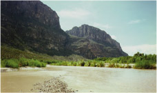
Five study sites, and a sampling reach within each site, were established on the Rio Grande in and near Big Bend National Park in 1999 to provide the National Park Service with data and information on the status of stream habitat, fish communities, and benthic macroinvertebrates. Differences in stream-habitat conditions and riparian vegetation reflect differences in surface geology among the five sampling reaches. In the most upstream reach, Colorado Canyon, where igneous rock predominates, streambed material is larger; and riparian vegetation is less diverse and not as dense as in the four other, mostly limestone reaches. Eighteen species of fish and a total of 474 individuals were collected among the five reaches; 348 of the 474 were minnows. The most fish species (15) were collected at the Santa Elena reach and the fewest species (9) at the Colorado Canyon and Johnson Ranch reaches. The fish community at Colorado Canyon was least like the fish communities at the four other reaches. Fish trophic structure reflected fish-community structure among the five reaches. Invertivores made up at least 60 percent of the trophic structure at all reaches except Colorado Canyon. Piscivores dominated the trophic structure at Colorado Canyon. At the four other reaches, piscivores were the smallest trophic group. Eighty percent of the benthic macroinvertebrate taxa collected were aquatic insects. Two species of blackfly were the most frequently collected invertebrate taxon. Net-spinning caddisflies were common at all reaches except Santa Elena. The aquatic-insect community at the Boquillas reach was least similar to the aquatic-insect community at the other reaches.
| AccessibilityFOIAPrivacyPolicies and Notices | |
 |
|