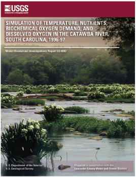
Water-Resources Investigation Report 03-4092
U.S. Geological Survey Water-Resources Investigation Report 03-4092, 123 pages (Published 2003)
By Toby D. Feaster, Paul A. Conrads, Wladmir B. Guimaraes, Curtis L. Sanders, Jr., and Jerad D. Bales
Prepared in cooperation with the Lancaster County Water and Sewer District
![]() This report is available online in pdf format (13 MB): USGS WRIR 03-4092
This report is available online in pdf format (13 MB): USGS WRIR 03-4092

Time-series plots of dissolved-oxygen concentrations were determined for various simulated hydrologic and point-source loading conditions along a free-flowing section of the Catawba River from Lake Wylie Dam to the headwaters of Fishing Creek Reservoir in South Carolina. The U.S. Geological Survey one-dimensional dynamic-flow model, BRANCH, was used to simulate hydrodynamic data for the Branched Lagrangian Transport Model. Waterquality data were used to calibrate the Branched Lagrangian Transport Model and included concentrations of nutrients, chlorophyll a, and biochemical oxygen demand in water samples collected during two synoptic sampling surveys at 10 sites along the main stem of the Catawba River and at 3 tributaries; and continuous water temperature and dissolved-oxygen concentrations measured at 5 locations along the main stem of the Catawba River.
A sensitivity analysis of the simulated dissolvedoxygen concentrations to model coefficients and data inputs indicated that the simulated dissolved-oxygen concentrations were most sensitive to watertemperature boundary data due to the effect of temperature on reaction kinetics and the solubility of dissolved oxygen. Of the model coefficients, the simulated dissolved-oxygen concentration was most sensitive to the biological oxidation rate of nitrite to nitrate.
To demonstrate the utility of the Branched Lagrangian Transport Model for the Catawba River, the model was used to simulate several water-quality scenarios to evaluate the effect on the 24-hour mean dissolved-oxygen concentrations at selected sites for August 24, 1996, as simulated during the model calibration period of August 23 – 27, 1996. The first scenario included three loading conditions of the major effluent discharges along the main stem of the Catawba River — (1) current load (as sampled in August 1996); (2) no load (all point-source loads were removed from the main stem of the Catawba River; loads from the main tributaries were not removed); and (3) fully loaded (in accordance with South Carolina Department of Health and Environmental Control National Discharge Elimination System permits). Results indicate that the 24-hour mean and minimum dissolved-oxygen concentrations for August 24, 1996, changed from the no-load condition within a range of - 0.33 to 0.02 milligram per liter and - 0.48 to 0.00 milligram per liter, respectively. Fully permitted loading conditions changed the 24-hour mean and minimum dissolved-oxygen concentrations from - 0.88 to 0.04 milligram per liter and - 1.04 to 0.00 milligram per liter, respectively. A second scenario included the addition of a point-source discharge of 25 million gallons per day to the August 1996 calibration conditions. The discharge was added at S.C. Highway 5 or at a location near Culp Island (about 4 miles downstream from S.C. Highway 5) and had no significant effect on the daily mean and minimum dissolved-oxygen concentration.
A third scenario evaluated the phosphorus loading into Fishing Creek Reservoir; four loading conditions of phosphorus into Catawba River were simulated. The four conditions included fully permitted and actual loading conditions, removal of all point sources from the Catawba River, and removal of all point and nonpoint sources from Sugar Creek. Removing the point-source inputs on the Catawba River and the point and nonpoint sources in Sugar Creek reduced the organic phosphorus and orthophosphate loadings to Fishing Creek Reservoir by 78 and 85 percent, respectively.
Abstract
Introduction
Purpose and scope
Description of study area
Previous studies
Approach
Acknowledgments
Data-collection methods and data analysis
Continuous measurements of water level, streamflow, water temperature, and dissolved-oxygen concentration
Discrete measurements of discharge
Estimation of subbasin inflow hydrographs
Unit-flow method
Flow-simulation method
Time of travel
Reaeration rates
Water-quality data
Laboratory quality assurance and quility control
Summary statistics
Substrate and sediment oxygen demand data
Point-source flow and water-quality data
Meteorological data
Channel geometry
Water-quality model description
Water-quality model calibration and validation
Computational grid
Water level and streamflow
Mass transport
Water temperature
Water quality
Sensitivity analysis
Water-quality model applications
Variation in point-source loading
Addition of point-source load
Phosphorous loading
Summary
Selected references
![]() This report is available online in pdf format (13 MB): USGS WRIR 03-4092
This report is available online in pdf format (13 MB): USGS WRIR 03-4092
To view the PDF document, you need the Adobe Acrobat® Reader installed on your computer. (A free copy of the Acrobat® Reader may be downloaded from Adobe Systems Incorporated.)
For more information, contact the South Carolina Publications Unit.
![]() USGS South Carolina Publications • South Carolina Water Science Center
USGS South Carolina Publications • South Carolina Water Science Center