Characterization of Aquifer Heterogeneity Using Cyclostratigraphy and Geophysical Methods in the Upper Part of the Karstic Biscayne Aquifer, Southeastern Florida—Water Resources Investigations Report 03-4208
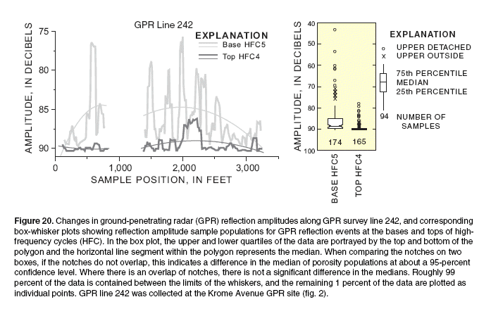
Back to Report

Figure 20. Changes in ground-penetrating radar (GPR) reflection amplitudes along GPR survey line 242, and corresponding
box-whisker plots showing reflection amplitude sample populations for GPR reflection events at the bases and tops of highfrequency
cycles (HFC). In the box plot, the upper and lower quartiles of the data are portrayed by the top and bottom of the
polygon and the horizontal line segment within the polygon represents the median. When comparing the notches on two
boxes, if the notches do not overlap, this indicates a difference in the median of porosity populations at about a 95-percent
confidence level. Where there is an overlap of notches, there is not a significant difference in the medians. Roughly 99
percent of the data is contained between the limits of the whiskers, and the remaining 1 percent of the data are plotted as
individual points. GPR line 242 was collected at the Krome Avenue GPR site (fig. 2).

Back to Report