
Water-Quality Trends for Streams and Reservoirs in the Research Triangle Area of North Carolina, 1983-95
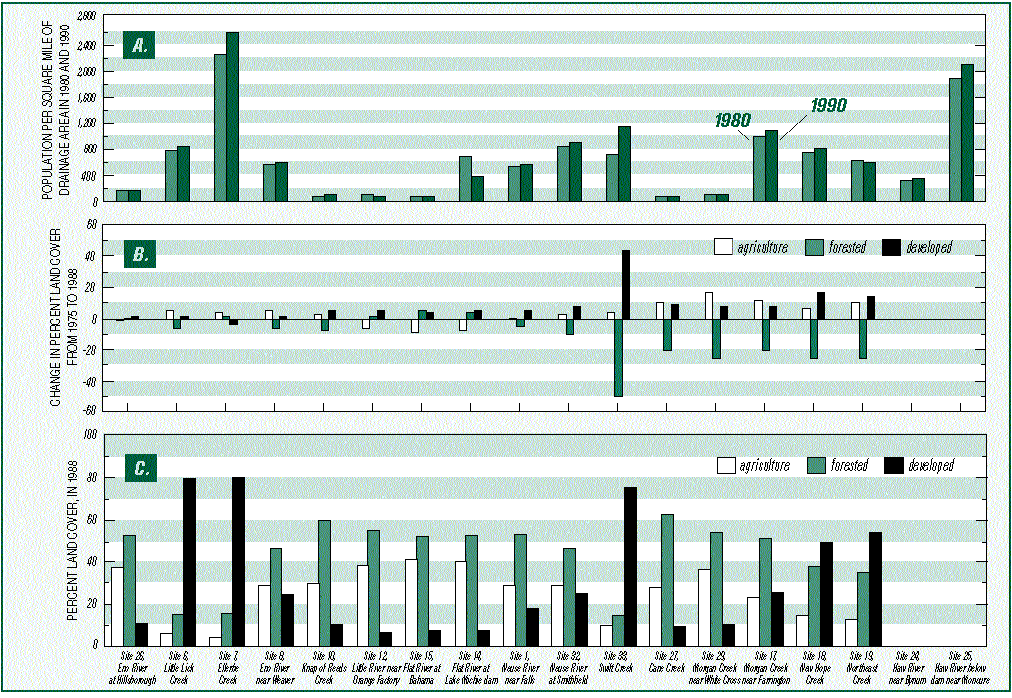
Figure 2. -- (A) Population per square mile of drainage basin area in 1980 and 1990, (B) change in percentage of land cover from 1975 to 1988, and (C) percentage of land cover in 1988 for generalized categories.
Last modified: Mon Jun 8 10:04:11 1998