|
WRIR 99-4079: Estimates of Ground-Water Discharge as Determined from Measurements of Evapotranspiration, Ash Meadows Area, Nye County, Nevada |
|
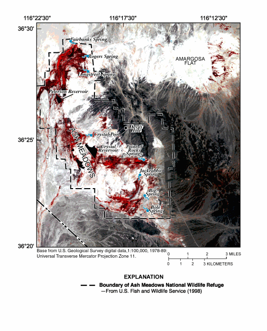
Figure 5. Color-infrared composite generated from June 13, 1992, thematic mapper image, Ash Meadows area, Nevada (scene identification number LT5040035009216510).