|
WRIR 99-4079: Estimates of Ground-Water Discharge as Determined from Measurements of Evapotranspiration, Ash Meadows Area, Nye County, Nevada |
|
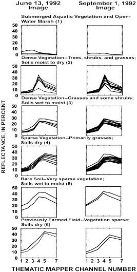
Figure 7. Spectral clusters and component spectral-response curves used in June and September 1992 image classifications for land covers of different vegetation and soil conditions equated with ground-water evapotranspiration in Ash Meadows area, Nevada. Integer in parenthesis is cluster number (table 1).