|
WRIR 99-4079: Estimates of Ground-Water Discharge as Determined from Measurements of Evapotranspiration, Ash Meadows Area, Nye County, Nevada |
|
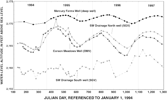
Figure 20.Annual water-level fluctuation in selected deep and shallow wells, April 10, 1994, to July 22, 1997. Circle represents periodic water-level measurement. Text in parentheses identifies associated ET unit or general well type (see table 3 for description of ET units).