 (Click on image for a larger version, 103K) |
| Figure 8. Example of study designs for a Study- Unit Survey and Land-Use Study, San Joaquin/ Tulare Basins Study Unit. |

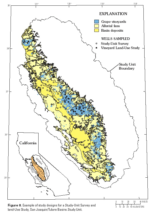
The priority of potential Land-Use Studies is based on a combination of Study-Unit and National Synthesis priorities. Factors considered in assigning priorities include importance of the land-use setting to used ground water in the Study Unit, contamination potential of the targeted land use, geographic correspondence to subunits concurrently sampled as part of the Study-Unit Survey, geographic correspon-dence to surface-water studies, and National Synthesis plans for comparisons among land-use settings of regional and national importance. The top two to four land-use settings are chosen for investigation. An example of the geographic relation of Land-Use Study areas to the Study-Unit Survey is shown by the study design in figure 8 for the San Joaquin/Tulare Basins Study Unit. The large vineyard area in the southern part of the Study Unit was not included in the Land-Use Study because of a much different hydrogeologic setting.
(Click on image for a larger version, 103K) |
| Figure 8. Example of study designs for a Study- Unit Survey and Land-Use Study, San Joaquin/ Tulare Basins Study Unit. |
Many, if not most, land-use settings defined for study are not single, homogeneous, contiguous areas but exist in multiple distinct "islands" or are intermingled with other land uses. In the study approach, the selection of sampling wells targets all occurrences of the defined setting rather than a representative subarea. A possible exception would be if a large (greater than 75-percent) majority of the targeted setting is in a single area or a few large contiguous areas, but with complex boundaries and small independent areas scattered around. Because of the increased uncertainty about land-use influences near boundaries, these small, independent areas with complex boundaries sometimes are excluded.
Usually in the mapped areas of the targeted land-use setting, land use is not truly homogenous, and more than one land use can be near a well. In evaluating the effects of land use on ground-water quality, the most reliable approach is to select wells located in recharge areas, screened near the water table, and directly downgradient from the specific targeted land-use setting. This approach helps avoid the influence of other land-use activities and complications from upward movement of water that originated in distant areas. Because land use can change with time, sampling locations are selected where it has been stable over the past decade.
These restrictions lead to very selective choices of wells to sample. The wells sampled for the Land-Use Studies have short (ideally less than 3 m in length) open intervals located near the top of unconfined aquifers. Only wells located in recharge areas under-lying or immediately downgradient from the land use of interest are selected. Ideally, they are observation wells or low-capacity existing wells to avoid the complexities of determining contributing areas to heavily pumped wells. Many wells are installed by NAWQA to meet these criteria.
Last modified: 3:45 EDT 22jun98 klf