
Water Quality in the Western Lake Michigan Drainages, Wisconsin and Michigan, 1992-95
Table of contents || Previous section
GLOSSARY
The terms in this glossary were compiled from numerous sources. Some definitions have been modified and may not be the only valid ones for these terms.
- Alluvial aquifer
- A water-bearing deposit of unconsolidated material (sand and gravel) left behind by a river or other flowing water.
- Anthropogenic
- Occurring because of, or influenced by, human activity.
- Aquatic-life criteria
- Water-quality guidelines for protection of aquatic life. Often refers to U.S. Environmental Protection Agency water-quality criteria for protection of aquatic organisms. See also Water-quality guidelines and Water-quality criteria.
- Aquifer
- A water-bearing layer of soil, sand, gravel, or rock that will yield usable quantities of water to a well.
- Atmospheric deposition
- The transfer of substances from the air to the surface of the Earth, either in wet form (rain, fog, snow, dew, frost, hail) or in dry form (gases, aerosols, particles).
- Base flow
- Sustained, low flow in a stream; ground-water discharge is the source of base flow in most places.
- Basin
- See Drainage basin.
- Bedrock
- General term for consolidated (solid) rock that underlies soils or other unconsolidated material.
- Bed sediment
- The material that temporarily is stationary in the bottom of a stream or other watercourse.
- Bed sediment and tissue studies
- Assessment of concentrations and distributions of trace elements and hydrophobic organic contaminants in streambed sediment and tissues of aquatic organisms to identify potential sources and to assess spatial distribution.
- Benchmark streams
- Sites selected to represent standards of reference for comparison to other streams in similar physical settings.
- Benthic
- Refers to plants or animals that live on the bottom of lakes, streams, or oceans.
- Benthic invertebrates
- Insects, mollusks, crustaceans, worms, and other organisms without a backbone that live in, on, or near the bottom of lakes, streams, or oceans.
- Bioaccumulation
- The biological sequestering of a substance at a higher concentration than that at which it occurs in the surrounding environment or medium. Also, the process whereby a substance enters organisms through the gills, epithelial tissues, dietary, or other sources.
- Bioavailability
- The capacity of a chemical constituent to be taken up by living organisms either through physical contact or by ingestion.
- Biota
- Living organisms.
- Blue-baby syndrome
- A condition that can be caused by ingestion of high amounts of nitrate resulting in the blood losing its ability to effectively carry oxygen. It is most common in young infants and certain elderly people.
- Carbonate rocks
- Rocks (such as limestone or dolostone) that are composed primarily of minerals (such as calcite and dolomite) containing the carbonate ion (CO3-2).
- Climate
- The sum total of the meteorological elements that characterize the average and extreme conditions of the atmosphere over a long period of time at any one place or region of the Earth's surface.
- Community
- In ecology, the species that interact in a common area.
- Concentration
- The amount or mass of a substance present in a given volume or mass of sample. Usually expressed as micrograms per liter (water sample) or micrograms per kilogram (sediment or tissue sample).
-
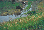 (203,641 bytes)
Cattle may destroy habitat and increase nutrient concentrations in streams.
- Confined aquifer (artesian aquifer)
- An aquifer that is completely filled with water under pressure and that is overlain by material that restricts the movement of water.
- Confining layer
- A layer of sediment or lithologic unit of low permeability that bounds an aquifer.
- Constituent
- A chemical or biological substance in water, sediment, or biota that can be measured by an analytical method.
- Contamination
- Degradation of water quality compared to original or natural conditions due to human activity.
- Criterion
- A standard rule or test on which a judgment or decision can be based.
- Cubic foot per second (ft3/s, or cfs)
- Rate of water discharge representing a volume of 1 cubic foot passing a given point during 1 second, equivalent to approximately 7.48 gallons per second or 448.8 gallons per minute or 0.02832 cubic meter per second.
- Degradation products
- Compounds resulting from transformation of an organic substance through chemical, photochemical, and/or biochemical reactions.
- DDT
- Dichloro-diphenyl-trichloroethane. An organochlorine insecticide no longer registered for use in the United States.
- Discharge
- Rate of fluid flow passing a given point at a given moment in time, expressed as volume per unit of time.
- Dissolved constituent
- Operationally defined as a constituent that passes through a 0.45-micrometer filter.
- Dissolved solids
- Amount of minerals, such as salt, that are dissolved in water; amount of dissolved solids is an indicator of salinity or hardness.
- Drainage basin
- The portion of the surface of the Earth that contributes water to a stream through overland runoff, including tributaries and impoundments.
- Drinking-water standard or guideline
- A threshold concentration in a public drinking-water supply, designed to protect human health. As defined here, standards are U.S. Environmental Protection Agency regulations that specify the maximum contamination levels for public water systems required to protect the public welfare; guidelines have no regulatory status and are issued in an advisory capacity.
- Ecological studies
- Studies of biological communities and habitat characteristics to evaluate the effects of physical and chemical characteristics of water and hydrologic conditions on aquatic biota and to determine how biological and habitat characteristics differ among environmental settings in NAWQA Study Units.
- Effects Range Low (ERL)
- Concentration below which effects are rarely observed or predicted among sensitive life stages and (or) species of biota for Sediment Effect Concentrations used to evaluate sediment concentrations of trace elements and synthetic organic compounds.
- Effects Range Median (ERM)
- Concentration above which effects are frequently or always observed among most species of biota for Sediment Effect Concentrations used to evaluate sediment concentrations of trace elements and synthetic organic compounds.
- Environmental setting
- Land area characterized by a unique combination of natural and human-related factors, such as row-crop cultivation or glacial-till soils.
- Equal-width increment (EWI) sample
- A composite sample across a section of stream with equal spacing between verticals and equal transit rates within each vertical that yields a representative sample of stream conditions.
- Eutrophication
- The process by which water becomes enriched with plant nutrients, most commonly phosphorus and nitrogen.
- Fertilizer
- Any of a large number of natural or synthetic materials, including manure and nitrogen, phosphorus, and potassium compounds, spread on or worked into soil to increase its fertility.
- Fish community
- See Community.
- Fixed Sites
- Sites on streams at which streamflow is measured and samples are collected for temperature, salinity, suspended sediment, major ions and metals, nutrients, and organic carbon to assess the broad-scale spatial and temporal character and transport of inorganic constituents of streamwater in relation to hydrologic conditions and environmental settings. See also Intensive Fixed Sites.
- Flow path
- An underground route for ground-water movement, extending from a recharge (intake) zone to a discharge (output) zone such as a shallow stream.
- Flow path study
- Network of clustered wells located along a flowpath extending from a recharge zone to a discharge zone, preferably a shallow stream. The studies examine the relations of land-use practices, ground-water flow, and contaminant occurrence and transport. These studies are located in the area of one of the land-use studies.
- Glacial till
- An unsorted deposit of a wide range of grain sizes directly related to a glacier.
- Grab sample
- A sample collected from one to three points in a stream using a Van Dorn sampler.
- Ground water
- In general, any water that exists beneath the land surface, but more commonly applied to water in fully saturated soils and geologic formations.
- Habitat
- The part of the physical environment where plants and animals live.
- Herbicide
- A chemical or other agent applied for the purpose of killing undesirable plants. See also Pesticide.
- Indicator Sites
- Stream sampling sites located at outlets of drainage basins with relatively homogeneous land use and physiographic conditions; most Indicator-Site basins have drainage areas ranging from 20 to 200 square miles.
- Insecticide
- A substance or mixture of substances intended to destroy or repel insects.
- Integrator or Mixed-Use Site
- Stream sampling site located at an outlet of a drainage basin that contains multiple environmental settings. Most Integrator Sites are on major streams with relatively large drainage areas.
- Intensive Fixed Sites
- Fixed Sites with increased sampling frequency during selected seasonal periods and analysis of dissolved pesticides for 1 year. Most NAWQA Study Units have one to two Integrator Intensive Fixed Sites and one to four Indicator Intensive Fixed Sites.
- Land-use Study
- A network of shallow wells in an area having a relatively uniform land use. These studies are to be as a subset of the Study-Unit Survey and have the goal of relating the quality of shallow ground water to land use.
- Lowest Effect Level (LEL)
- Concentration that 95% of the benthic biota can tolerate as part of the Ontario Ministry of Environment and Energy's established guidelines for evaluating sediment concentration of trace elements and synthetic organic compounds as based on freshwater biota.
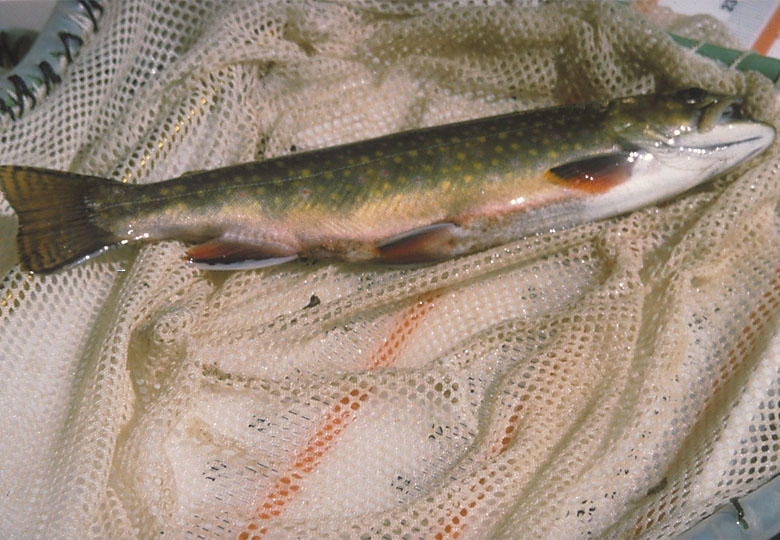
-
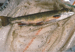 (125,362 bytes)
Indexes of biological integrity were calculated for fish, algae, invertebrates, and habitat at 28 sites in the study area.
- Major ions
- Constituents commonly present in concentrations exceeding 1.0 milligram per liter. Dissolved cations generally are calcium, magnesium, sodium, and potassium; the major anions are sulfate, chloride, fluoride, nitrate, and those contributing to alkalinity, most generally assumed to be bicarbonate and carbonate.
- Maximum contaminant level (MCL)
- Maximum permissible level of a contaminant in water that is delivered to any user of a public water system. MCLs are enforceable standards established by the U.S. Environmental Protection Agency.
- Median
- The middle or central value in a distribution of data ranked in order of magnitude. The median is also known as the 50th percentile.
- Metabolite
- A substance produced in or by biological processes.
- Micrograms per liter (µg/L)
- A unit expressing the concentration of constituents in solution as weight (micrograms) of solute per unit volume (liter) of water; equivalent to one part per billion in most stream water and ground water. One thousand micrograms per liter equals 1 mg/L.
- Milligrams per liter (mg/L)
- A unit expressing the concentration of chemical constituents in solution as weight (milligrams) of solute per unit volume (liter) of water; equivalent to one part per million in most streamwater and ground water. One thousand micrograms per liter equals 1 mg/L.
- Monitoring
- Repeated observation or sampling at a site, on a scheduled or event basis, for a particular purpose.
- Monitoring well
- A well designed for measuring water levels and testing ground-water quality.
- Nitrate
- An ion consisting of nitrogen and oxygen (NO3-). Nitrate is a plant nutrient and is very mobile in soils.
- Nutrient
- Element or compound essential for animal and plant growth. Common nutrients in fertilizer include nitrogen, phosphorus, and potassium.
- Organochlorine compound
- Synthetic organic compounds containing chlorine. As generally used, term refers to compounds containing mostly or exclusively carbon, hydrogen, and chlorine. Examples include organochlorine insecticides, polychlorinated biphenyls, and some solvents containing chlorine.
- Permeable
- The ability to allow fluids or gases to move through material such as ground water moving through a porous aquifer.
- Pesticide
- A chemical applied to crops, rights of way, lawns, or residences to control weeds, insects, fungi, nematodes, rodents or other "pests."
- Phosphorus
- A nutrient essential for growth that can play a key role in stimulating aquatic growth in lakes and streams.
- Picocurie (pCi)
- One trillionth (10-12) of the amount of radioactivity represented by a curie (Ci). A curie is the amount of radioactivity that yields 3.7 x 10¹⁰ radioactive disintegrations per second (dps). A picocurie yields 2.22 disintegrations per minute (dpm) or 0.037 dps.
- Point source
- A source at a discrete location such as a discharge pipe, drainage ditch, tunnel, well, concentrated livestock operation, or floating craft.
- Pollutant
- Any substance that, when present in a hydrologic system at sufficient concentration, degrades water quality in ways that are or could become harmful to human and(or) ecological health or that impair the use of water for recreation, agriculture, industry, commerce, or domestic purposes.
- Polychlorinated biphenyl (PCB)
- A mixture of chlorinated derivatives of biphenyl, marketed under the trade name Aroclor with a number designating the chlorine content (such as Aroclor 1260). PCBs were used in transformers and capacitors for insulating purposes and in gas pipeline systems as a lubricant. Further sale for new use was banned by law in 1979.
- Precipitation
- Any or all forms of water particles that fall from the atmosphere, such as rain, snow, hail, and sleet.
- Radon
- A naturally occurring, colorless, odorless, radioactive gas formed by the disintegration of the element radium; damaging to human lungs when inhaled.
- Recharge
- Water that infiltrates the ground and reaches the saturated zone.
- Retrospective analysis
- Review and analysis of existing data in order to address NAWQA objectives, to the extent possible, and to aid in the design of NAWQA studies.
- Riffle
- A shallow part of the stream where water flows swiftly over completely or partially submerged obstructions to produce surface agitation.
- Runoff
- Excess rainwater or snowmelt that is transported to streams by overland flow, tile drains, or ground water.
- Secondary Maximum Contaminant Level (SMCL)
- The maximum contamination level in public water systems that, in the judgement of the U.S. Environmental Protection Agency (USEPA), are required to protect the public welfare. SMCLs are secondary (nonenforceable) drinking water regulations established by the USEPA for contaminants that may adversely affect the odor or appearance of such water.
- Sediment
- Particles, derived from rocks or biological materials, that have been transported by a fluid or other natural process, suspended or settled in water.
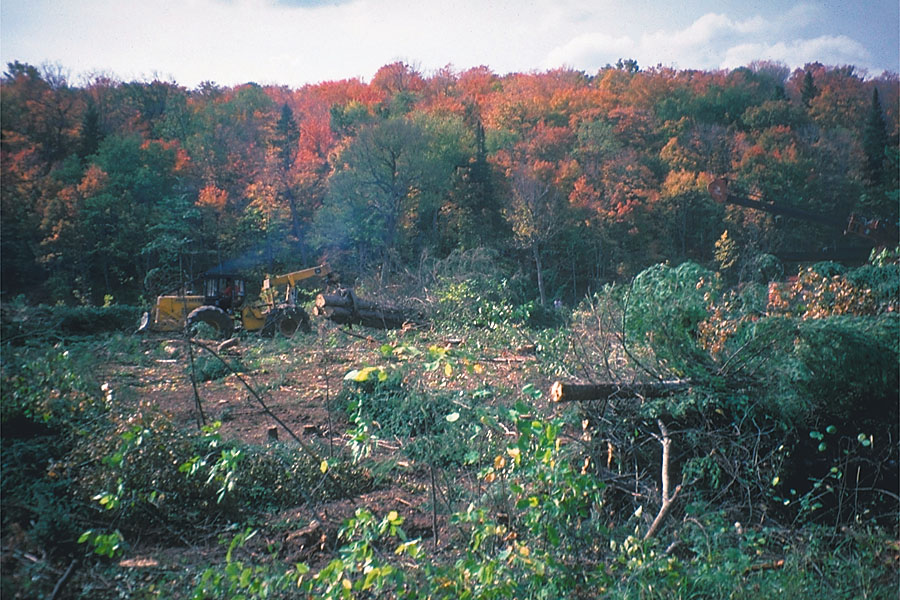
-
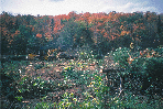 (201,671 bytes)
Logging can increase sediment concentrations and reduce habitat in streams.
- Semivolatile organic compound (SVOC)
- Operationally defined as a group of synthetic organic compounds that are solvent-extractable and can be determined by gas chromatography/mass spectrometry. SVOCs include phenols, phthalates, and polycyclic aromatic hydrocarbons (PAHs).
- Severe Effect Level (SEL)
- Concentration at which pronounced effects can be expected for the benthic community as part of the Ontario Ministry of Environment and Energy's established guidelines for evaluating sediment concentration of trace elements and synthetic organic compounds as based on freshwater biota.
- Streamflow
- A type of channel flow, applied to that part of surface runoff in a stream whether or not it is affected by diversion or regulation.
- Study Unit
- A major hydrologic system of the United States in which NAWQA studies are focused. Study Units are geographically defined by a combination of ground- and surface-water features and generally encompass more than 4,000 square miles of land area.
- Surface water
- An open body of water, such as a lake, river, or stream.
- Surficial deposits
- Material, usually unconsolidated, overlying bedrock. Surficial deposits in the Study Unit are primarily glacial and alluvial related.
- Suspended (as used in tables of chemical analyses)
- The amount (concentration) of undissolved material in a water-sediment mixture. It is associated with the material retained on a 0.45- micrometer filter.
- Tissue study
- The assessment of concentrations and distributions of trace elements and certain organic contaminants in tissues of aquatic organisms.
- Trace element
- An element found in only minor amounts (concentrations less than 1.0 milligram per liter) in water or sediment; includes arsenic, cadmium, chromium, copper, lead, mercury, nickel, and zinc.
- Urban Site
- A site that has greater than 50 percent urbanized and less than 25 percent agricultural area.
- Water-quality criteria
- Specific levels of water quality which, if reached, are expected to render a body of water unsuitable for its designated use. Commonly refers to water-quality criteria established by the U.S. Environmental Protection Agency. Water-quality criteria are based on specific levels of pollutants that would make the water harmful if used for drinking, swimming, farming, fish production, or industrial processes.
- Water-quality guidelines
- Specific levels of water quality which, if reached, may adversely affect human health or aquatic life. These are nonenforceable guidelines issued by a governmental agency or other institution.
- Water-quality standards
- State-adopted and U.S. Environmental Protection Agency-approved ambient standards for water bodies. Standards include the use of the water body and the water-quality criteria that must be met to protect the designated use or uses.
- Watershed
- See Drainage basin.
- Water table
- The point below the land surface where ground water is first encountered and below which the earth is saturated. Depth to the water table varies widely across the country.
- Wetlands
- Ecosystems whose soil is saturated for long periods seasonally or continuously including marshes, swamps, and ephemeral ponds.
U.S. Geological Survey Circular 1156
Table of contents || Previous section
Suggested citation:
C. A. Peters, D. M. Robertson, D. A. Saad, D. J. Sullivan, B. C. Scudder, F. A. Fitzpatrick, K. D. Richards, J. S. Stewart, S. A. Fitzgerald, and B. N. Lenz, 1998, U.S. Geological Survey Circular 1156, on line at <URL: https://water.usgs.gov/pubs/circ1156>, updated June 11, 1998
 (203,641 bytes)
 (125,362 bytes)
 (201,671 bytes)