Data Series 985
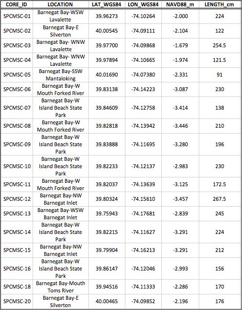
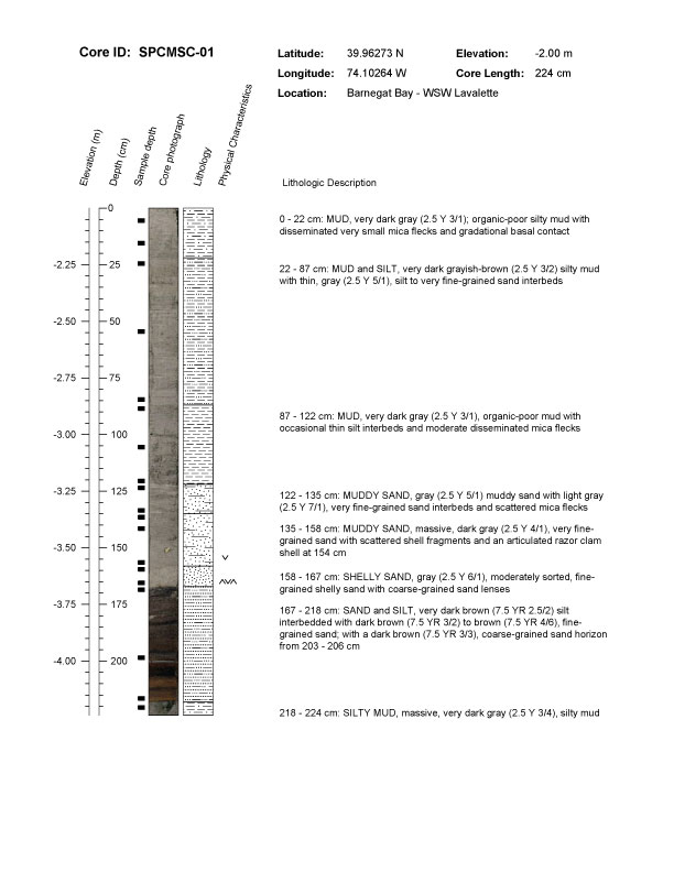
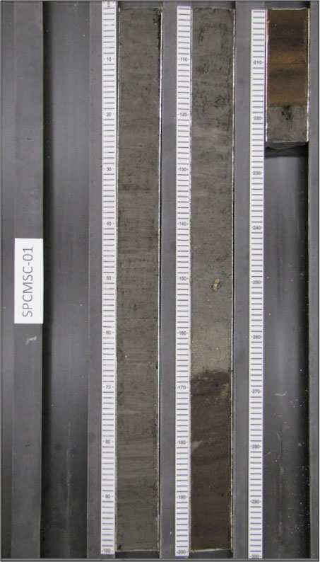
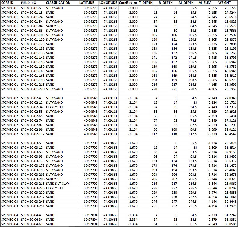
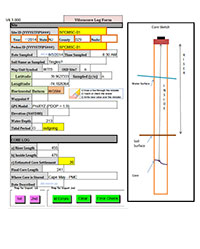
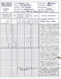
| Data Products and Downloads Figure 3. Map showing locations of vibracores collected from Barnegat Bay, New Jersey. Base map modified from U.S. Geological Survey (USGS) 1:100,000 scale digital data overlaid with a USGS 10-meter resolution terrain model and 1-meter resolution backscatter mosaic (Andrews and others, 2015a). Darker colors on backscatter mosaic represent finer-grained sediments. Click on a core location to view the core log for that core. The sediment data described in this report, including descriptive core logs, core photographs, processed grain-size data, sample location maps, and Geographic Information System (GIS) data files with accompanying formal Federal Geographic Data Committee (FDGC) metadata, can be downloaded from the Data Download Table. Additionally, the core logs for each core can be viewed by clicking on the core number on the sample location map (fig. 3). Core logs are provided in Portable Document Format (PDF) format and can be viewed using the free software Adobe Reader. The core photographs are provided as high-resolution Joint Photographic Experts Group (JPEG) images and can be viewed using standard image viewing software. The sample locations table and grain-size spreadsheet were created in Microsoft Excel 2010 and can be opened using Microsoft Excel 2007 or higher; these data can also be viewed using the free Microsoft Excel Viewer. The sample locations are also provided as GIS data files in Esri shapefile (SHP) and Keyhole Markup Language (KML) format; these files can be opened using the free ArcGIS Explorer or Google Earth GIS viewers. All sample locations and GIS data files presented this report use the coordinate system World Geodetic System of 1984 (WGS84), and all elevations are North American Vertical Datum of 1988 (NAVD88) orthometric heights, derived using the GEOID09 geoid model. Data Download Table
Supplemental Information
|

![]() U.S. Department of the Interior |
U.S. Geological Survey
U.S. Department of the Interior |
U.S. Geological Survey
URL: http://pubsdata.usgs.gov/pubs/ds/0985/ds985_data.html
Page Contact Information: GS Pubs Web Contact
Page Last Modified: Monday, 28-Nov-2016 20:47:56 EST