Data Series 1007
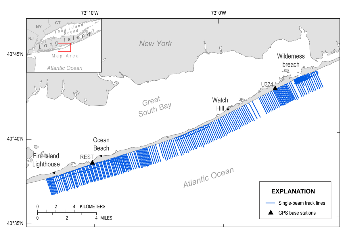
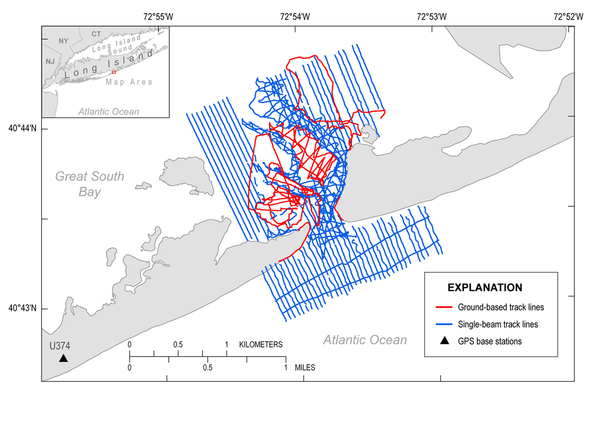
| Survey OverviewOn the shoreface, shore-perpendicular transects were surveyed using single-beam echosounders and Global Positioning Systems (GPS) mounted on two personal watercraft (PWC). The transects were spaced 100 meters (m) apart along 31.8 kilometers (km) of coastline that extends eastward from the eastern boundary of Robert Moses State Park to the Otis Pike Fire Island High Dune Wilderness eastward of the wilderness breach (figs. 1 and 3). Each transect stretched from the shallowest obtainable surf zone depth to approximately 2 km offshore. Within the wilderness breach, shore-perpendicular transects extended from approximately 2 km seaward of the pre-Hurricane Sandy shoreline and 1.8 km into the bay (fig. 4). Additional survey lines were collected within the wilderness breach that extended 500 m shoreward of the pre-Hurricane Sandy shoreline and 1.8 km into the bay. The additional transects were spaced 50 m apart and covered the wilderness breach ebb-tidal delta, the primary breach channel, and most of the flood-tidal delta. Elevation data were collected with a backpack GPS system on subaerial shoals and in the shallow flood shoals where the PWC were unable to survey (fig. 4).
|

![]() U.S. Department of the Interior |
U.S. Geological Survey
U.S. Department of the Interior |
U.S. Geological Survey
URL: http://pubsdata.usgs.gov/pubs/ds/1007/ds1007_overview.html
Page Contact Information: GS Pubs Web Contact
Page Last Modified: Monday, 28-Nov-2016 20:51:25 EST