Data Series 1045
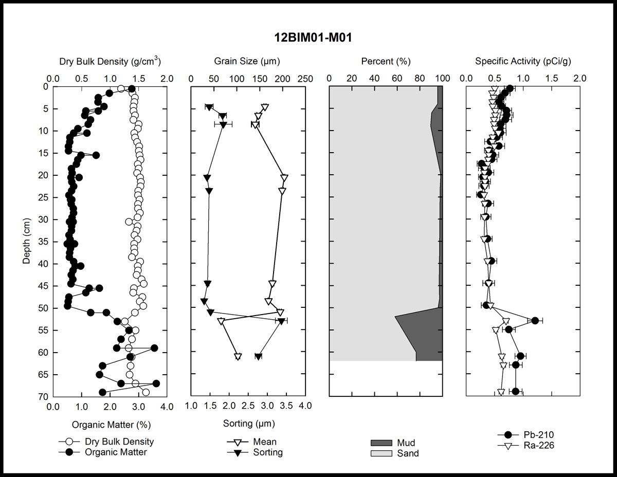
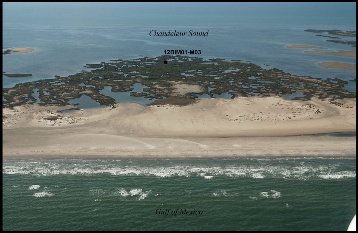
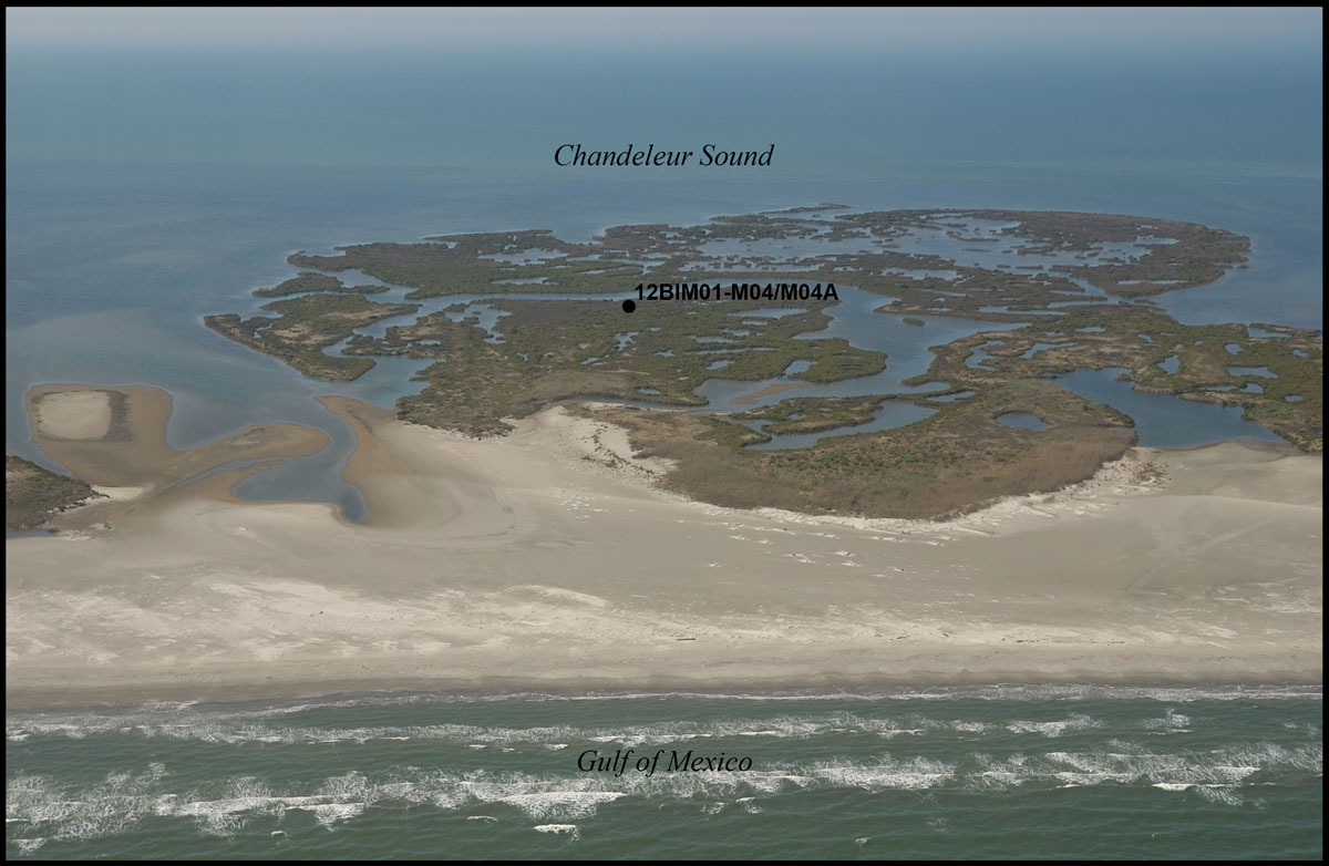
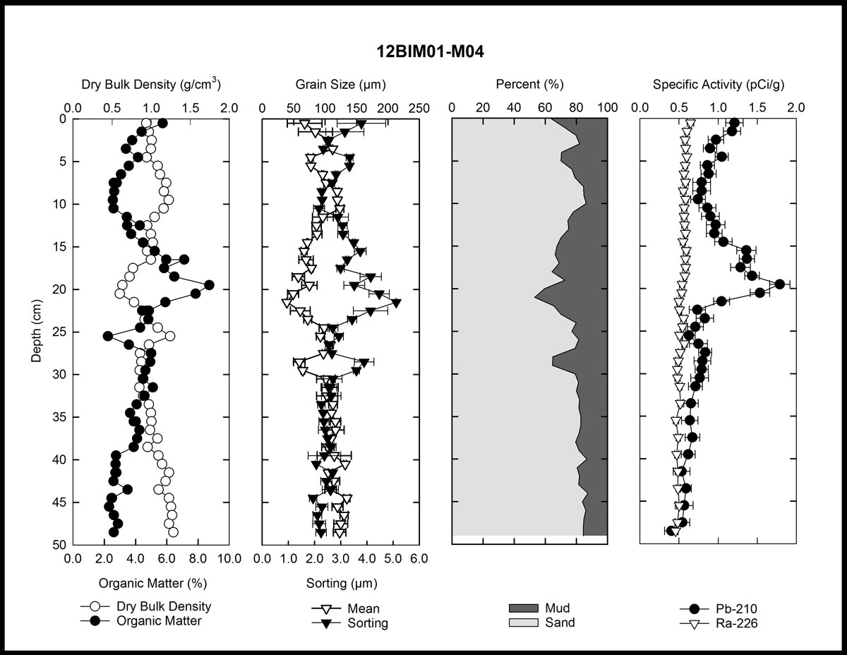
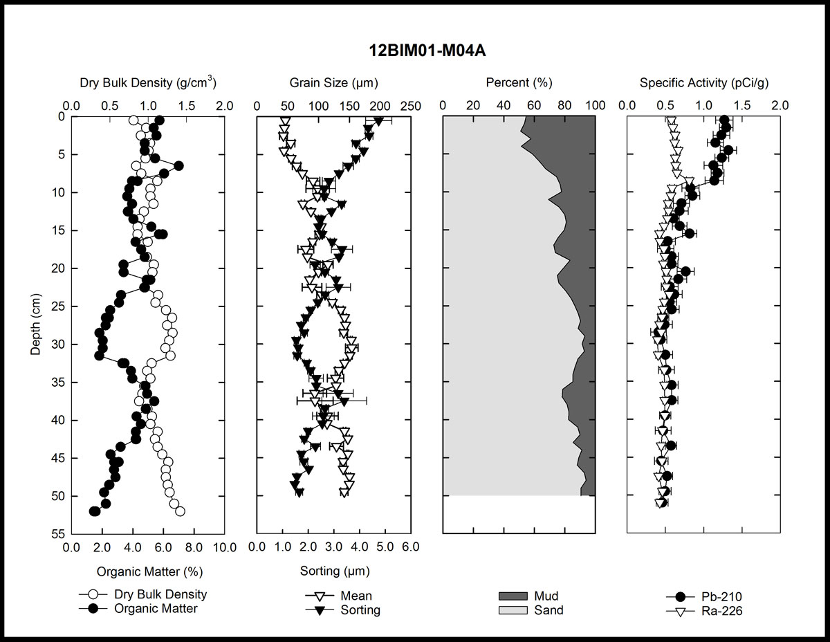
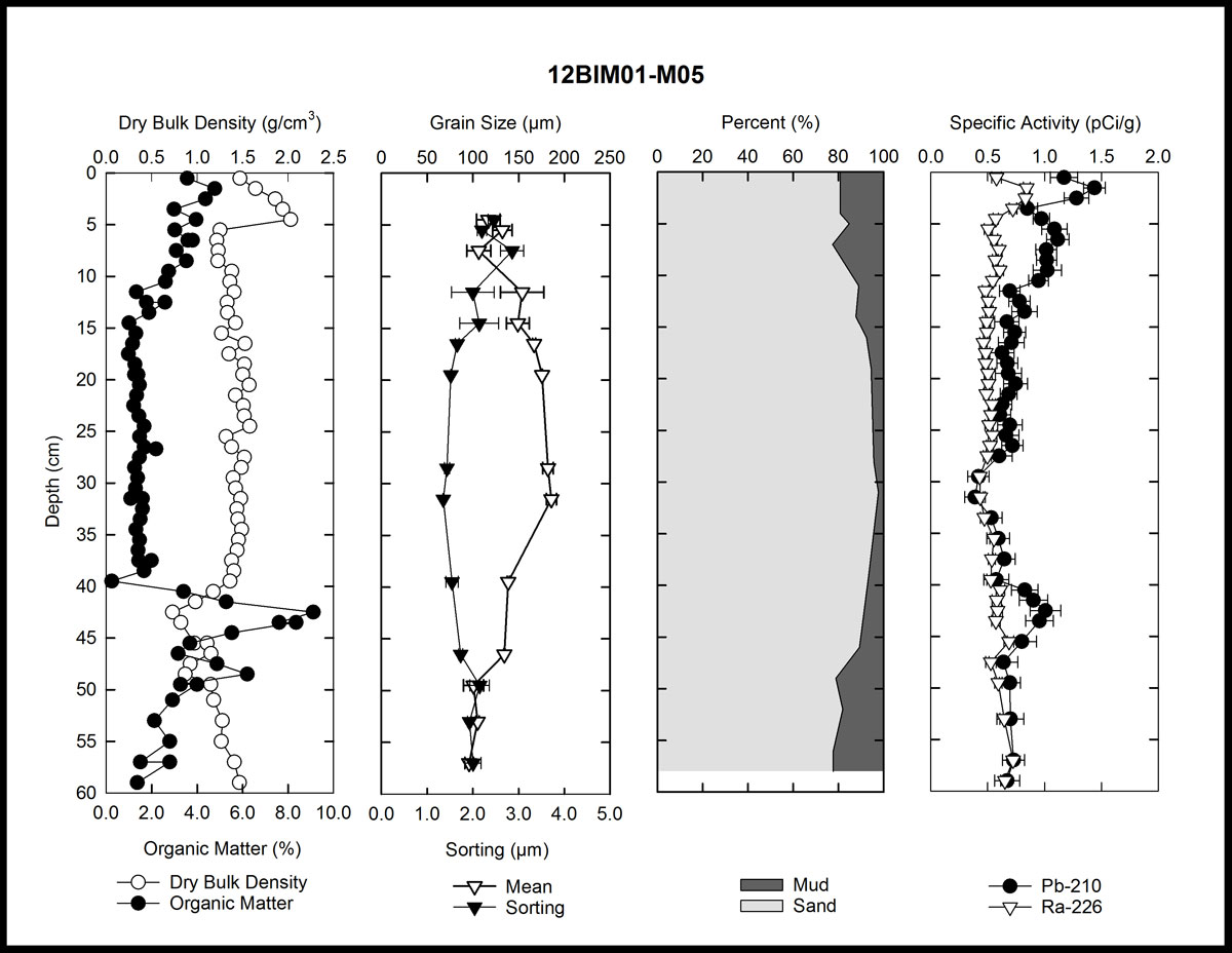
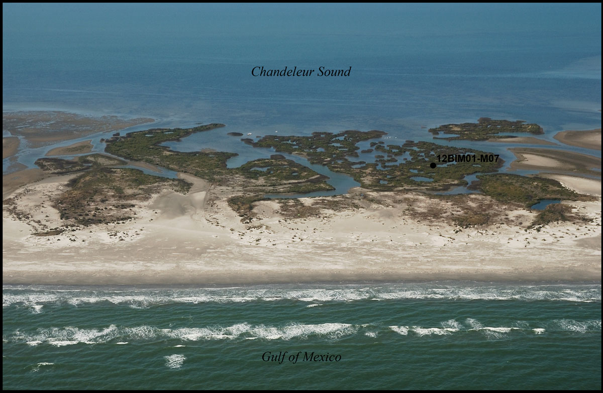
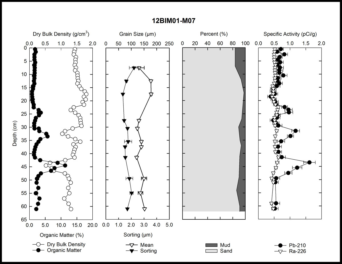
| Field Data CollectionUSGS SPCMSC scientists collected 8 sediment cores at 7 sites during the period March 24–26, 2012 (USGS Field Activity Number [FAN] 12BIM01) to quantify long-term (decadal to centennial) sediment accumulation in the back-barrier environments. Accurate position and elevation were obtained at all sampling locations with an Ashtech Differential Global Positioning System (DGPS) receiver and antenna with occupation times of 30 minutes. The accuracy of both horizontal position and elevation were improved by post-processing the DGPS data using a local benchmark, which was occupied throughout the course of each field activity by a similar DGPS system. At each site, a 10.2-centimeter (cm)-diameter push core was collected. Translucent polycarbonate core barrels were used that allowed inspection of each core to insure continuous, undisturbed sediment recovery. Core lengths varied between 45.5 and 70 cm in length. At site 04, one core was collected in the open marsh (site M04, fig. 2) and a second core was taken inside a shallow pond, several meters from its edge (site M04A, fig. 2). The two cores at site 04 were collected to capture potential variability in sediment deposition between the two sub-environments. All cores were returned to a local field station for sectioning. The cores were sectioned at 1-cm intervals to a depth of 50 cm, then at 2-cm intervals to the base of the core. The sections were placed in individual storage bags, and stored on ice for transport to the laboratory. 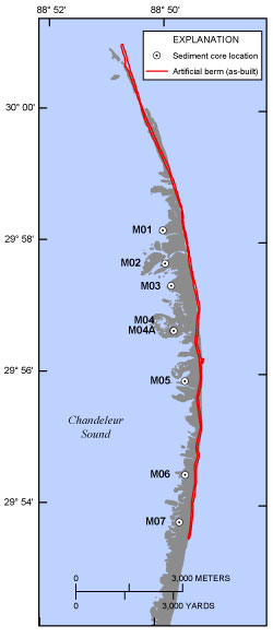 Figure 2. Map showing the locations of sediment push cores collected on Chandeleur Islands, Louisiana, during March 2012. The island shoreline is derived from U.S. Geological Survey lidar collected in February 2012 (Guy and others, 2014). Click on individual core locations for an oblique photograph (Morgan and others, 2013) and data plots.
The core sites discussed in this report were reoccupied up to 3 times each as part of a time-series sampling of the back-barrier environments in July and September 2012 and July 2013 (USGS Field Activity Numbers [FAN] 12BIM02, 12BIM05, and 13BIM06, respectively). The time-series sediment data is reported by Marot and others (2014). During the March 2012 survey, an additional 31 short (<60 cm), 1-inch-diameter push cores were collected along 10 transects across the berm and natural island; 29 grab samples were collected from the sediment surface along the axis of the berm and adjacent natural island; and 10 grab samples were collected in shallow water north and west of the berm. These samples were collected as part of a complementary USGS Coastal and Marine Geology Program BIER study investigating sediment movement between the berm and the natural island since berm construction. Analyses of those data are described in Bernier and others (2014). |

![]() U.S. Department of the Interior |
U.S. Geological Survey
U.S. Department of the Interior |
U.S. Geological Survey
URL: http://pubsdata.usgs.gov/pubs/ds/1045/ds1045_collection.html
Page Contact Information: GS Pubs Web Contact
Page Last Modified: Thursday, 30-Mar-2017 11:34:35 EDT
