Data Series 147
By Karynna Calderon,1 Shawn V. Dadisman,2 Jack L. Kindinger,2 James G. Flocks,2 and Dana S. Wiese2
1CSC, St. Petersburg, FL 33701.
2U.S. Geological Survey, St. Petersburg, FL 33701.
U.S. Department of the Interior
U.S. Geological Survey
Florida Integrated Science Center - Coastal and Watershed Studies
|
Publications are available from USGS Information Services, |
 |
||
 |
|||
Information Statement
This DVD publication was prepared by an agency of the United States Government. Neither the United States Government nor any agency thereof nor any of their employees makes any warranty, expressed or implied, or assumes any legal liability or responsibility for the accuracy, completeness, or usefulness of any information, apparatus, product, or process disclosed in this report or represents that its use would not infringe privately owned rights. Reference therein to any specific commercial product, process, or service by trade name, trademark, manufacturer, or otherwise does not constitute or imply its endorsement, recommendation, or favoring by the United States Government or any agency thereof.
Although all data and software published on this DVD have been used by the USGS, no warranty, expressed or implied, is made by the USGS as to the accuracy of the data and related materials and (or) the functioning of the software. The act of distribution shall not constitute any such warranty, and no responsibility is assumed by the USGS in the use of these data, software, or related materials.
System Requirements
This DVD disc is readable on any computing platform that has standard DVD driver software installed. The minimum software requirements are a web browser, Acrobat Reader, and a text editor.
Project Summary
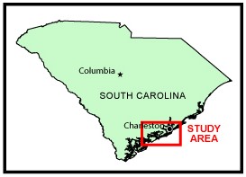
In August of 1994, the U.S. Geological Survey, in cooperation with Coastal Carolina University, conducted marine geophysical surveys in numerous water bodies adjacent to the south-central South Carolina coastal region as part of the USGS Coastal Change and Transport (CCT) Project. These data were collected aboard the MS Coastal in the Ashley, North Edisto, Wadmalaw, Dawho, South Edisto, and Ashepoo Rivers; the Wappoo, North, Steamboat, Bohicket, and Toogoodoo Creeks; Charleston Harbor; Wadmalaw Sound; Fenwick Cut; and the Atlantic Ocean from offshore Isle of Palms to Kiawah Island. This report serves as an archive of unprocessed digital boomer seismic reflection data, trackline maps, navigation files, GIS information, observers' logbooks, Field Activity Collection System (FACS) logs, and FGDC metadata. Filtered and gained digital images of the seismic profiles are also provided. Refer to the Acronyms page for expansion of all acronyms and abbreviations used in this report.
The archived trace data are in standard Society of Exploration Geophysicists (SEG) SEG-Y format (Barry and others, 1975) and may be downloaded and processed with commercial or public domain software such as Seismic Unix (SU). Example SU processing scripts and USGS software for viewing the SEG-Y files (Zihlman, 1992) are also provided. Note: The web version of this archive does not contain the SEG-Y trace files. These files are very large and would require extremely long download times. To obtain the complete DVD archive, contact USGS Information at 1-888-ASK-USGS or infoservices@usgs.gov.
The USGS Florida Integrated Science Center (FISC) - Coastal and Watershed Studies in St. Petersburg, Florida, assigns a unique identifier to each cruise or field activity. For example, 94CCT02 tells us the data were collected in 1994 for the Coastal Change and Transport (CCT) Project and the data were collected during the second field activity for that project in that calendar year. Refer to http://walrus.wr.usgs.gov/infobank/programs/html/definition/activity.html for a detailed description of the method used to assign the cruise ID.
The boomer is an acoustic energy source that consists of capacitors charged to a high voltage and discharged through a transducer in the water. The transducer is towed on a sled at the sea surface and when discharged emits a short acoustic pulse, or shot, that propagates through the water and sediment column. The acoustic energy is reflected at density boundaries (such as the seafloor or sediment layers beneath the seafloor), detected by a receiver, and recorded by a PC-based seismic acquisition system. This process is repeated at timed intervals (e.g., 0.25 s) and recorded for specific intervals of time (e.g., 125 ms). In this way, a two-dimensional vertical image of the shallow geologic structure beneath the ship track is produced. Refer to the observers' logbooks for diagrams and descriptions of acquisition geometry, which changed several times throughout the cruise. Table 1 is a summary of acquisition parameters. See the FACS equipment log for more information about the acquisition equipment used.
The unprocessed seismic data are stored in SEG-Y format (Barry and others, 1975). For a detailed description of the data format, refer to the SEG-Y Format page. See the How To Download SEG-Y Data page for download instructions. Note: The web version of this archive does not contain the SEG-Y trace files. These files are very large and would require extremely long download times. To obtain the complete DVD archive, contact USGS Information at 1-888-ASK-USGS or infoservices@usgs.gov. Processed profiles can be viewed as GIF images from the Profiles page. Refer to the Software page for details about the processing and examples of the processing scripts.
Detailed information about the navigation systems used can be found in table 1 and the FACS equipment log. To view the trackline maps and navigation files, and for more information about these items, see the Navigation page.
The original trace files for all lines were recorded in nonstandard ELICS format and converted to standard SEG-Y format. The original trace files for lines SC810_4, SC814_20, SC815_24, and SC816_26 were divided into two trace files each (e.g., SC810_4 became SC810_4a and SC810_4b) because the original total number of traces exceeded the maximum allowed by the processing software. Lines SC810_7, SC811_12, SC811_13, SC814_20b, SC814_21, SC815_24a, SC816_26a, and SC816_27 are missing navigation for the first 100 shots or more.
DVD Organization
The Disc Contents page is a diagram of the location of all files and folders contained on this disc and provides links to these files and folders.
Getting Started
To access the information contained on this disc, use a web browser to open the file index.htm. This report is divided into five sections: Navigation Data and Maps, Seismic Profiles, Field Activity Logs, Metadata, and Software. Links at the top and bottom of each page provide access to these sections. This report contains links to the USGS and collaborators or other resources that are only accessible if access to the Internet is available while viewing these documents.
Acknowledgments
Funding and/or support for this study were provided by the USGS Office of Energy and Marine Geology and Coastal Carolina University. This document was improved by the reviews of N.T. Edgar and R.A. Morton of the USGS in St. Petersburg, Florida.
References Cited
Barry, R.M., Cavers, D.A., and Kneale, C.W., 1975, Recommended standards for digital tape formats: Geophysics, v. 40, p. 344-352. Also available online at: http://www.seg.org/publications/tech-stand.
Zihlman, F.N., 1992, DUMPSEGY V1.0: A program to examine the contents of SEG-Y disk-image seismic data: U.S. Geological Survey Open-File Report 92-590, 28 p.

![]() U.S. Department of the Interior |
U.S. Geological Survey
U.S. Department of the Interior |
U.S. Geological Survey
URL: pubsdata.usgs.gov/pubs/ds/2005/147/index.html
Page Contact Information: Publishing Services
Page Last Modified: Monday, 28-Nov-2016 12:19:58 EST