
Multibeam Sonar Mapping and Modeling of a Submerged Bryophyte Mat in Crater Lake, Oregon
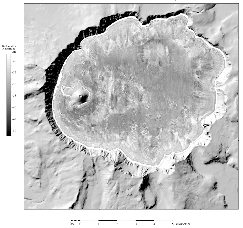
Figure 4. Acoustic backscatter image of Crater Lake, Oregon. The surrounding land is a shaded-relief topography image generated from U.S. Geological Survey 7.5-minute DEM's. In the backscatter image, brighter contrasts are stronger acoustic returns from the lake floor, possibly rock, whereas darker contrasts are weaker acoustic returns from the lake floor, possibly soft sediment.
In the backscatter amplitude gray-level key, dB (decibels) is the intensity of the backscattered acoustic pulse.
For more information contact: Peter Dartnell
