 Abstract Abstract
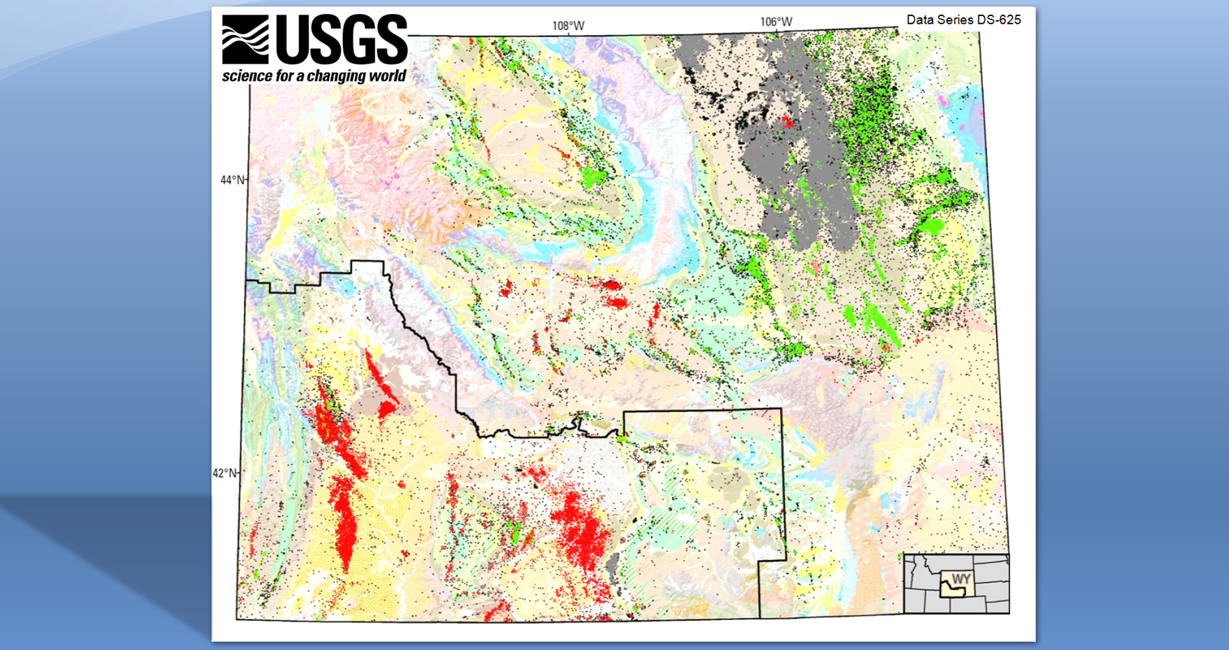
The U.S. Geological Survey (USGS) compiled a geographic information system (GIS) of Wyoming statewide historical oil and gas drilling activity for the Wyoming Landscape Conservation Initiative (WLCI). The WLCI is representative of the partnerships being formed by the USGS with other Department of the Interior bureaus, State and local agencies, industry, academia, and private landowners that are committed to maintaining healthy landscapes, sustaining wildlife, and preserving recreational and grazing uses as energy resources development progresses in southwestern Wyoming. This product complements the 2009 USGS publication on oil and gas development in southwestern Wyoming https://pubs.usgs.gov/ds/437/) by approximating, based on database attributes, the time frame of drilling activity for each well (start and stop dates). This GIS product also adds current oil and gas drilling activity not only in the area encompassing the WLCI, but also statewide. Oil and gas data, documentation, and spatial data processing capabilities are available and can be downloaded from the USGS website. These data originated from the Wyoming Oil and Gas Conservation Commission (WOGCC), represent decades of oil and gas drilling (1900 to 2010), and will facilitate a landscape-level approach to integrated science-based assessments, resource management and land-use decision making.
Acknowledgment
The USGS acquired the oil and gas wells dataset in spreadsheet format from Robert Meyer, Wyoming Oil and Gas Conservation Commission (WOGCC) in 2010.
|
First posted August 8, 2011
Part or all of this report is presented in Portable Document Format (PDF); the latest version of Adobe Reader or similar software is required to view it. Download the latest version of Adobe Reader, free of charge. |