![]()
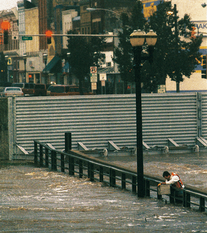
Photo from U.S. Geological Fact Sheet 001-99
|
|
|
Figure 1. With floodgates closed behind him, a USGS hydrographer measures the water level of the Marais des Cygnes River from the submerged U.S. Highway 59 bridge near Ottawa, northeastern Kansas. (Photograph courtesy of Richard Gwin, Lawrence Journal-World, Lawrence, Kansas.) |