 downloadable tiff file G059.tif.gz (4.2MB
compressed)
downloadable tiff file G059.tif.gz (4.2MB
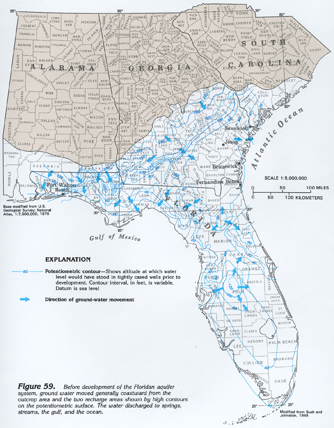
compressed) Figure 59 Map showing pre-development potentiometric contours
and ground-water movement in the Floridan aquifer system (572K)
downloadable tiff file G059.tif.gz (4.2MB
compressed)
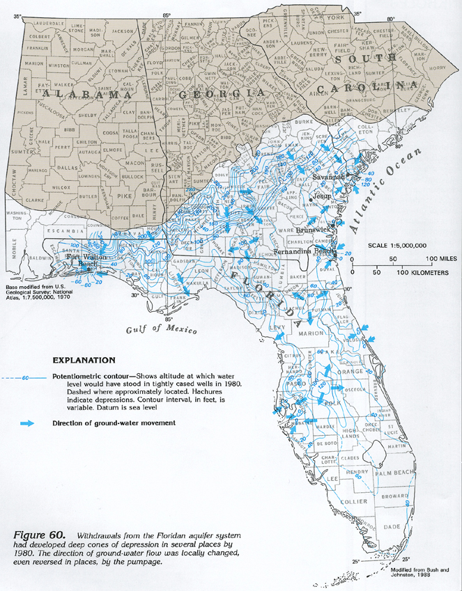
Figure 60 Map showing potentiometric contours and ground-water
movement in the Floridan aquifer system in 1980 (608K)
 downloadable tiff file G060.tif.gz (4.1MB
compressed)
downloadable tiff file G060.tif.gz (4.1MB
compressed)
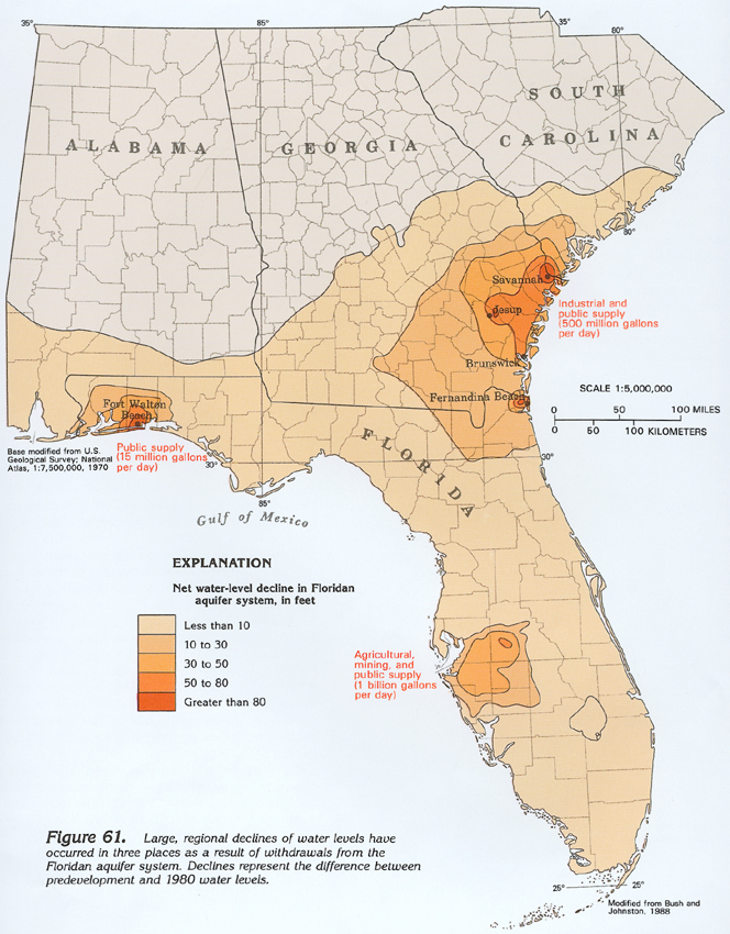
Figure 61 Map showing net water-level decline in Floridan aquifer
system between pre-development and 1980 (504K)
 downloadable tiff file G061.tif.gz (4.2MB
compressed)
downloadable tiff file G061.tif.gz (4.2MB
compressed)