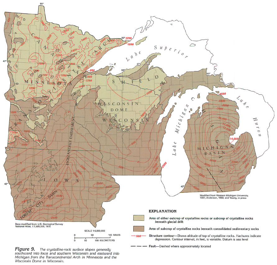
Figure 9 Map showing crystalline-rock surface structural contour lines (215K)
 downloadable
tiff file J009.tif.gz (4.8MB
compressed)
downloadable
tiff file J009.tif.gz (4.8MB
compressed)
Figure 9 Map showing crystalline-rock surface structural
contour lines (215K)
downloadable
tiff file J009.tif.gz (4.8MB
compressed)
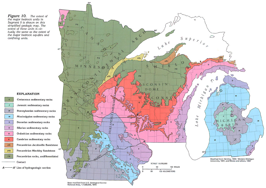
Figure 10 Map showing the extent of the major bedrock
units in Segment 9 (200K)
 downloadable
tiff file J010.tif.gz (4.5MB
compressed)
downloadable
tiff file J010.tif.gz (4.5MB
compressed)
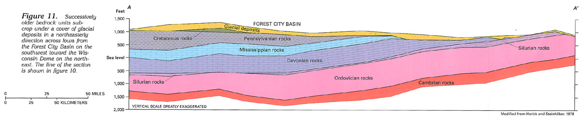
Figure 11 Section showing bedrock units across Iowa
from the Forest City Basin toward the Wisconsin Dome (74K)
 downloadable
tiff file J011.tif.gz (1.5MB
compressed)
downloadable
tiff file J011.tif.gz (1.5MB
compressed)
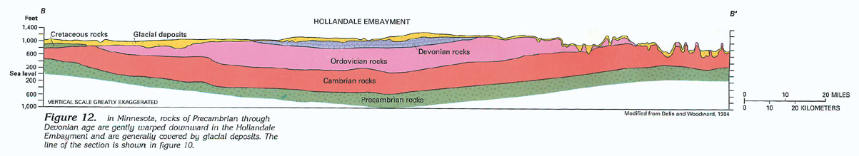
Figure 12 Section showing bedrock units in the Hollandale
Embayment (63K)
 downloadable
tiff file J012.tif.gz (965KB
compressed)
downloadable
tiff file J012.tif.gz (965KB
compressed)
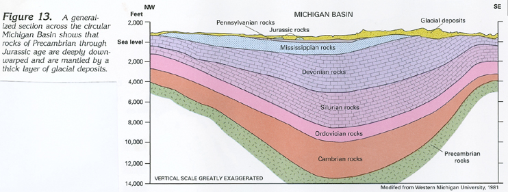
Figure 13 Generalized section showing bedrock units in the
Michigan Basin (194K)
 downloadable tiff file J013.tif.gz (1.8MB
compressed)
downloadable tiff file J013.tif.gz (1.8MB
compressed)