
Geologic Investigations Series I-2723
By Robert L. Christiansen, Michael A. Clynne, and L.J. Patrick Muffler
|
The Lassen Peak, Chaos Crags, and Upper Hat Creek map area lies near the southern end of the Cascade Range in northern California. The map area includes parts of the three elements that together form the Lassen volcanic center: the Lassen dacitic dome field, the Central Plateau andesitic lava field, and the underlying deeply eroded and partly altered Brokeoff andesitic stratocone. The Lassen volcanic center is the southernmost active long-lived center of the present-day Cascades volcanic arc. This geologic map contributes to understanding the youngest major volcanic events in the evolution of the Lassen dacitic dome field and provides the basis for a revised assessment of its volcano hazards by emphasizing the youngest eruptive products of the dome field. The most recent eruptive activity, mainly steam-blast eruptions, occurred intermittently between May, 1914, and June, 1917, and climaxed during a week of magmatic eruptions of Lassen Peak in May, 1915. This report consists of a geologic map and an accompanying explanatory pamphlet. Geologic mapping was compiled at a scale of 1:24,000 for the entire mapping area with some 1:2,500-scale mapping for the summit area of Lassen Peak. The geologic mapping was compiled as a digital geologic map database in ArcInfo GIS format. |
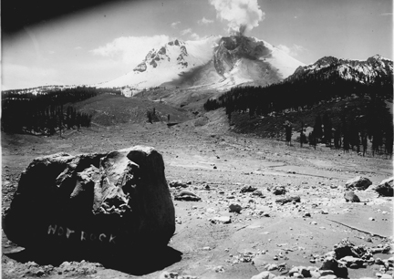 Photograph by B.F. Loomis, May 22, 1915. Photograph by B.F. Loomis, May 22, 1915.
|
FILES for VIEWING and PLOTTING
A PDF version of the geologic map lpgeo.pdf (8.3 MB)
A PDF version of the accompanying pamphlet lppam.pdf (112 KB)
README
readme.txt Text-only readme file that explains the contents of the two data files (56 KB)
DATA
Federal Geographic Data Committee (FGDC) metadata:
metadata-geo.htm: metadata for the digital geologic map (168 KB)
metadata-base.htm: metadata for the topographic base data (80 KB)
lassenpeak.zip: compressed file containing the digital database (31 MB)
PHOTOGRAPHS
Photographs: A set of 12 photographs, both recent and historic (2.9 MB)
For questions regarding the content of this report contact Robert Christiansen
| Help
| PDF help
| Publications main page | I
Maps |
| Privacy
Statement | Disclaimer
| Accessibility |
| Geologic Division |
Volcano Hazards Program |
Printed copies of this map and the accompanying pamphlet as well as a CD-ROM of the digital database are also available from:
USGS Information Services, Box 25286,
Federal Center, Denver, CO 80225
telephone: 303-202-4210; e-mail: infoservices@usgs.gov
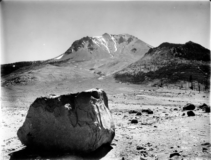 Photograph by B.F. Loomis, summer, 1915.