
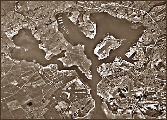
 Pearl Harbor
Disposal sites for dredged material from Pearl and Honolulu Harbors are located in Mamala Bay off the south coast of Oahu, adjacent to the city of Honolulu, Hawaii. The disposal sites are situated the north central reaches of a broad, gently sloping trough that slopes to the southeast. Water depths in and around the sites range from 300 to 600 m, with the South Oahu site (the active site) having a mean water depth of 450 m. The trough is bounded on the west by submerged reefs and banks, and on the east by a scarp that separates the trough from the narrow shelf that hugs the south Oahu coast from Diamond Head to Barbers Point. Studies that include bottom sampling and seafloor photography show that the native seafloor sediment is primarily muddy carbonate sand, with areas of coralline and limestone rubble. Bedforms ranging from ripples to sand waves are common throughout the area (including the disposal sites), and imply active sediment transport.
The U.S. Geological Survey conducted an acoustical survey using 3.5-kHz and chirp sonar subbottom profilers and sidescan sonar to determine the character of the seafloor and near surface substrate, and to delimit the extent and potential transport pathways of dredge materials and associated contaminants. These data were used to plan subsequent sampling strategies that were carried out in May 1994) and were designed to assess both the geological and environmental impacts of dredge material disposal in Mamala Bay.
Sidescan sonar images show that the dredged material leaves a distinct imprint (acoustic signature) on the seafloor. Dredged material forms two major deposits that affect an area of about 100 km2, and they are characterized by high-backscatter, circular to subcircular footprints 25-150 m across. The footprints are widely spaced at the extremities of the disposal sites, but coalesce to form a high-backscatter blanket over the disposal sites. The high-backscatter blanket covers most of the natural, low-backscatter sediment that mantles the seafloor. Associated with some footprints are lower-backscatter aprons that are interpreted to be the finer grained components of individual dredged material deposits. These aprons likely settled after the main body of a particular material dump settled. Close examination of plate 1 shows that bedforms are also visible on the dredged material deposits.
High-resolution subbottom profiles show that a subtle undulating seafloor topography characterizes most of the deposits. Pronounced bedforms visible in the southeast edge of the high backscatter, former Honolulu Harbor disposal site, and the bedforms extend east nearly 2 km from the dredged material deposit and into the low-backscatter seafloor that is unaffected by dredged material disposal. The bedforms, originally interpreted as mounds, are large amplitude symmetrical sand waves up to 2 m high with wave-lengths up to 150 m along ship's track. Some mounds on the 3.5-kHz profiles correlate with the high-backscatter footprints seen on the sonar imagery, but most probably are natural rather than anthropogenic.
Surficial sediment thickness is indeterminable over most of the area affected by dredged material disposal. Subbottom profiles collected over the disposal sites are characterized by lateral discontinuities in seafloor reflectivity and hardness. Subbottom reflectors are not present below the seafloor reflector, and the dredged materials are opaque in subbottom profiles. Because the dredged material has an acoustic signature that differs from the native seafloor sediment (dredged materials are primarily mud and coarse carbonate rubble), the dredged materials likely scatter or absorb the 3.5-kHz signal resulting in the structureless subbottom profiles. In contrast, subbottom profiles collected from areas unaffected by dredged material disposal are characterized by a seafloor reflector that has no lateral discontinuities in reflectivity, and has a distinct subbottom reflector or hyperbolic diffractions. Closely spaced diffractions seen on the 3.5-kHz profiles are common in the area west of the South Oahu disposal site and are associated with bedforms, and/or carbonate debris and rubble visible on seafloor photographs. Subbottom profiles collected south and east of the dredged material deposits are characterized by a smooth, continuous seafloor reflector having one or more subbottom reflectors.
In summary, dredged material disposal off of Honolulu Hawaii has created deposits that have a distinct acoustic signature on the sidescan sonar images and a subtler signature on the seismic reflection profiles. The combination of subtle mounding, the coarse rubble contained in harbor dredged material, and the acoustic impedance difference between the dredged material and the underlying native sediment is likely responsible for the high-backscatter footprints seen in the sidescan sonar mosaic and the structureless 3.5-kHz subbottom profiles. Additional studies are required to define the biological and physical benthic processes, and the roles of the substrate and the ecosystem in the transfer and storage of dredged material-related contaminants in Mamala Bay.
Files available for downloads:
Introduction Part 1 (12 kb), Part 2 (12 kb)
Study Area (12 kb).
Previous Studies (12 kb).
Oceanography (8 kb).
Seafloor Materials (12 kb).
K1-93 Survey (12 kb):
Methods
Scope of Work
Navigation
Sidescan Sonar
Bathymetry
Profiling
Results (8 kb):
Bathymetry
Sonar, 3.5kHz
Part 1 (8 kb),
Part 2 (8 kb),
Part 3 (12 kb)
Conclusions (12 kb)
Figures (total of 1328 kb)
1 (12 kb)
2 (16 kb)
3 (16 kb)
4 (20 kb)
5 (36 kb)
6 (52 kb)
7 (76 kb)
8 (96 kb)
9 (68 kb)
10 (72 kb)
11 (72 kb)
12 (76 kb)
13 (76 kb)
14 (80 kb)
15 (60 kb)
16 (100 kb)
17 (108 kb)
18 (88 kb)
19 (100 kb)
20 (104 kb)
Plate 1 (1.7 MB)
Appendices
Apx 1: Statistics 1 (12 kb)
Apx 1: Statistics 2 (12 kb)
Apx 2: Equipment 1 (12 kb)
Apx 2: Equipment 2 (12 kb)
Acknowledgments (8 kb)
References
Page 1 (12 kb),
Page 2 (12 kb),
Page 3 (12 kb)
Infobank data sources
K1-93-HW
K1-94-HW
K2-94-HW
For questions about the scientific content of this report, contact Mike Torresan
Download a free copy of Adobe Reader
This report is also available in printed format from:
USGS Information Services
Box 25286 Federal Center
Denver, CO 80225
Telephone: 1-888-ASK-USGS
E-mail: infoservices@usgs.gov
| Help
| PDF help |
| Publications main page
| Open-file reports [on line] |
| Department of the Interior
| U.S. Geological Survey |
| Geologic Division
|Western Coastal and Marine Geology|
| Privacy Statement
| Disclaimer
| Accessibility |
The URL for this page is:
https://pubs.usgs.gov/of/1995/of95-017/
Please send comments and suggestions, or report problems, to:
Michael Diggles
Updated: June 28, 2007 (bwr, mfd)