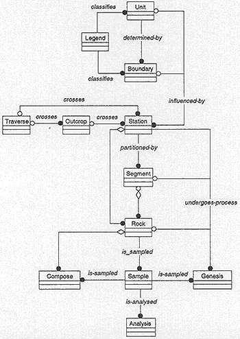
Figure 4. Fieldlog's General Field Data Model. Reference and Dictionary concepts have been omitted for presentation purposes. References and Dictionaries may be related to any of the general concepts portrayed in this diagram The influenced-by relation between units, boundaries and traverses, outcrops has also been omitted for presentation purposes.