| Objectives: |
- Focus on the impact of hurricanes on the natural and cultural environments of the Lake Pontchartrain Basin.
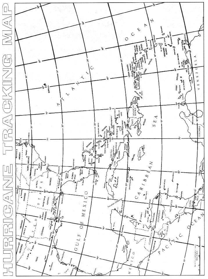
- Plot data of major hurricanes that have affected the Lake Pontchartrain Basin on a hurricane tracking map
- Predict the effects of a major hurricane on the Lake Pontchartrain Basin.
- Understand the relationships among healthy wetlands, coastal erosion, and hurricane impact on the Lake Pontchartrain Basin.
| Materials: |
- Hurricane Data Sets
- Hurricane Tracking Map (or obtain one from local sources)
- Construction Paper
- Colored Pencils
| Getting Ready: |
- Discuss hurricane formation prior to this in a unit on meteorology.
- Make copies of hurricane tracking map
(or have students obtain one from local sources.)
- Research impact/effects of hurricanes in the Lake Pontchartrain Basin.
| Procedure: |
- On a hurricane tracking map, using a different color for each hurricane, plot the path of each storm data set provided.
- Glue or tape student tracking maps on construction paper. Display in the classroom, hallway, cafeteria, or library.
- Complete student activity sheet.