
U.S. Department of the Interior
Gail A. Norton, Secretary
U.S. Geological Survey
Charles G. Groat, Director
This report is preliminary and has not been reviewed for conformity with U.S. Geological Survey (USGS) editorial standards or with the North American Stratigraphic Code. Any use of trade, firm, or product names is for descriptive purposes only and does not imply endorsement by the U.S. Government.
1 PO Box 141, Teasdale, UT 84773
2 U.S. Geological Survey, Tucson, Ariz.
3 U.S. Geological Survey, Menlo Park, Calif.
For those already familiar with Adobe Acrobat Reader and who have version 5.0 or higher on their computer, go directly to the file OF00-309.PDF.
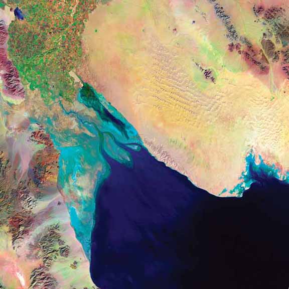
Sample of one of the satellite images
This publication is an online version of a 3-CD-ROM publication, U.S. Geological Survey Open-File Report 00-309. The data for this publication total 1.8 GB.
The report contains PDF files for which you will need Adobe Reader to view. You can download a free copy of the latest version by using this button.

The study is summarized in the Adobe Acrobat Portable Document Format (PDF) file OF00-309.PDF. This publication also contain satellite full-scene images of selected areas along the U.S.-Mèxico border. These images are presented as high-resolution images in jpeg format (IMAGES). The folder LOCATIONS in contains TIFF images showing exact positions of easily-identified reference locations for each of the Landsat TM scenes located at least partly within the U.S. A reference location table (BDRLOCS.DOC in MS Word format) lists the latitude and longitude of each reference location with a nominal precision of 0.001 minute of arc
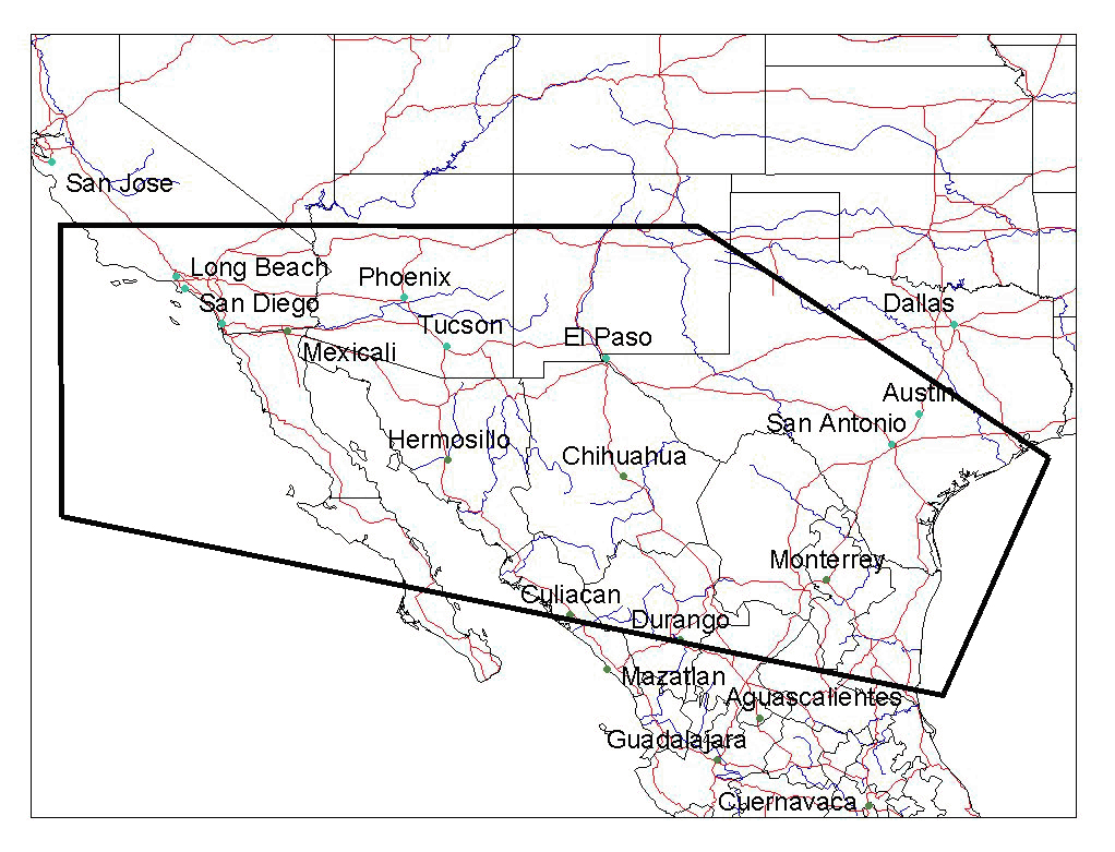
Figure 1. General location map of the United States-Mexico transborder region (within heavy black line).
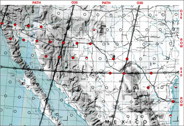
Figure 2. Approximate locations of the centers of the TM scenes. Scenes indicated with a red circle are included in this dataset. Half filled circles indicate scenes shifted from the normal scene center.
A detailed list of directories and files is given in the documentation file OF00-309.PDF.
1_README.TXT - Gives details about this publication; this file is from the CD-ROM version.
FIGURES folder - Location.jpg is Figure 1 and TM_index.jpg is Figure 2 in the documentation files (OF00-309.PDF and OF00-309.DOC). The file Figures.txt gives details.
metadata.txt and metadata.html - Metadata or "data about data" that describe the content, quality, condition, and other characteristics of the Thematic Mapper image data. These metadata meet the Federal Geographic Data Committee (FGDC) Metadata Standard.
OF00-309.DOC - Documentation for this publication in MS-Word format.
OF00-309.PDF - Documentation for this publication in Adobe Acrobat Portable Document Format. This file also has screen-resolution versions of the Landsat TM images.
OF00-309.TXT - Documentation for this publication in ASCII Format but with graphics and formatting removed.
version_history.txt - ASCII file that gives the bibliographical citation, version number(s), and version date(s).
IMAGES folder - JPEG file of the Landsat TM images that have been created using minimum JPEG compression and average approximately 60 MB in size.
LOCATIONS folder - The folder LOCATIONS contains TIFF images showing reference locations for each of the Landsat TM scenes. The file BDRLOCS.DOC is the same as Table 1 in OF00-309.PDF and gives details.
This publication consists of the online version of a 3-CD-ROM publication that contains, in addition to the information on this Web site, CD-ROM-autoplay files for Windows and installer software for Adobe Acrobat Reader. The data for this publication total 1.8 GB on the CD-ROM. The 3-CD-ROM set is available for sale by writing:
USGS Information Services
Box 25286, Federal Center
Denver, CO 80225
e-mail: infoservices@usgs.gov
or calling
1- 888-ASK-USGS (1-888-275-8747)
ISBN: 0-607-95952-5
Current pricing information is available from http://ask.usgs.gov/to_order.html#cd.
|
U.S. Department of the Interior, U.S. Geological Survey
Maintained by: Michael Diggles Created: November 28, 2001 Last update: January 17, 2008 (mfd) Privacy Statement || Disclaimer || Accessibility URL of this page: https://pubs.usgs.gov/of/2000/of00-309/ |