Holocene Evolution, OFR 01-076
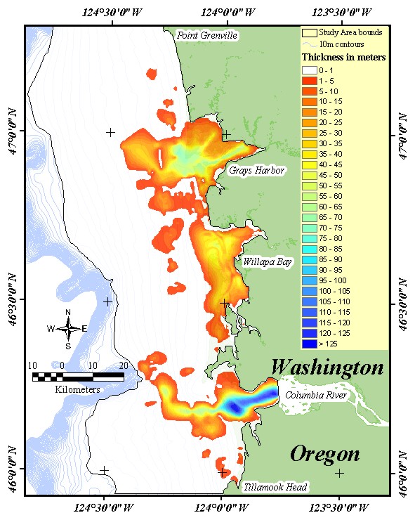
Home | Intro | Geology | Methods | Animation | Data | GIS | Acknowledgements | References | AppendixFigure 12. Map showing the distribution and thickness of bay and fluvial deposits within the CRLC. Paleo-valleys extend offshore from the Columbia River and Grays Harbor, but one does not appear to be present off Willapa Bay. Seismic coverage on the outer shelf was not sufficient to trace the paleo-valley offshore of Grays Harbor to the shelf edge.
 [an error occurred while processing this directive]