Skip past header informationUSGS Logo with Link to USGS Home Page

Holocene Evolution, OFR 01-076

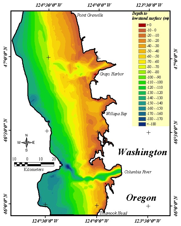
Home | Intro | Geology | Methods | Animation | Data | GIS | Acknowledgements | References | Appendix

Figure 6.  Map of the lowstand surface that resulted from the integration of the varied datasets shown in Figure 2.  An in-depth description of the procedure is given in the Methods section.

Figure 6.  Map of the lowstand surface that resulted from the integration of the varied datasets shown in Figure 2.

Return to Table of  Contents Return to Table of Contents

U.S. Department of the Interior, U.S. Geological Survey
URL: http://pubs.usgs.gov/of/2001/of01-076/HTMLDOCS/FIGURE6.HTM
Maintained by Publishing Services
Last modified: 16:11:28 Tue 11 Jun 2002
Privacy statement | General disclaimer | Accessibility