![]()
Arizona Aeromagnetic and Gravity Maps and Data:
A Web Site for Distribution of Data
by
Ronald E. Sweeney and Patricia L. Hill
Open-File-Report 01-0081
2001
Arizona Merged Aeromagnetic Anomaly Map (NE illumination)
Continued to 1000 Feet Above Ground
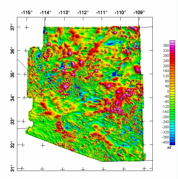
The grids for this map in various formats are available from the data directory as az1000ag.***

Non-graphical version of this page.
U.S. Department of the Interior
U.S. Geological Survey
This page is <URL: https://greenwood.cr.usgs.gov/pub/open-file-reports/ofr-01-0081/html/arizona.htm>
Maintained by: Gene Ellis
Last Modified Monday, 15-May-2000
For more information about this report contact: Ron Sweeney