Open-File Report 02-353
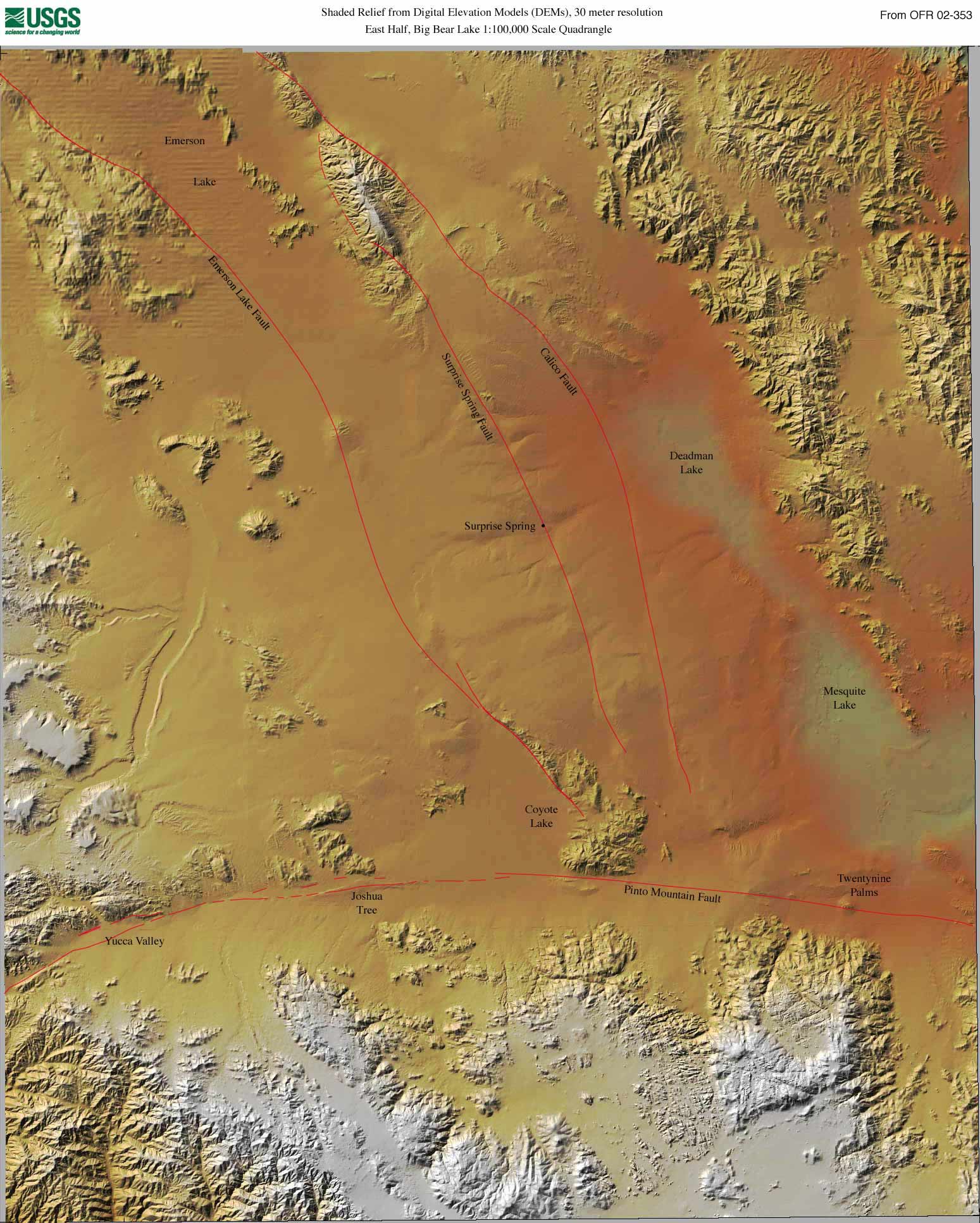
A topographic map illustrates the relief or elevation differences in an area (and usually many other features). It may show this by contours or shading.The eastern portion of the Big Bear Lake quadrangle is in the Basin and Range province with large areas of low relief and flat playas separated by mountains. From the shaded relief image below we see this clearly with the Deadman Lake and Mesquite Lake playas being shown in gray at right.
|

![]() U.S. Department of the Interior |
U.S. Geological Survey
U.S. Department of the Interior |
U.S. Geological Survey
URL: http://pubsdata.usgs.gov/pubs/of/2002/0353/topography.html
Page Contact Information: GS Pubs Web Contact
Page Last Modified: Wednesday, 07-Dec-2016 19:27:27 EST
