![]()
San Antonio, Texas Audio-magnetotelluric Index Maps
and Data Table
![]()

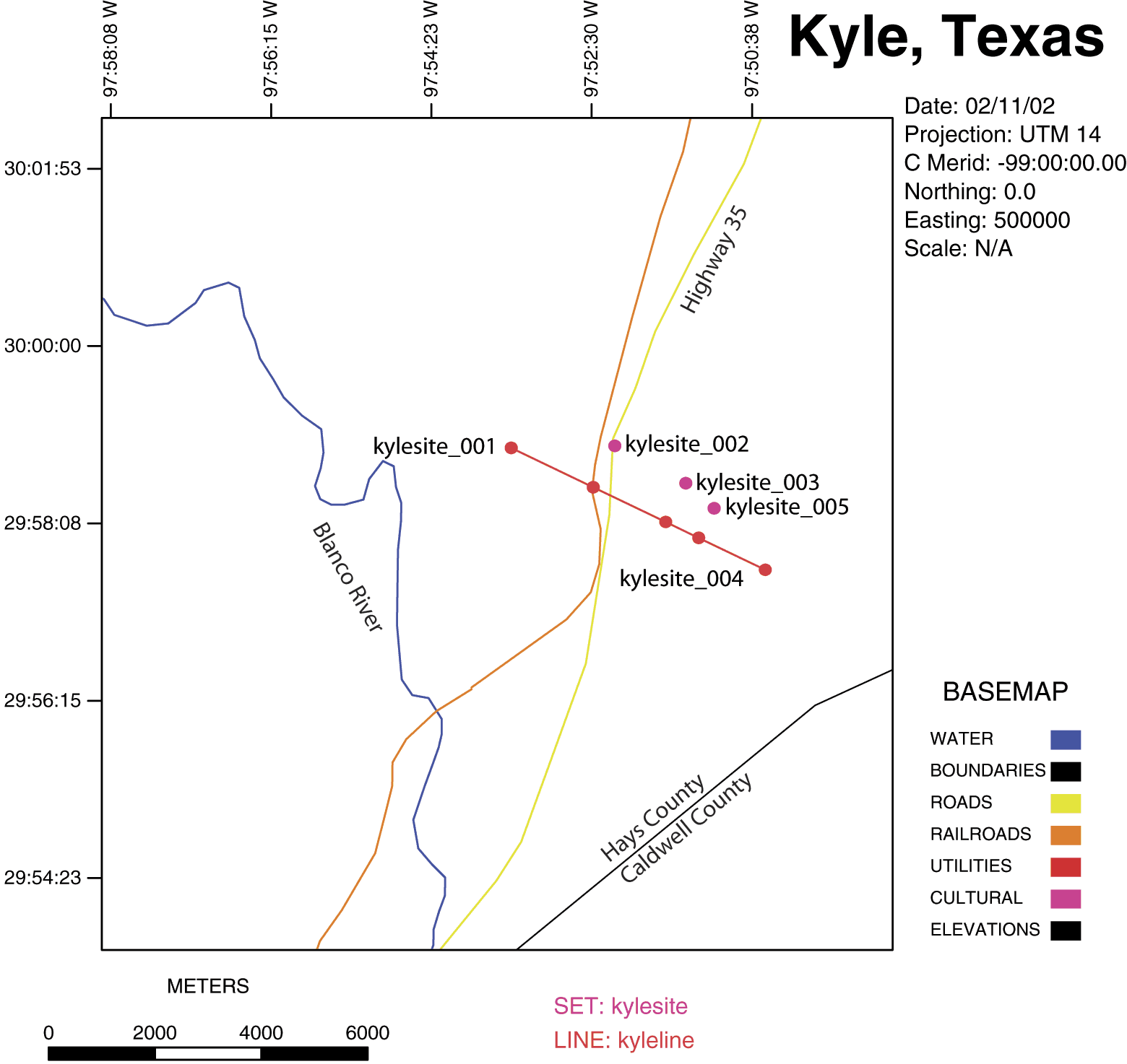
The Kyle, Texas Audio-magnetotelluric data set contains 5 Audio-magnetotelluric sounding sites. This map is an index to the locations of the original sites and their projected lines. Data for surveys may be downloaded by clicking on: data

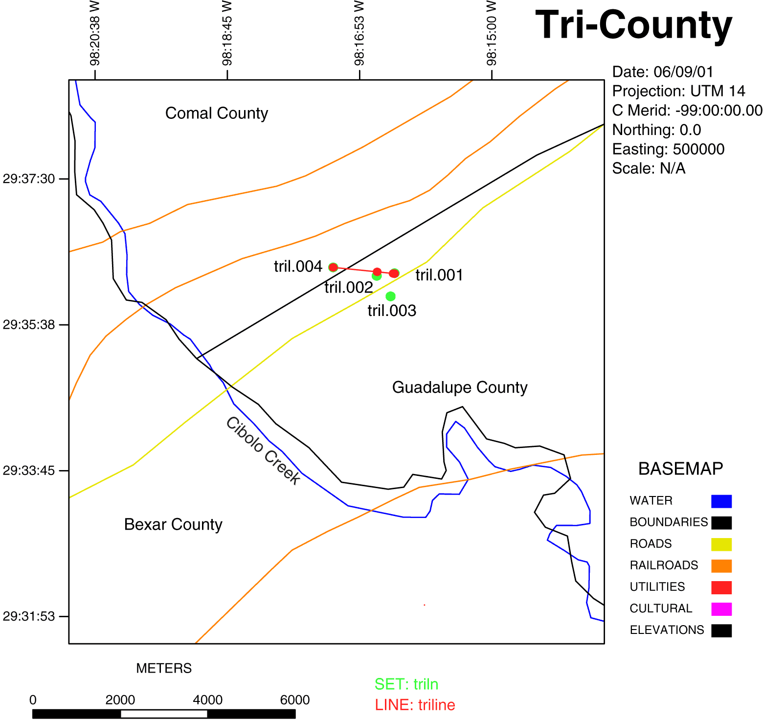
The Tri-County area Audio-magnetotelluric data set contains 4 Audio-magnetotelluric sounding sites. This map is an index to the locations of the original sites and their projected lines. Data for surveys may be downloaded by clicking on: data

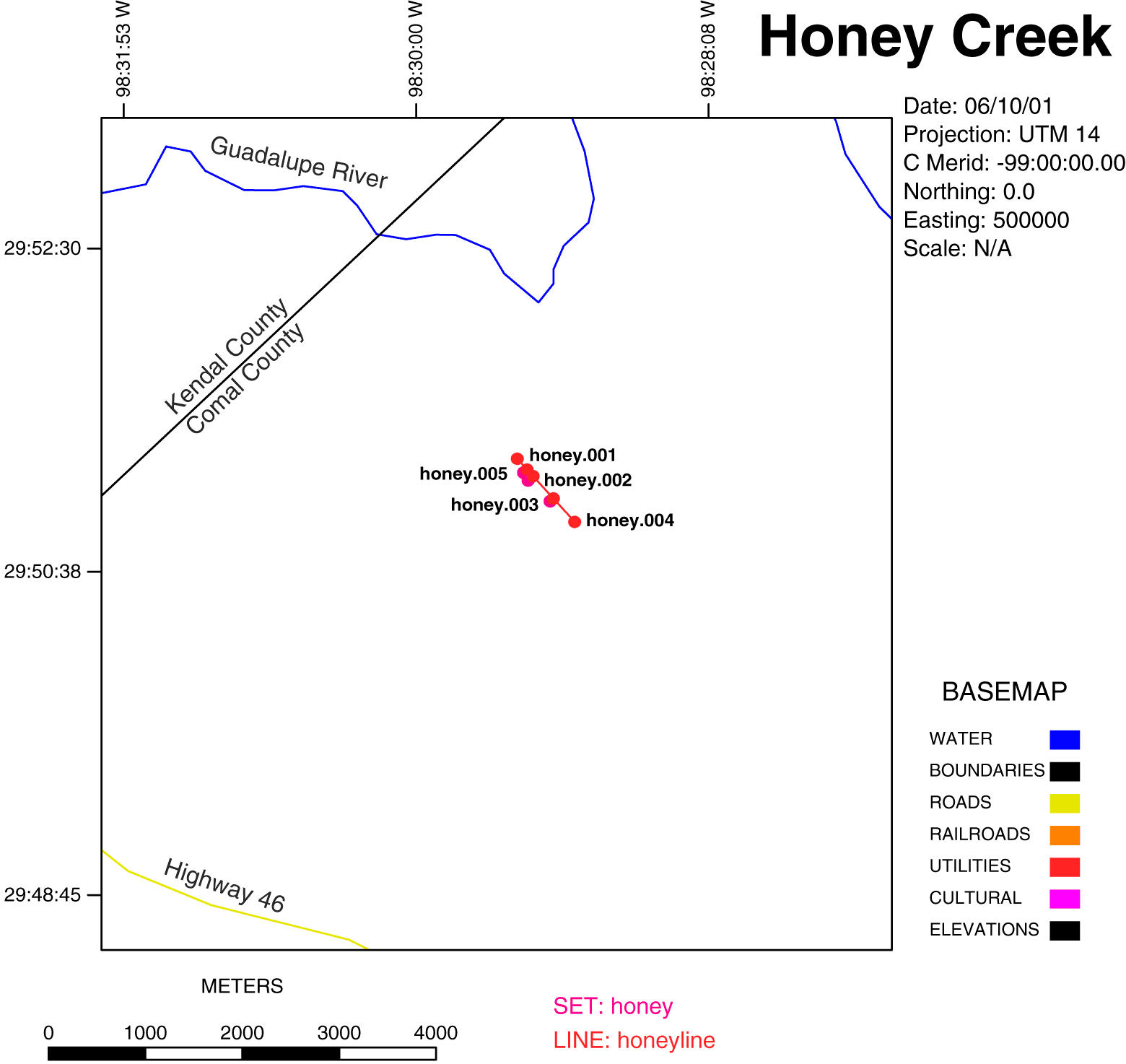
The Honey Creek, Texas Audio-magnetotelluric data set contains 5 Audio-magnetotelluric sounding sites. This map is an index to the locations of the original sites and their projected lines. Data for surveys may be downloaded by clicking on: data

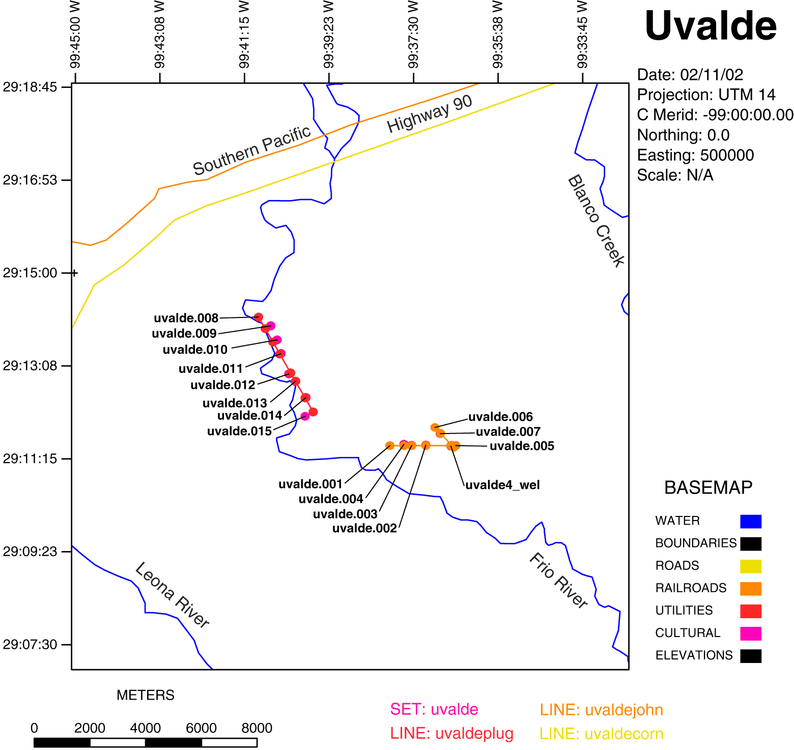
The Kyle, Texas Audio-magnetotelluric data set contains 15 Audio-magnetotelluric sounding sites. The uvalde4_wel in the above index map is the SAWS E. Uvalde well No. 4. This map is an index to the locations of the original sites and their projected lines. Data for surveys may be downloaded by clicking on: data
Table of San Antonio, Texas Audio-magnetotelluric Site numbers and locations (UTM zone 14 N)
|
Site Number |
Latitude |
Longitude |
UTM Easting |
UTM Northing |
|
Kylesite_001 |
29º 58' 53.12" |
-97º 53' 28.75" |
606955 |
3317064 |
|
Kylesite_002 |
29º 58' 53.77" |
-97º 52' 16.21" |
608899 |
3317103 |
|
Kylesite_003 |
29º 58' 29.73" |
-97º 51' 26.64" |
610235 |
3316376 |
|
Kylesite_004 |
29º 57' 34.21" |
-97º 50' 31.54" |
611729 |
3314682 |
|
Kylesite_005 |
29º 58' 13.54" |
-97º 51' 07.00" |
610766 |
3315883 |
|
Tril.001 |
29º 36' 15.81" |
-98º 16' 23.85" |
570368 |
3274993 |
|
Tril.002 |
29º 36' 13.88" |
-98º 16' 38.99" |
569961 |
3274930 |
|
Tril.003 |
29º 35' 58.02" |
-98º 16' 27.26" |
570280 |
3274444 |
|
Tril.004 |
29º 36' 21.91" |
-98º 17' 16.67" |
568946 |
3275171 |
|
Honey.001 |
30º 11' 42.09" |
-98º 28' 14.94" |
550940 |
3340334 |
|
Honey.002 |
30º 11' 45.37" |
-98º 28' 23.57" |
549432 |
3302361 |
|
Honey.003 |
30º 11' 53.11" |
-98º 28' 31.86" |
550486 |
3340671 |
|
Honey.004 |
30º 12' 54.16" |
-98º 28' 59.76" |
550264 |
3340925 |
|
Honey.005 |
30º 12' 01.39" |
-98º 28' 40.12" |
550792 |
33040397 |
|
Uvalde.001 |
29º 11' 39.29" |
-99º 37' 58.87" |
438458 |
3229308 |
|
Uvalde.002 |
29º 11' 34.05" |
-99º 37' 11.02" |
439749 |
3229328 |
|
Uvalde.003 |
29º 11' 33.85" |
-99º 36' 52.92" |
440238 |
3229319 |
|
Uvalde.004 |
29º 11' 34.21" |
-99º 37' 40.13" |
438963 |
3229337 |
|
Uvalde.005 |
29º 11' 33.69" |
-99º 36' 31.28" |
440822 |
3229311 |
|
Uvalde.006 |
29º 11' 55.49" |
-99º 36' 58.96" |
440078 |
3229986 |
|
Uvalde.007 |
29º 11' 48.02" |
-99º 36' 51.99" |
440265 |
3229755 |
|
Uvalde.008 |
29º 14' 08.03" |
-99º 40' 53.43" |
433743 |
3234100 |
|
Uvalde.009 |
29º 13' 57.55" |
-99º 40' 38.11" |
434182 |
3233775 |
|
Uvalde.010 |
29º 13' 40.63" |
-99º 40' 29.43" |
434413 |
3233253 |
|
Uvalde.011 |
29º 13' 24.09" |
-99º 40' 24.24" |
434550 |
3232743 |
|
Uvalde.012 |
29º 12 '59.45" |
-99º 40' 13.64" |
434832 |
3231983 |
|
Uvalde.013 |
29º 12' 50.68" |
-99º 40' 04.44" |
435079 |
3231712 |
|
Uvalde.014 |
29º 12' 31.00" |
-99º 39' 51.06" |
435437 |
3231104 |
|
Uvalde.015 |
29º 12' 08.22" |
-99º 39' 51.70" |
435416 |
3230403 |
|
E. Uvalde Well No. 4 |
29º 11' 32.99" |
-99º 36' 37.63" |
440651 |
3229291 |
|| San Antonio AMT || Processing information || Survey information || Electrical Sections || USGS - Eastern Minerals Team || USGS - Geology || USGS ||