This is a subset of the original dataset. It has been clipped to the extent of the Gulf of Maine surficial sediment GIS project extent.
National Atlas of the United States and the United States Geological Survey, Environmental Systems Research , Inc. (ESRI), and Paskevich, Valerie, 20020401, URBAN_DTL: U.S. National Atlas Urbanized Areas for the Gulf of Main surficial sediment GIS project area.: ESRI Data & Maps 2002, Environmental Systems Research Institute, Inc. (ESRI), Redlands, California, USA.Online Links:
- <http://pubs.usgs.gov/of/2003/of03-001/data/basemaps/usa/urban/urban-dtl.zip>
- <http://pubs.usgs.gov/of/2003/of03-001/data/basemaps/usa/urban/urban-dtl.zip>
Poppe, L.J., Paskevich, V.F., Williams, S.J., Hastings, M.E., Kelley, J.T., Belknap, D.F., Ward, L.G., FitzGerald, D.M., and Larsen, P.F., 2002, Surficial Sediment Data from the Gulf of Maine, Georges Bank, and vicinity: a GIS Compilation: Open-File report 03-001, U.S. Geological Survey, Coastal and Marine Geology Program, Woods Hole Field Center, Woods Hole, MA.Online Links:
This is a Vector data set. It contains the following vector data types (SDTS terminology):
Horizontal positions are specified in geographic coordinates, that is, latitude and longitude. Latitudes are given to the nearest 0.000000. Longitudes are given to the nearest 0.000000. Latitude and longitude values are specified in Decimal degrees.
The horizontal datum used is North American Datum of 1983.
The ellipsoid used is Geodetic Reference System 80.
The semi-major axis of the ellipsoid used is 6378137.000000.
The flattening of the ellipsoid used is 1/298.257222.
Sequential unique whole numbers that are automatically generated.
Coordinates defining the features.
Names for the features.
| Formal codeset | |
|---|---|
| Codeset Name: | Federal Information Processing Standards 52 |
| Codeset Source: | National Institute of Standards and Technology |
| Formal codeset | |
|---|---|
| Codeset Name: | Federal Information Processing Standards |
| Codeset Source: | National Institute of Standards and Technology |
| Value | Definition |
|---|---|
| -999 or 0 | The population is unknown. |
Please review the cross reference information for the original data set credit.
U.S. Geological Survey
c/o Valerie Paskevich
Information Specialist
384 Woods Hole Road
Woods Hole, MA 02543-1598
USA
(508) 548-8700 x2281 (voice)
(508) 457-2310 (FAX)
vpaskevich@usgs.gov
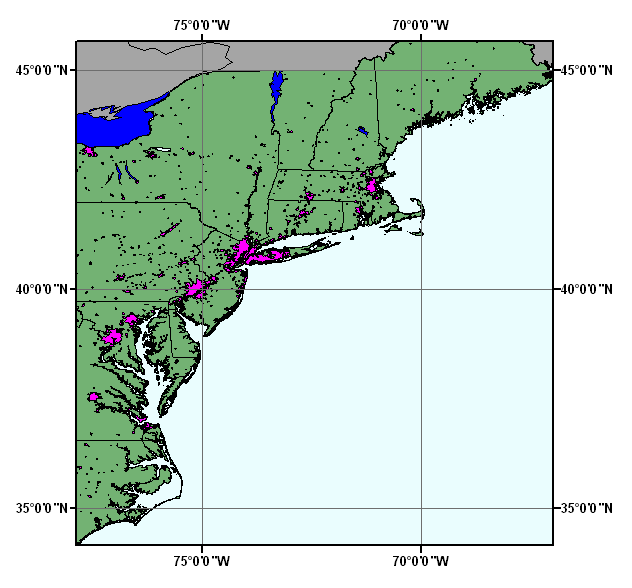
U.S. National Atlas Urbanized Areas provides information about the locations, names, and populations of urbanized areas for conducting geographic analysis on national and large regional scales.
National Atlas of the United States and the United States Geological Survey, 1998, nationalatlas.gov Urban Areas:, United States Geological Survey, Reston, Virginia, USA.Online Links:
The state in which the urban area is located was also added. Several areas were modified to conform to the 1:2,000,000-scale hydrography layer. Some smaller polygons that represent undeveloped areas within the urban area were removed and merged with the larger urban area. Military reservations were removed.
Revisions: 1) 6/29/98 - Corrected ellipsoid name from WGS84 to GRS1980 and changed flattening ratio. 2) 11/13/98 - Added State FIPS attribute; moved polygons for Altus, OK and Olustee, OK; and edited State attribute for Kansas City and Washington metro area.
Data sources produced in this process:
Data sources used in this process:
The geospatial part of this data set was originally extracted from the Digital Chart of the World at 1:1,000,000-scale with some geospatial data from a USGS 1:2,000,000-scale hydrography layer. It was updated several times using various sources whose horizontal positional accuracies are unknown.
After processing, the data set is checked for drawing display and number of records and file sizes compared with source materials.
This is a subset of the original dataset and has been clipped to the extent of the Gulf of Maine surficial sediment GIS project extent.
No duplicate features are present. The shapefile is exported using Avenue request ExportClean. This request verifies and enforces the correctness of shapes.
Are there legal restrictions on access or use of the data?
- Access_Constraints: Access granted to Licensee only.
- Use_Constraints:
- The data are provided by multiple, third party data vendors under license to ESRI for inclusion on ESRI Data & Maps CD-ROMs for use with ESRI® software. Each data vendor has its own data licensing policies and may grant varying redistribution rights to end users. Please consult the redistribution rights below for this data set provided on ESRI Data & Maps CD-ROMs. As used herein, "Geodata" shall mean any digital data set consisting of geographic data coordinates and associated attributes.
The redistribution rights for this data set: Public domain data from U.S. government is freely redistributable with proper metadata and source attribution.
The terms and conditions below apply to all the data sets provided on the ESRI Data & Maps CD-ROMs.
Proprietary Rights and Copyright: Licensee acknowledges that the Data and Related Materials contain proprietary and confidential property of ESRI and its licensor(s). The Data and Related Materials are owned by ESRI and its licensor(s) and are protected by United States copyright laws and applicable international copyright treaties and/or conventions.
Limited Warranty and Disclaimer: ESRI warrants that the media upon which the Data and Related Materials are provided will be free from defects in materials and workmanship under normal use and service for a period of ninety (90) days from the date of receipt.
THE DATA AND RELATED MATERIALS ARE EXCLUDED FROM THE LIMITED WARRANTY, AND THE LICENSEE EXPRESSLY ACKNOWLEDGES THAT THE DATA CONTAINS SOME NONCONFORMITIES, DEFECTS, OR ERRORS. ESRI DOES NOT WARRANT THAT THE DATA WILL MEET LICENSEE'S NEEDS OR EXPECTATIONS; THAT THE USE OF THE DATA WILL BE UNINTERRUPTED; OR THAT ALL NONCONFORMITIES, DEFECTS, OR ERRORS CAN OR WILL BE CORRECTED. ESRI IS NOT INVITING RELIANCE ON THIS DATA, AND THE LICENSEE SHOULD ALWAYS VERIFY ACTUAL DATA.
EXCEPT FOR THE LIMITED WARRANTY SET FORTH ABOVE, THE DATA AND RELATED MATERIALS CONTAINED THEREIN ARE PROVIDED "AS-IS," WITHOUT WARRANTY OF ANY KIND, EITHER EXPRESS OR IMPLIED, INCLUDING, BUT NOT LIMITED TO, THE IMPLIED WARRANTIES OF MERCHANTABILITY AND FITNESS FOR A PARTICULAR PURPOSE.
Exclusive Remedy and Limitation of Liability: The entire liability of ESRI or its licensor(s) and Licensee's exclusive remedy shall be to terminate the Agreement upon Licensee returning the Data and Related Materials to ESRI with a copy of Licensee's invoice/receipt and ESRI returning the license fees paid to Licensee.
IN NO EVENT SHALL ESRI AND/OR ITS LICENSOR(S) BE LIABLE FOR COSTS OF PROCUREMENT OF SUBSTITUTE GOODS OR SERVICES; LOST PROFITS, LOST SALES, OR BUSINESS EXPENDITURES, INVESTMENTS, OR COMMITMENTS IN CONNECTION WITH ANY BUSINESS; LOSS OF ANY GOODWILL; OR FOR ANY INDIRECT, SPECIAL, INCIDENTAL, EXEMPLARY, OR CONSEQUENTIAL DAMAGES ARISING OUT OF THIS AGREEMENT OR USE OF THE DATA AND RELATED MATERIALS, HOWEVER CAUSED, ON ANY THEORY OF LIABILITY, AND WHETHER OR NOT ESRI OR ITS LICENSOR(S) HAVE BEEN ADVISED OF THE POSSIBILITY OF SUCH DAMAGE. THESE LIMITATIONS SHALL APPLY NOTWITHSTANDING ANY FAILURE OF ESSENTIAL PURPOSE OF ANY EXCLUSIVE REMEDY.
Third Party Beneficiary: ESRI's licensor(s) has (have) authorized ESRI to (sub)distribute and (sub)license its (their) data as incorporated into the Data and Related Materials. As an intended third party beneficiary to this Agreement, the ESRI licensor(s) is (are) entitled to directly enforce, in its own name, the rights and obligations undertaken by the Licensee and to seek all legal and equitable remedies as are afforded to ESRI.
In the event that the data vendor(s) has (have) granted the end user permission to redistribute the Geodata, please use proper proprietary or copyright attribution for the various data vendor(s), and provide the associated metadata file(s) with the Geodata. In compliance with FGDC metadata standards, ESRI has attempted to practice proper metadata methodologies by providing any data source information, descriptions, and file names to assist in this effort.
Environmental Systems Research Institute, Inc. (ESRI); ESRI International Distributors
380 New York Street
Redlands, California 92373-8100
USA
800-447-9778 (voice)
- Contact_Instructions:
- In the United States, contact the ESRI Telesales staff at 800-447-9778 for more information about our software and data.
Outside the United States, please direct all inquiries to your local ESRI International Distributor. This information can be found at <http://gis.esri.com/intldist/contactint.cfm>.
Offline Data
See use constraints.
| Data format: | SHP The SHP file contains the geospatial data. The SHX file contains the index of the geospatial data. The DBF file contains the attribute data in dBASE format. The PRJ file contains the coordinate system information (optional). The AVL file contains the legend information (optional). The SBN and SBX files contain the spatial index of the geospatial data (optional). The XML file contains the metadata describing the data set <data set name>.shp.xml (optional). Size: 0.715 |
|---|---|
| Media you can order: |
ESRI Data & Maps 2002 CDROM Set is available only as part of ESRI® software.
(Density 650
MB (megabytes))
(format ISO 9660)
|
To use this data requires software that supports ArcView® GIS shapefiles.
U.S. Geological Survey
c/o Valerie Paskevich
Information Specialist
384 Woods Hole Road
Woods Hole, MA 02543-1598
USA
(508) 548-8700 x2281 (voice)
(508) 457-2310 (FAX)
vpaskevich@usgs.gov
Regional Mapping of Surficial Sediments: Gulf of Maine and Georges Bank, Aggregates and Habitats Projects, urban_dtl.shp
Although this data set has been used by the U.S. Geological Survey, no warranty, expressed or implied, is made by the USGS as to the accuracy of the data and/or related materials. The act of distribution shall not constitute any such warranty, and no responsibility is assumed by the USGS in the use of these data or related materials.
| Data format: | Three files (urban_dtl.shp, urban_dtl.dbf, urban_dtl.shx) comprising the ArcView polygon shapefile components, 'prj' and 'avl' files, metadata text file and browse graphic. in format ArcView Shapefile (version 3.2) ESRI polygon shapefile Size: 0.715 |
|---|---|
| Media you can order: |
CD-ROM
(Density 650
MB (megabytes))
(format ISO 9660)
Note: The user must have a computer system with a CD-ROM available. To browse the information contained on this CD-ROM, the user must have a current WWW browser available. The user must also have software installed on their computer to unzip the archived file.
|
The data is available in ArcView shapefile format. The user must have ArcView 3.0 or greater software to read and process the data file. In lieu of ArcView, the user may utilize another GIS application package capable of importing data.
U.S. Geological Survey
c/o Valerie Paskevich
Information Specialist
384 Woods Hole Road
Woods Hole, MA 02543-1598
USA
(508) 548-8700 x2281 (voice)
(508) 457-2310 (FAX)
vpaskevich@usgs.gov
OFR03-001 Home | Introduction | Nomenclature | Browse Maps | Data Catalog | Data Dictionary