
|
|
| Coastal and Marine Geology Program | Woods Hole Science Center |
U.S. Geological Survey Open-File Report 2004-1003
By L.J. Poppe1, V.F. Paskevich1, M.S. Moser2, M.L.
DiGiacomo-Cohen3, and E.B. Christman4
|
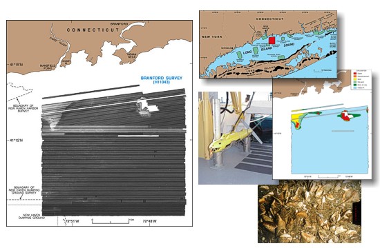
Data Acquisition and Processing |
COLLABORATORS
|
|
|
|
|
1 - U.S. Geological Survey Coastal and Marine Geology Woods Hole Science Center 384 Woods Hole Road Woods Hole, MA 02543-1598 (508) 548-8700 |
2 - National Oceanic and Atmospheric Administration Hydrographic Systems and Technology Program Bldg. 2, AHB 439 West York Street Norfolk, VA 23510 (757) 441-6726 |
|
3 - Long Island Sound Resource Center Connecticut Department of Environmental Protection Avery Point 1080 Shennecossett Road Groton, CT 06340 (860) 405-9015 |
4 - National Oceanic and Atmospheric Administration Atlantic Hydrographic Branch 439 West York Street Norfolk, VA 23510 (757) 441-6746 |

