Skip past header information
Identifier symbol and link to USGS Home page
The Gulf of the Farallones: Sidescan-Sonar Imagery, USGS Open-File Report 2004-1082

Skip past index
Figure showing the location of the Gulf of the Farallones study region

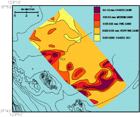
Figure 2. Sediment classification map of the Gulf of the Farallones compiled by Maher and others (1991) using Soutar Van Veen grab samples.


Back to Introduction


Skip past footer information
Home Page / Mosaic & Explanation / GIS Data / Contacts / About this Disk

[an error occurred while processing this directive]