[Link to USGS home page]
125 Years of Science for America - 1879 to 2004
link to Western Coastal and Marine Geology website

U.S. Geological Survey
Open-File Report 2004-1243

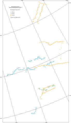
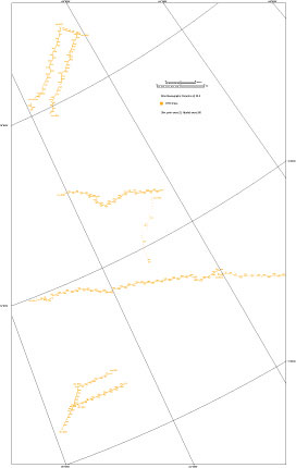
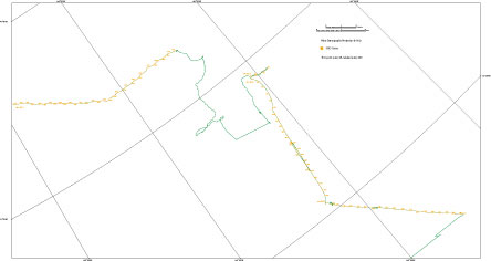
Seismic reflection and refraction data acquired in Canada Basin, Northwind Ridge and Northwind Basin, Arctic Ocean in 1988, 1992 and 1993.


Introduction
Cruise history
Data acquisition methods
Data processing
Data tables
Figures
Navigation Data
Acknowledgements
References cited
Metadata

Figure 10

a.
a. Shot point map of cruises conducted in 1988, 1992 and 1993. - Thumbnail

Full-size pdf file (4.3 MB)

b.
b. Shot point map of cruises conducted in 1988, 1992 and 1993. - Thumbnail

Full-size pdf file (2.6 MB)

c.
c. Shot point map of cruises conducted in 1988, 1992 and 1993. - Thumbnail

Full-size pdf file (0.6 MB)

Shot point map of cruises conducted in 1988, 1992 and 1993. The map is broken up into three files (.pdf) for better viewing.

Open-File Report 2004-1243 Home Page Coastal and Marine Geology Home Page

http://pubs.usgs.gov/of/2004/1243/figures/figure10.html
maintained by Michael Diggles
last modified 17 May 2004 (pjt)

USGS Privacy Statement  |  Disclaimer  |  Feedback  |  Accessibility
U.S. Department of the Interior   U.S. Geological Survey   Geologic Division
Coastal & Marine Geology Program   Western Region Coastal & Marine Geology