|
|
|
|
|
| Report Home | Maps | Overview | Mapping Methods | Coastal Classifications | Geologic Setting | Coastal Processes | Coastal Vulnerability | Classification Summary | References | |||||||||||||||||||||||||||||||
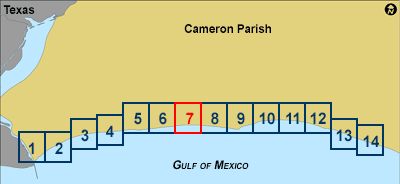
| Introduction || City: Texas Point | Johnsons Bayou/Smith Bayou | Peveto Beach | Holly Beach | Cameron | Grand Bayou | Creole/Hackberry Beach | ||||||||||||||||||||||||||||||||||||||||
| Area: Southwest | Southeast | ||||||||||||||||||||||||||||||||||||||||
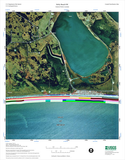
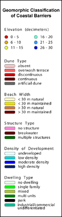
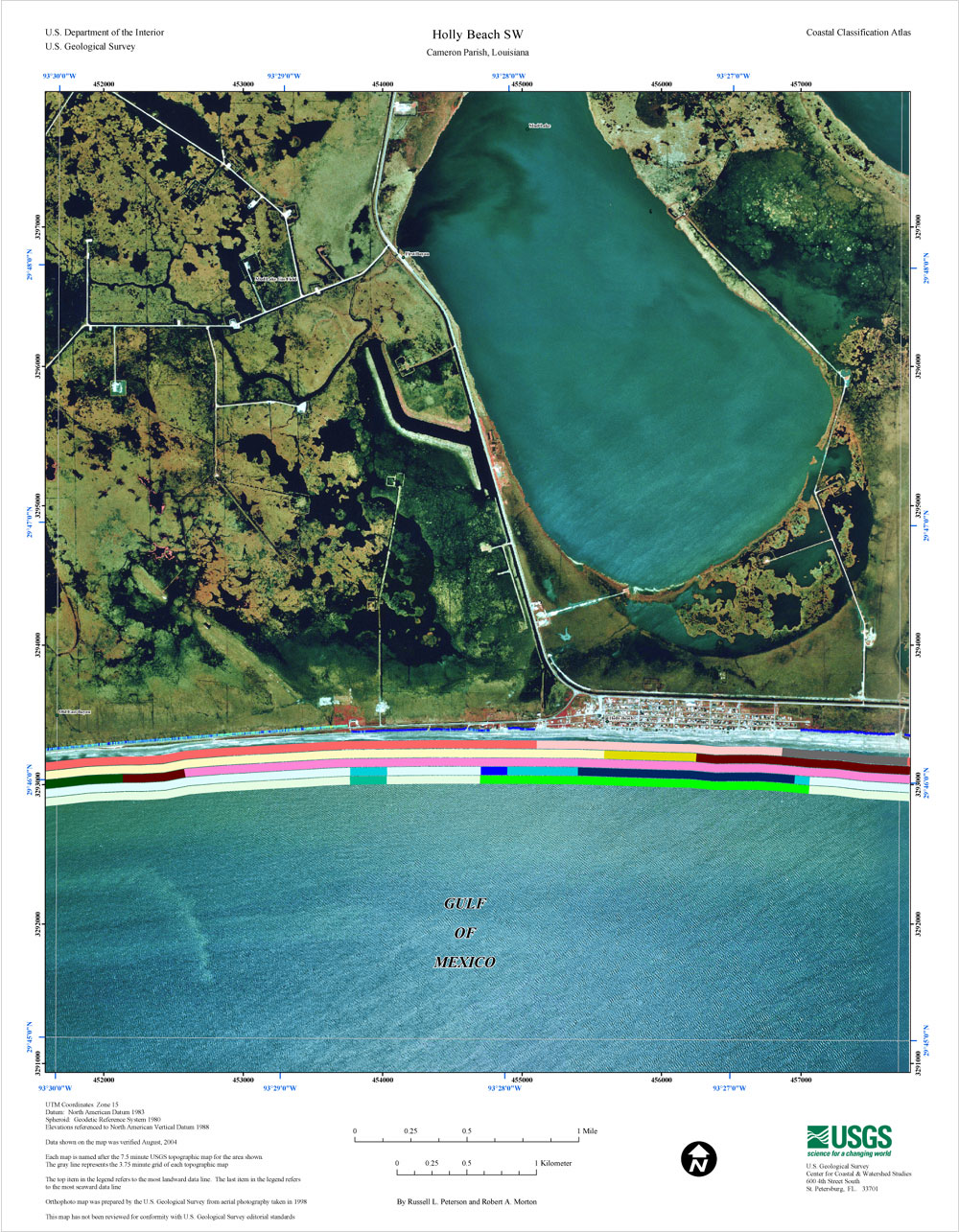
Western Louisiana Coastal Classification MapCoastal Classification Map for Holly Beach SW. Map showing the coastal classifications along the western Louisiana shoreline. The top item in the legend refers to the most landward data line. The last item in the legend refers to the most seaward data line. Click on the links below to download and view larger versions of the map. At the bottom of the page is a clickable index map that will take you to the other maps.
|
|||||||||||||||||||||||||||||||||||||||||||