Link to USGS home page.
Measurements of Wind, Aeolian Sand Transport, and Precipitation in the Colorado River Corridor, Grand Canyon, Arizona; January 2005 to January 2006
U.S. Geological Survey
Open-File Report 2006-1188

Measurements of Wind, Aeolian Sand Transport, and Precipitation in the Colorado River Corridor, Grand Canyon, Arizona; January 2005 to January 2006

By Amy E. Draut and David M. Rubin

2006


Photograph of one instrument station. Four sand traps are shown on a vertical pole at the right of the photo. A tripod with two anemometers (at heights 2.0 m and 0.5 m above ground level) is at left; the data logger is also attached to this tripod. In the center is a tipping-bucket rain gauge. (click image to view a larger version).

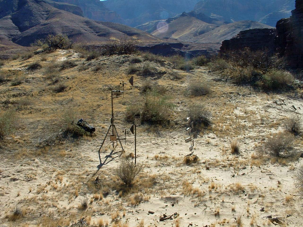
ABSTRACT

This report presents measurements of aeolian sediment-transport rates, wind speed and direction, and precipitation records from six locations that contain aeolian deposits in the Colorado River corridor through Grand Canyon, Grand Canyon National Park, Arizona. Aeolian deposits, many of which contain and preserve archaeological material, are an important part of the Grand Canyon ecosystem. This report contains data collected between January 2005 and January 2006, and is the second in a series; the first contained data that were collected between November 2003 and December 2004 (Draut and Rubin, 2005; http://pubs.usgs.gov/of/2005/1309/).

Analysis of data collected in 2005 shows great spatial and seasonal variation in wind and precipitation patterns. Total annual rainfall can vary by more than a factor of two over distances ~ 10 km. Western Grand Canyon received substantially more precipitation than the eastern canyon during the abnormally wet winter of 2005. Great spatial variability in precipitation indicates that future sedimentary and geomorphic studies would benefit substantially from continued or expanded data collection at multiple locations along the river corridor, because rainfall records collected by NPS at Phantom Ranch (near river-mile 88) cannot be assumed to apply to other areas of the canyon.

Wind velocities and sand transport in 2005 were greatest during May and June, with maximum winds locally as high as ~25 m s-1, and transport rates locally
>100 g cm-1 d-1. This represents a later peak in seasonal aeolian sand transport compared to the previous year, in which transport rates were greatest in April and May 2004. Dominant wind direction varies with location, but during the spring windy season the greatest transport potential was directed upstream in Marble Canyon (eastern Grand Canyon). At all locations, rates of sand transport during the spring windy season were 5–15 times higher than at other times of year. This information has been used to evaluate the potential for aeolian reworking of new fluvial sand deposits, and restoration of higher-elevation aeolian deposits, following the 60-hour controlled flood release from Glen Canyon Dam in November 2004. Substantial deposition of new sand occurred at all study sites during this high-flow experiment, but most of the new sediment was eroded by high flow fluctuations between January and March 2005. Comparison of aeolian sand transport in the spring windy seasons of the preand post-flood years indicates that, where some of the flood-deposited sand remained by spring, aeolian sand transport was significantly higher than during the pre-flood spring. Gully incision in an aeolian dune field was observed to be partially ameliorated by deposition of wind-blown sand derived from a nearby 2004 flood deposit. These results imply that sediment-rich controlled floods can renew sand deposition in aeolian dune fields above the flood-stage elevation. The potential for restoration of archaeological sites in aeolian deposits can be maximized by using dam operations that maximize the open sand area on fluvial sandbars during spring, when aeolian sediment transport is greatest.

Download Open-File Report 2006-1188 as an 88-page PDF file (66.5 MB)

View the supplemental data filenames for the data folder (see below).

Download the supplemental data as a .zip file that contains 117 .xls spreadsheets (24.6-MB compressed file that becomes 107 MB when opened)

For questions about the content of this report, contact Amy Draut

Version history


Download a current version of Adobe Reader for free

| Help | PDF help | Western reports main page | Open-File Reports for 2006 |
| Privacy Statement | Disclaimer | Accessibility |
| Geologic Division | Coastal and Marine Geology Program |


| Department of the Interior | U.S. Geological Survey |
URL of this page: http://pubs.usgs.gov/of/2006/1188/
Maintained by: Michael Diggles
Created: July 27, 2006
Last modified: July 27, 2006 (mfd)