| File description |
File name (Metadata) |
View |
File format |
Download zip file |
| Table 1. Basemaps (data/basemaps) |
|
|
|
|
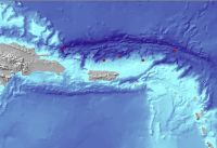
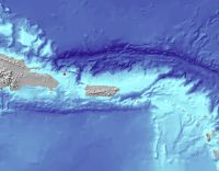
Caribbean Island Nations Coastline Boundaries
(Geographic Coordinate System, WGS84) |
caribis
|
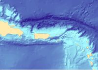 |
ESRI Shapefile polygon |
caribis.zip (102 KB) |
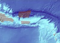
United States Exclusive Economic Zone Regional Boundary
(Geographic Coordinate System, WGS84) |
pr_eez_region
|
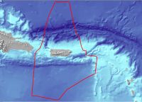 |
ESRI Shapefile polyline |
pr_eez_region.zip (307 KB) |
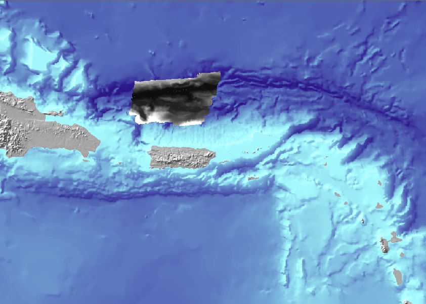
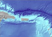
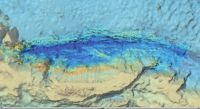
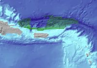
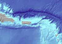
Caribbean Regional Shaded Relief Imagery for Puerto Rico Trench Featured Data
(Geographic Coordinate System, WGS84) |
shadedrelief |
 |
JPEG |
shadedrelief.zip (65 MB) |
| Table 2. IVS3D files (data/ivs3d) |
|
|
|
|
Fledermaus multibeam 150m grid object file for data collected in 2002.
(UTM, Zone 19, WGS84) |
rb2002sd |
 |
Fledermaus Grid Object |
rb2002sd.zip (5 MB) |
Fledermaus multibeam 150m grid object file for data collected in February and March of 2003.
(UTM, Zone 19, WGS84) |
rb2003sd |
 |
Fledermaus Grid Object |
rb2003sd.zip (12 MB) |
Fledermaus multibeam 150m grid object file for data collected in August and September of 2003.
(UTM, Zone 19, WGS84) |
rb2003augustsd |
 |
Fledermaus Grid Object |
rb2003augustsd.zip (5 MB) |
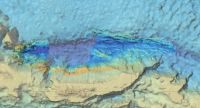
Fledermaus scene file combining the individual multibeam 150m grids object files from 2002 and 2003, along with basemap data.
(UTM, Zone 19, WGS84) |
combined |
 |
Fledermaus Scene |
combined.zip (52 MB) |
| Table 3. Multibeam grids (data/multibeam) |
|
|
|
|
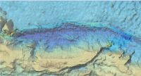
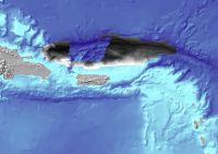
Multibeam 150 meter grid from 2002.
(UTM, Zone 19, WGS84) |
rb2002 |
 |
ESRI Grid |
rb2002_grd.zip (6 MB) |
Multibeam 150 meter grid from February and March, 2003.
(UTM, Zone 19, WGS84) |
rb2003 |
 |
ESRI Grid |
rb2003_grd.zip (16 MB) |
Multibeam 150 meter grid from August and September, 2003.
(UTM, Zone 19, WGS84) |
rb2003august |
 |
ESRI Grid |
rb2003august_grd.zip (9 MB) |
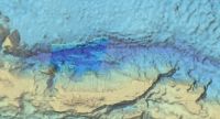
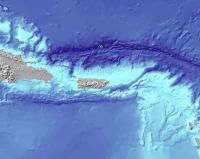
Combined grids as a sun illuminated GeoTIFF image of the Puerto Rico Trench from data collected in 2002 and 2003.
(Geographic Coordinate System, WGS84) |
combined_grd.tif |
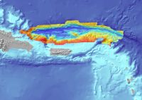 |
GeoTIFF 8 bit |
combined_grd.zip (3 MB) |
| Table 4. Navigation (data/navigation) |
|
|
|
|
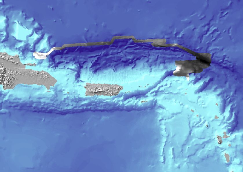
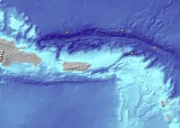
Navigation Tracklines of the USGS Cruise 03032 (NOAA RB0305) August 28 to September 4, 2003.
(Geographic Coordinate System, WGS84) |
nav2003aug
|
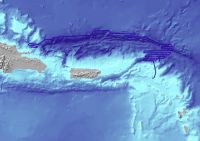 |
ESRI Shapefile polyline |
nav2003aug.zip (512 KB) |
Navigation Tracklines of the USGS Cruise 03008 (NOAA RB0303) February 18 to March 7, 2003.
(Geographic Coordinate System, WGS84) |
nav2003
|
 |
ESRI Shapefile polyline |
nav2003.zip (512 KB) |
Navigation Tracklines of the USGS Cruise 02051 (NOAA RB0208) September 24 to September 30, 2002.
(Geographic Coordinate System, WGS84) |
nav2002
|
 |
ESRI Shapefile polyline |
nav2002.zip (512 KB) |
| Table 5. Oceanography (data/oceanography) |
|
|
|
|
Oceanographic Data Device Cast Location for Joint USGS Cruise 03032 and NOAA RB0305
(Geographic Coordinate System, WGS84) |
xbt_aug2003
|
 |
ESRI Shapefile point |
xbt_aug2003.zip (102 KB) |
Oceanographic Data Device (XBT) Cast Location for Joint USGS Cruise 03008 and NOAA RB0303
(Geographic Coordinate System, WGS84) |
xbt2003
|
 |
ESRI Shapefile point |
xbt2003.zip (102 KB) |
Oceanographic Data Device (CTD) Cast Location for Joint USGS Cruise 03008 and NOAA RB0303
(Geographic Coordinate System, WGS84) |
ctd_2003
|
 |
ESRI Shapefile point |
ctd_2003.zip (102 KB) |
Oceanographic Data Device (XBT) Cast Location for Joint USGS Cruise 02051 and NOAA RB0208
(Geographic Coordinate System, WGS84) |
xbt2002
|
 |
ESRI Shapefile point |
xbt2002.zip (102 KB) |
Oceanographic Data Device (CTD) Cast Location for Joint USGS Cruise 02051 and NOAA RB0208
(Geographic Coordinate System, WGS84) |
ctd_2002
|
 |
ESRI Shapefile point |
ctd_2002.zip (102 KB) |
Excel Spreadsheet containing XBT and CTD Oceanographic Data for USGS Cruises 02051 (NOAA RB028), 03008 (NOAA RB0303), and 03032 (NOAA RB0305). (image is sample sound velocity profiles from 2003).
|
SVP_2002_2003
|
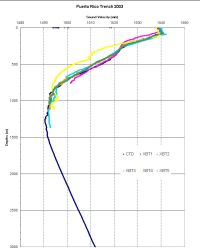 |
Excel (version 2003) spreadsheet |
svp_2002_2003xls.zip (1.5 MB) |