
Open-File Report 2007-1012
Geologic Interpretation and Multibeam Bathymetry of the Sea Floor in the Vicinity of the Race, Eastern Long Island Sound
![]() Title |
Introduction |
Setting |
Methods |
Results |
Discussion |
Data Catalog |
Acknowledgments |
References |
Figures |
Contacts
Title |
Introduction |
Setting |
Methods |
Results |
Discussion |
Data Catalog |
Acknowledgments |
References |
Figures |
Contacts
 |
||
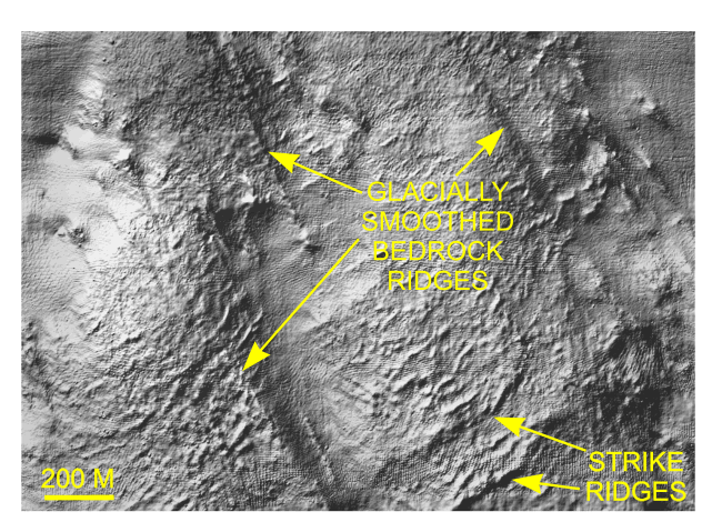
Figure 14. Detailed planar view of the multibeam DTM showing the exposed bedrock surface in the northwestern part of the study area. Glacially-smoothed bedrock ridges parallel similar features and glacial striations onshore (Goldsmith, 1962); strike ridges parallel those of the onshore Avalon Terrane. Location of view is shown in Figure 12. | ||

![]() U.S. Department of the Interior |
U.S. Geological Survey
U.S. Department of the Interior |
U.S. Geological Survey
URL: http://pubsdata.usgs.gov/pubs/of/2007/1012/html/fig14.html
Page Contact Information: GS Pubs Web Contact
Page Last Modified: Tuesday, 07-May-2024 19:49:54 EDT


