
Open-File Report 2007-1012
Geologic Interpretation and Multibeam Bathymetry of the Sea Floor in the Vicinity of the Race, Eastern Long Island Sound
![]() Title |
Introduction |
Setting |
Methods |
Results |
Discussion |
Data Catalog |
Acknowledgments |
References |
Figures |
Contacts
Title |
Introduction |
Setting |
Methods |
Results |
Discussion |
Data Catalog |
Acknowledgments |
References |
Figures |
Contacts
 |
||
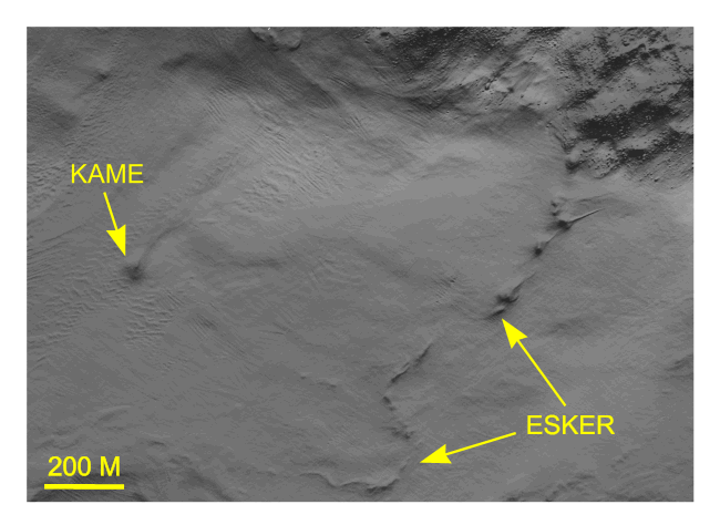
Figure 18. Detailed planar view of the multibeam DTM showing sinuous hummocky ridge interpreted to be an esker, and conical mound interpreted to be a kame. Location of view is shown in figure 12. | ||

![]() U.S. Department of the Interior |
U.S. Geological Survey
U.S. Department of the Interior |
U.S. Geological Survey
URL: http://pubsdata.usgs.gov/pubs/of/2007/1012/html/fig18.html
Page Contact Information: GS Pubs Web Contact
Page Last Modified: Tuesday, 07-May-2024 19:50:00 EDT


