Open-File Report 2009–1231
¹U.S. Geological Survey, Woods Hole Coastal and Marine Science Center, Woods Hole, MA 02543
²Atlantic Hydrographic Branch, National Oceanic and Atmospheric Administration, Norfolk, VA 23510
³Connecticut Department of Environmental Protection, Hartford, CT 06106
ABSTRACT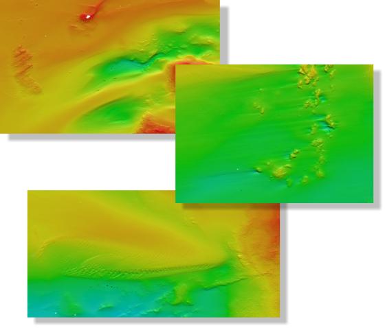
Nearshore areas within Long Island Sound are of great interest to the Connecticut and New York research and resource management communities because of their ecological, recreational, and commercial importance. Although advances in multibeam echosounder technology permit the construction of high-resolution representations of sea-floor topography in deeper waters, limitations inherent in collecting fixed-angle multibeam data make using this technology in shallower waters (less than 10 meters deep) difficult and expensive. These limitations have often resulted in data gaps between areas for which multibeam bathymetric datasets are available and the adjacent shoreline. To address this problem, the geospatial data sets released in this report seamlessly integrate complete-coverage multibeam bathymetric data acquired off New London and Niantic Bay, Connecticut, with hydrographic Light Detection and Ranging (LIDAR) data acquired along the nearshore. The result is a more continuous sea floor representation and a much smaller gap between the digital bathymetric data and the shoreline than previously available. These data sets are provided online and on CD-ROM in Environmental Systems Research Institute (ESRI) raster-grid and GeoTIFF formats in order to facilitate access, compatibility, and utility. |
Posted July 2010 For additional information contact: Part or all of this report is presented in Portable Document Format (PDF); the latest version of Adobe Reader or similar software is required to view it. Download the latest version of Adobe Reader, free of charge. |
Poppe, L.J., Danforth, W.W., McMullen, K.Y., Parker, C.E., Lewit, P.G., and Doran, E.F., 2010, Integrated multibeam and LIDAR bathymetry data offshore of New London and Niantic, Connecticut: U.S. Geological Survey Open-File Report 2009–1231. (Also available at https://pubs.usgs.gov/of/2009/1231/.)
Abstract
Introduction
Methods
Bathymetry
Data Catalog
Summary
Acknowledgments
References Cited
Contacts

![]() U.S. Department of the Interior |
U.S. Geological Survey
U.S. Department of the Interior |
U.S. Geological Survey
[an error occurred while processing this directive]
URL: https://pubsdata.usgs.gov
Page Contact Information: Contact USGS
Page Last Modified: Wednesday, 07-Dec-2016 22:25:09 EST
