
Bathymetry and Acoustic Backscatter: Northern Santa Barbara Channel, Southern California
byPete Dartnell, David Finlayson, Jamie Conrad, Guy Cochrane, Samuel Johnson
2009
Abstract
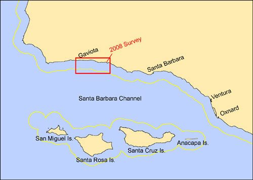
Figure 1. The Santa Barbara Channel in southern California showing the location of the
2008 USGS bathymetry and backscatter mapping (red box). The yellow line shows the
3-nautical mile California State jurisdictional limit.
In the summer of 2008, as part of the California Seafloor Mapping Program (CSMP) the U.S. Geological Survey, Coastal and Marine Geology mapped a nearshore region of the northern Santa Barbara Channel in Southern California (fig 1). The CSMP is a cooperative partnership between Federal and State agencies, Universities, and Industry to create a comprehensive coastal/marine geologic and habitat basemap series to support the Marine Life Protection Act (MLPA) inititive. The program is supported by the California Ocean Protection Council and the California Coastal Conservancy.
The 2008 mapping collected high resolution bathymetry and acoustic backscatter data using a bathymetric side scan system within State waters from about the 10-m isobath out over 3-nautical miles. This Open-File Report provides these data in a number of different formats, as well as a summary of the mapping mission, maps of bathymetry and backscatter, and FGDC metadata.
For more information contact: Peter Dartnell
