Open-File Report 2011-1039
Data CatalogThis report contains geographic information system (GIS) data in vector and raster formats. The vector data are available in Esri shapefile format. Shapefiles generally include .shp, .shx, and .dbf files at a minimum. All these data files include the .prj files that contain the dataset projection information. The raster data are available in Esri binary grid format and GeoTIFF format. For the sake of brevity, only the filename prefix has been included in the column ‘Filename’ listed below. Clicking on the image in the ‘View’ column of GIS-compatible data will display a thumbnail image of the dataset. The files necessary to load each dataset into a compatible GIS have been compressed into a single zip file, along with Federal Geographic Data Committee (FGDC)-compliant metadata in text, FAQ, HTML and XML format. A second XML metadata format generated and viewable by ArcCatalog is also included in the compressed zip file. In addition, the FGDC-compliant text, FAQ, and HTML versions of the metadata for each dataset have links provided in the links in the ‘Metadata’ column listed below. The data files can be downloaded directly from the ‘Download link and file size’ portion of the tables. In addition to the GIS data, this report also contains CRP and chirp seismic-reflection data. The CRP data are available in both raw and processed formats. Each line of data acquisition comprises multiple files, as described in the Methods section of this report. For this reason, these data are organized by day of collection and are available as compressed zip files for each day of data collection. The seismic-reflection data are available as JPEG images of the profiles and in the SEG-Y data format. All of the JPEG images of the seismic profiles are available for download in a single compressed zip file. The SEG-Y format files are available from the link to the folder where these files reside (data/seismics/segy/) and can be downloaded individually. The CRP tracklines as well as the seismic-reflection profile tracklines can be hyperlinked to associated images within ArcGIS. Within the CRP tracklines shapefile, two text attributes, “hotlink” and “hlink2”, can be utilized to hyperlink to the JPEG images of the resistivity profiles. The “hotlink” attribute points to the MATLAB JPEG image, and the “hlink2” attribute points to the long version of the EarthImager 2D JPEG image. Within the seismic-reflection tracklines shapefile, the attribute “hotlink” points to the JPEG image of the seismic-reflection profile. The metadata for each trackline shapefile gives further instruction on using the hyperlink feature. Additional data included in the tables below are the HYPACK navigation files (both raw and converted to shapefile format), the YSI 600 XLM surface water data, and the handwritten data acquisition logs converted into the Portable Document Format (PDF). These files along with the FGDC-compliant metadata are available from the tables in compressed zip files. To download the data from the table below, use the mouse to right-click on the link in the ‘Download…’ column, then select ‘Save Target As…’ to save the compressed zip file to the local hard drive. Microsoft Windows, since the Millennium Edition, supports extracting zip files natively without additional third party software. Simply double-click on the file to begin the extraction wizard. In cases where a utility program to uncompress files is needed and not currently installed on the local system, 7-zip (http://www.7-zip.org/) provides an open source utility. These files were compressed with WinZip version 9.0. Data Organization The data are organized in folders on the website. Data layers can be downloaded individually using the table below. If the website folder structure for the data is replicated on a computer, the provided ArcMap 9.2 map document, ofr2011-1039_IndianRiverBay.mxd, can be used to display the data layers. The ArcMap document was created with the "Save As" command in ArcMap 9.3.1 in order to generate the 9.2 version document. data — Top-level directory for all the data.
|
basemap (data/basemap/)
| Filename | Description | View | Metadata | Download |
|---|---|---|---|---|
| nos80k_northeast | Polyline shapefile from the National Oceanic and Atmospheric Administration of the shoreline in the Northeast United States. (Geographic, NAD83) |  |
nos80k_northeast.zip 8.3 MB |
|
| irb_bathy | Esri binary grid of Indian River Bay bathymetry generated from fathometer data. (UTM, Zone 18, WGS84, NGVD29) | 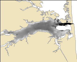 |
irb_bathy.zip 0.26 MB |
|
| irb_bathyimg | Color GeoTIFF image of Indian River Bay bathymetry generated from fathometer data. (UTM, Zone 18, WGS84) | 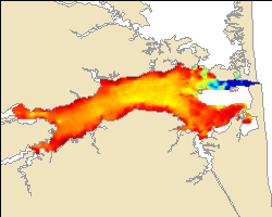 |
irb_bathyimg.zip 0.06 MB |
|
| irb_bathy_geo | Color GeoTIFF image of Indian River Bay bathymetry generated from fathometer data. (Geographic, WGS84) | 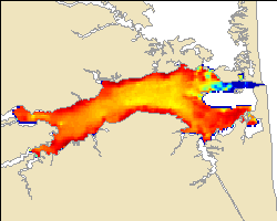 |
irb_bathy_geo.zip 0.06 MB |
navigation (data/navigation/)
These data are organized into three subdirectories based on the instrument associated with the navigation.
| hypack - this folder contains the navigation recorded by the HYPACK navigation system (data/navigation/hypack/). |
| resistivity - this folder contains the navigation recorded by the Lowrance GPS that is part of the CRP acquisition system (data/navigation/resistivity/). |
| seismics - this folder contains the navigation used with the seismic-reflection profiles (data/navigation/seismics/). |
| Filename | Description | View | Metadata | Download |
|---|---|---|---|---|
| jd103hypack | Point shapefile of the parsed HYPACK navigation from Julian day 103 (April 13, 2010). (Geographic, WGS84) | 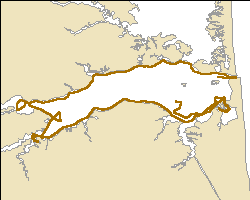 |
jd103hypack.zip 0.52 MB |
|
| jd104hypack | Point shapefile of the parsed HYPACK navigation from Julian day 104 (April 14, 2010). (Geographic, WGS84) | 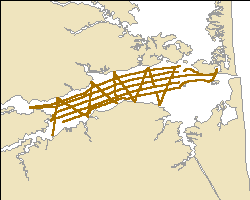 |
jd104hypack.zip 0.68 MB |
|
| jd105hypack | Point shapefile of the parsed HYPACK navigation from Julian day 105 (April 15, 2010). (Geographic, WGS84) | |
jd105hypack.zip 0.66 MB |
|
| hypacknav_raw | Text files of the raw HYPACK navigation collected during Field Activity 2010-006-FA. | hypacknav_raw.zip 6.4 MB |
||
| jd103gps_bestdepth | Point shapefile of all the navigation fixes acquired with the CRP data on Julian day 103 (April 13, 2010) with additional bathymetry data processing. (Geographic, WGS84) | 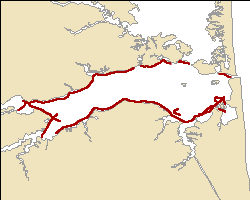 |
jd103gps_bestdepth.zip 0.28 MB |
|
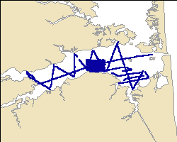
| jd103gps_lines_splits | Polyline shapefile of all the navigation fixes acquired with the CRP data on Julian day 103 (April 13, 2010). Original polylines, as well as polylines split to correspond to processed sections, are included. (Geographic, WGS84) | 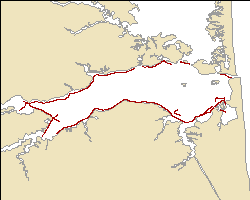 |
jd103gps_lines_splits.zip 0.08 MB |
|
| jd104gps_bestdepth | Point shapefile of all the navigation fixes acquired with the CRP data on Julian day 104 (April 14, 2010) with additional bathymetry data processing. (Geographic, WGS84) | 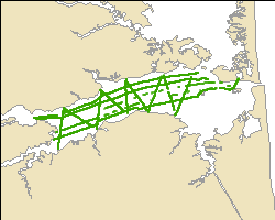 |
jd104gps_bestdepth.zip 0.38 MB |
|
| jd104gps_lines | Polyline shapefile of all the navigation fixes acquired with the CRP data on Julian day 104 (April 14, 2010). (Geographic, WGS84) | 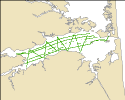 |
jd104gps_lines.zip 0.09 MB |
|
| jd105gps_bestdepth | Point shapefile of all the navigation fixes acquired with the CRP data on Julian day 105 (April 14, 2010) with additional bathymetry data processing. (Geographic, WGS84) | 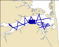 |
jd105gps_bestdepth.zip 0.44 MB |
|
| jd105gps_lines_splits | Polyline shapefile of all the navigation fixes acquired with the CRP data on Julian day 105 (April 15, 2010). Original polylines, as well as polylines split to correspond to processed sections are included. (Geographic, WGS84) | 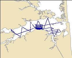 |
jd105gps_lines_splits.zip 0.11 MB |
|
| ir_seisnav | Point shapefile of all the unique seismic shot point navigation collected during the cruise. (Geographic, WGS84) | 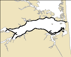 |
ir_seisnav.zip 0.48 MB |
|
| ir_100shot_sort | Point shapefile of the 100 shot interval seismic navigation. (Geographic, WGS84) | 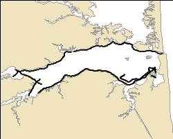 |
ir_100shot_sort.zip 0.08 MB |
|
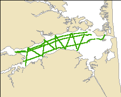
| ir_Routes_Calib | Polyline-M shapefile of all the seismic navigation calibrated to the shot point navigation. (Geographic, WGS84) | 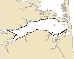 |
ir_Routes_Calib.zip 0.21 MB |
CRP data (data/resistivity/)
| Raw CRP data (data/resistivity/raw_resis/): Compressed zip file contains the raw resistivity data collected by the AGI SuperSting system. |
| Processed CRP data (data/resistivity/proc_resis/): Compressed file includes the linearized STG file and accompanying DEP file, the EarthImager processed files that used the measured water resistivity value when possible, and the MATLAB-generated profile images. Additionally, one folder contains the linearized STG file and accompanying DEP file and a CON file containing the continuous water resistivity values as well as the EarthImager processing results and MATLAB-generated profile images. |
| Processed CRP data (data/resistivity/shapefile/): Compressed file includes processed CRP data below the sediment water interface in shapefile format. |
| RES2DINV format CRP data (data/resistivity/res2dinv_format/): WinZip file includes the RES2DINV format files based on the linearized STG and DEP files. |
See the metadata for more details on the individual file types and how they were generated.
| Filename | Description | Metadata | Download |
|---|---|---|---|
| apr12_raw | Compressed zip file containing the raw CRP data from April 12, 2010, in Indian River Bay. | apr12_raw.zip 0.06 MB |
|
| apr13_raw | Compressed zip file containing the raw CRP data from April 13, 2010, in Indian River Bay. | apr13_raw.zip 0.78 MB |
|
| apr14_raw | Compressed zipfile containing the raw CRP data from April 14, 2010, in Indian River Bay. | apr14_raw.zip 0.99 MB |
|
| apr15_raw | Compressed zip file containing the raw CRP data from April 15, 2010, in Indian River Bay. | apr15_raw.zip 1.24 MB |
|
| apr13_proc | Compressed zipfile containing the processed CRP data from April 13, 2010, in Indian River Bay. | ||
| apr14_proc | Compressed zip file containing the processed CRP data from April 14, 2010, in Indian River Bay. | apr14_proc.zip 45.4 MB |
|
| apr15_proc | Compressed zip file containing the processed CRP data from April 15, 2010, in Indian River Bay. | apr15_proc.zip 71.0 MB |
|
| watercon_proc | Compressed zip file containing the processed CRP using continuous water resistivity values in Indian River Bay. | watercon_proc.zip 41.5 MB |
|
mrgapr13_allxyzres |
Point shapefile of all the processed resistivity data from April 13, 2010, in Indian River Bay with data points in the water column removed. | mrgapr13_allxyzres.zip 12.9 MB |
|
mrgapr14_allxyzres |
Point shapefile of all the processed resistivity data from April 14, 2010, in Indian River Bay with data points in the water column removed. | mrgapr14_allxyzres.zip 15.3 MB |
|
mrgapr15_allxyzres |
Point shapefile of all the processed resistivity data from April 15, 2010, in Indian River Bay with data points in the water column removed. | mrgapr15_allxyzres.zip 21.9 MB |
|
mrgwcon_allxyzres |
Point shapefile of all the resistivity data processed with continuous water conductivity values in Indian River Bay with data points in the water column removed. | mrgwcon_allxyzres.zip 20.7 MB |
|
| apr13_res2dinv | RES2DINV formatted CRP data from April 13, 2010, in Indian River Bay, Delaware. | apr13_res2dinv.zip 0.32 MB |
|
| apr14_res2dinv | RES2DINV formatted CRP data from April 14, 2010, in Indian River Bay, Delaware. | apr14_res2dinv.zip 0.41 MB |
|
| apr15_res2dinv | RES2DINV formatted CRP data from April 15, 2010, in Indian River Bay, Delaware. | apr15_res2dinv.zip 0.55 MB |
Chirp seismic-reflection profiles (data/seismics/)
| Filename | Description | Metadata | Download |
|---|---|---|---|
| seismic_jpegs | Compressed zip file of all the seismic-reflection profiles in the JPEG image format. | seismic_jpegs.zip 19.4 MB |
|
| seismic_segy | SEG-Y format of the chirp seismic-reflection data. The top link is to the folder containing the data. The second link is to a compressed zip file of the metadata. | data/seismics/segy/ seismic_segymeta.zip |
YSI 600 XLM data (data/ysi_sensor/)
| Filename | Description | Metadata | Download |
|---|---|---|---|
| IndianRivBayYSI | Excel 2003 spreadsheet containing the YSI 600 XLM data collected in Indian River Bay in April 2010. | IndianRivBayYSI.zip 0.10 MB |
|
| ysi_Merge | Point shapefile of filtered YSI 600 data that have been assessed to be valid values for use with the CRP data. (Geographic, WGS84) | ysi_Merge.zip 0.07 MB |
PDF logs (data/survey_log/)
| Filename | Description | Metadata | Download |
|---|---|---|---|
| cruise2010-006_logs | PDF file of the data acquisition logs. | cruise2010-006_logs.zip 1.91 MB |

![]() U.S. Department of the Interior |
U.S. Geological Survey
U.S. Department of the Interior |
U.S. Geological Survey
URL: http://pubsdata.usgs.gov/pubs/of/2011/1039/html/ofr2011-1039-catalog.html
Page Contact Information: GS Pubs Web Contact
Page Last Modified: Thursday, 07-Aug-2014 15:52:26 EDT