Appendix 1 — Geospatial Data
This section describes the qualitatively derived data interpretation, selected source data files, the location of the data, and how to access the data.
Data Format and Projection
All vector data are delivered as Esri shapefiles in the geographic coordinate system, referenced to the World Geodetic System of 1984 (WGS 84). Raster representations of bathymetry and seismic interpretation products are in Esri binary grid or GeoTIFF formats in Universal Transverse Mercator (UTM) projection, Zone 19N, WGS 84 datum. Shaded relief of the surface terrain of Massachusetts is in MrSID image format in the Massachusetts Mainland state plane coordinate system (Federal Information Processing Standards Zone 2001, North American Datum of 1983 [NAD 83]). All spatial data are distributed with Federal Geographic Data Committee (FGDC)-compliant metadata in text, FGDC Classic hypertext markup language (HTML), and FAQ HTML formats. Esri ArcCatalog can also be used to examine the metadata available in the Esri extensible markup language (XML) format associated with each geographic information system (GIS) data file.
Data Access
The datasets from this project can be accessed in the following ways:
- With ArcGIS 9.3 or later, all shapefile and raster data may be viewed and manipulated, although the Spatial Analyst extension will be required to fully examine and work with the Esri grids. Copy the GIS_catalog folder or download the GIS_catalog.zip file (382 megabytes) to a computer and open the ArcMap document 2016-1119.mxd. This map document has all the data layers loaded in the table of contents.
- Without any GIS software, view the data through ArcReader, a free mapping application distributed by Esri for Windows, Linux, and Unix operating systems. Download ArcReader from the Esri Web site (http://www.Esri.com/software/arcgis/arcreader/download.html) and follow the directions for downloading and installing the software. Once ArcReader is installed, all the data can be viewed by opening the published map file (PMF) named 2016-1119.pmf, which was created in ArcMap version 9.3.1.
Data Organization
The data are organized in folders on the Publications Warehouse Web site. The file structure is described below. Data layers can be downloaded individually from the table below or collectively from the GIS_catalog.zip file (382 megabytes).
 GIS_catalog GIS_catalog
2016-1119.mxd—ArcMap™ 9.3 map document containing selected data layers described below.
2016-1119.pmf— Esri ArcReader (created with Esri ArcGIS Publisher 9.3.1) map document for use with free ArcReader software. Download ArcReader at http://www.esri.com/software/arcgis/arcreader/download.html.
Basemap
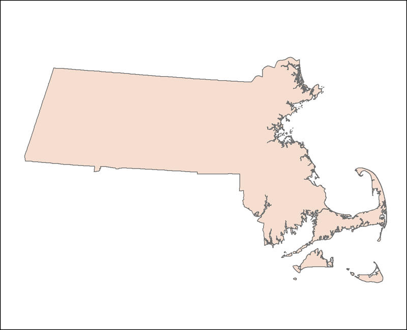
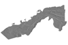
OUTLINE25K_POLY_dd.shp—Shapefile: Outline of the Commonwealth of Massachusetts (1:25,000)
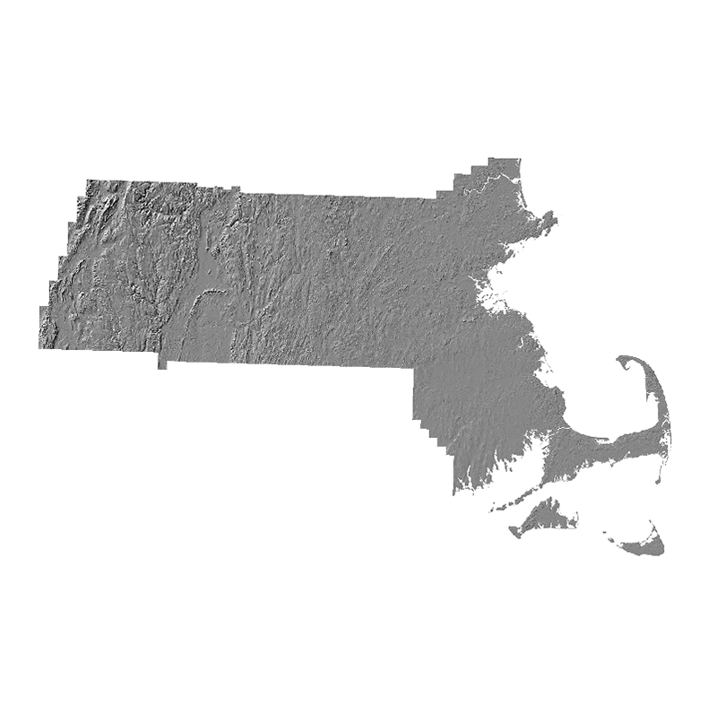
shdrel5k—MrSID Image: Shaded relief for the surface terrain of the Commonwealth of Massachusetts (1:5,000)
PhysiographicZones
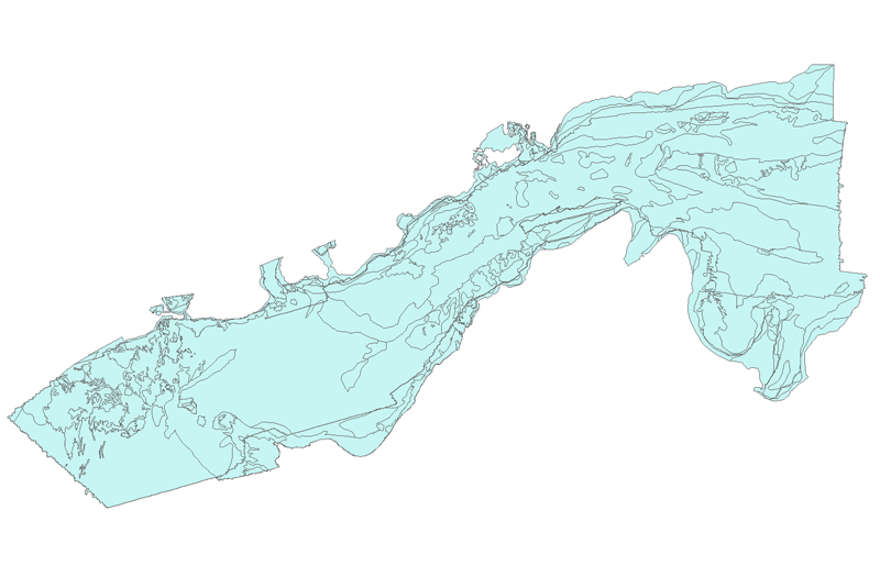
VineyardNantucketSound_Pzones.shp—Shapefile: Physiographic zones polygons defined through the interpretation of geophysical and sample data.
SedimentTexture
VineyardNantucketSound_sedcover.shp—Shapefile: Sediment texture polygons defined through the interpretation of geophysical and sample data.
SourceData
- bathy
- vns10m_navd88—Grid: Bathymetry at 10-m resolution.
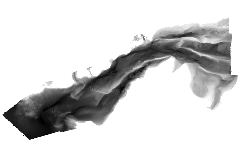
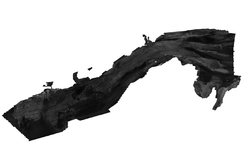
- vns10m_navd88_hs.tif—GeoTIFF Image: Hillshaded relief image at 10-m resolution.
- backscatter
- vns_bsmos_1m—GeoTIFF Image: Acoustic-backscatter intensity mosaic image at 1-m resolution.
Stratigraphy
- vnspgisop
- vnspgisop—Grid: Thickness of postglacial stratigraphic unit at 40-m resolution.
- vnsurnavd88
- vnsurnavd88—Grid: Elevation of late Wisconsinan to Early Holocene regressive unconformity (Ur) at 40-m resolution.
- vnsurnavd88hs
- nvsurnavd88hs.tif—GeoTIFF Image: Hillshaded relief image of the Ur surface at 40-m resolution.
SurficialGeology
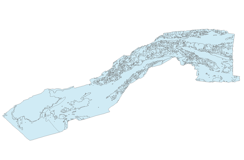
VineyardNantucketSound_surfgeol.shp—Shapefile: Surficial geology as defined through the interpretation of seismic profiles.
Data Preview
To download raster and vector data, right click on the link within the “Download” column in the table below. “Save Target As...” to save a compressed ZIP file to the local hard drive.
Basemap
| Filename |
Description |
View |
Metadata |
Download |
| OUTLINE25K_POLY_dd.shp |
Polygon shapefile outline of the Commonwealth of Massachusetts (1:25,000, geographic) |
|
|
|
| shdrel5k |
MrSID image of shaded relief for the surface terrain of the Commonwealth of Massachusetts (1:5,000, Massachusetts Mainland state plane FIPS Zone 2001 NAD 83) |
 |
|
|
Physiographic Zones
| Filename |
Description |
View |
Metadata |
Download |
| VineyardNantucketSounds_Pzones.shp |
Polygon shapefile of physiographic zones of Vineyard and western Nantucket Sounds (geographic) |
|
|
|
Sediment Texture
| Filename |
Description |
View |
Metadata |
Download |
| VineyardNantucketSound_sedcover.shp |
Polygon shapefile of sediment texture of Vineyard and western Nantucket Sounds (geographic) |
|
|
|
Source Data
| Filename |
Description |
View |
Metadata |
Download |
| vns10m_navd88 |
Esri binary grid of the bathymetry of Vineyard and western Nantucket Sounds at 10-m resolution (UTM Zone 19N) |
|
|
|
| vns10m_navd88_hs.tif |
Gray-scale GeoTIFF image of the hillshaded relief of Vineyard and western Nantucket Sounds at 10-m resolution (UTM Zone 19N) |
 |
|
|
| vns_bsmos_1m.tif |
Gray-scale GeoTIFF image of acoustic-backscatter intensity of Vineyard and western Nantucket Sounds at 1-m resolution (UTM Zone 19N) |
 |
|
|
Stratigraphy
| Filename |
Description |
View |
Metadata |
Download |
| vnspgisop |
Esri binary grid of the thickness of the postglacial stratigraphic unit of Vineyard and western Nantucket Sounds at 40-m resolution (UTM Zone 19N) |
 |
|
|
| vnsurnavd88 |
Esri binary grid of the Elevation of late Wisconsinan to Early Holocene regressive unconformity (Ur) at 40-m resolution (UTM Zone 19N) |
 |
|
|
| vnsurnavd88hs.tif |
Gray-scale GeoTIFF image hillshaded relief image of the Ur surface of Vineyard and western Nantucket Sounds at 40-m resolution (UTM Zone 19N) |
 |
|
|
Surficial Geology
| Filename |
Description |
View |
Metadata |
Download |
| VineyardNantucketSounds_surfgeol.shp |
Polygon shapefile of the surficial geology of Vineyard and western Nantucket Sounds (geographic) |
|
|
|
|