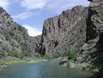
 Photograph by Karl Kellogg Photograph by Karl Kellogg
The online edition of this publication consists of a digital database, metadata,
screen-optimized PDF file for the map sheet, and PDF file that is accessible
as defined in Section 508 of the Rehabilitation Act. A high-quality printed
edition of this publication is for sale by Information Services, U.S.
Geological Survey (1-888-ASK-USGS).
Version 1.0
|
| Posted November 2004 |
|
Part or all of this report is presented in Portable Document Format. The latest
version of Adobe Acrobat Reader or similar software is required
to view it. If you wish to download the latest version of Acrobat
Reader free of charge, click here.
|
|
