Scientific Investigations Report 2008–5100
 Prepared in cooperation with the Maine Department of Marine Resources
Bureau of Sea Run Fisheries and Habitat
Prepared in cooperation with the Maine Department of Marine Resources
Bureau of Sea Run Fisheries and HabitatThis report is available only online in PDF Format (5,393 MB)
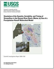
The cover for this report is also available in PDF Format (2,517 MB)The U.S. Geological Survey (USGS), in cooperation with the Maine Department of Marine Resources Bureau of Sea Run Fisheries and Habitat, began a study in 2004 to characterize the quantity, variability, and timing of streamflow in the Dennys River. The study included a synoptic summary of historical streamflow data at a long-term streamflow gage, collecting data from an additional four short-term streamflow gages, and the development and evaluation of a distributed-parameter watershed model for the Dennys River Basin. The watershed model used in this investigation was the USGS Precipitation-Runoff Modeling System (PRMS).
The Geographic Information System (GIS) Weasel was used to delineate the Dennys River Basin and subbasins and derive parameters for their physical geographic features. Calibration of the models used in this investigation involved a four-step procedure in which model output was evaluated against four calibration data sets using computed objective functions for solar radiation, potential evapotranspiration, annual and seasonal water budgets, and daily streamflows. The calibration procedure involved thousands of model runs and was carried out using the USGS software application Luca (Let us calibrate). Luca uses the Shuffled Complex Evolution (SCE) global search algorithm to calibrate the model parameters. The SCE method reliably produces satisfactory solutions for large, complex optimization problems. The primary calibration effort went into the Dennys main stem watershed model. Calibrated parameter values obtained for the Dennys main stem model were transferred to the Cathance Stream model, and a similar four-step SCE calibration procedure was performed; this effort was undertaken to determine the potential to transfer modeling information to a nearby basin in the same region. The calibrated Dennys main stem watershed model performed with Nash-Sutcliffe efficiency (NSE) statistic values for the calibration period and evaluation period of 0.79 and 0.76, respectively. The Cathance Stream model had an NSE value of 0.68.
The Dennys River Basin models make use of limited streamflow-gaging station data and provide information to characterize subbasin hydrology. The calibrated PRMS watershed models of the Dennys River Basin provide simulated daily streamflow time series from October 1, 1985, through September 30, 2006, for nearly any location within the basin. These models enable natural-resources managers to characterize the timing and quantity of water moving through the basin to support many endeavors including geochemical calculations, water-use assessment, Atlantic salmon population dynamics and migration modeling, habitat modeling and assessment, and other resource-management scenario evaluations. Characterizing streamflow contributions from subbasins in the basin and the relative amounts of surface- and ground-water contributions to streamflow throughout the basin will lead to a better understanding of water quantity and quality in the basin. Improved water-resources information will support Atlantic salmon protection efforts.
If you have Adobe® Acrobat® or Adobe® Acrobat® Reader® installed on your computer, you may view and print the PDF version of this report. Acrobat Reader is a free download from Adobe Systems, Inc. Users with disabilities can view information concerning accessibility at access.Adobe.com.
Suggested citation: Dudley, R.W., 2008, Simulation of the quantity, variability, and timing of streamflow in the Dennys River Basin, Maine, by use of a precipitation-runoff watershed model: U.S. Geological Survey Scientific Investigations Report 2008–5100, 44 p., available only online at http://pubs.usgs.gov/sir/2008/5100/.
For more information contact:
Director,
U.S. Geological Survey Maine Water Science Center
196 Whitten Road,
Augusta, Maine 04330
Telephone: (207) 622-8201
Email: dc_me@usgs.gov
Web site: http://me.water.usgs.gov