Scientific Investigations Report 2008–5235
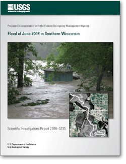
ABSTRACTIn June 2008, heavy rain caused severe flooding across southern Wisconsin. The floods were aggravated by saturated soils that persisted from unusually wet antecedent conditions from a combination of floods in August 2007, more than 100 inches of snow in winter 2007–08, and moist conditions in spring 2008. The flooding caused immediate evacuations and road closures and prolonged, extensive damages and losses associated with agriculture, businesses, housing, public health and human needs, and infrastructure and transportation. Record gage heights and streamflows occurred at 21 U.S. Geological Survey streamgages across southern Wisconsin from June 7 to June 21. Peak-gage-height data, peak-streamflow data, and flood probabilities are tabulated for 32 USGS streamgages in southern Wisconsin. Peak-gage-height and peak-streamflow data also are tabulated for three ungaged locations. Extensive flooding along the Baraboo River, Kickapoo River, Crawfish River, and Rock River caused particularly severe damages in nine communities and their surrounding areas: Reedsburg, Rock Springs, La Farge, Gays Mills, Milford, Jefferson, Fort Atkinson, Janesville, and Beloit. Flood-peak inundation maps and water-surface profiles were generated for the nine communities in a geographic information system by combining flood high-water marks with available 1-10-meter resolution digital-elevation-model data. The high-water marks used in the maps were a combination of those surveyed during the June flood by communities, counties, and Federal agencies and hundreds of additional marks surveyed in August by the USGS. The flood maps and profiles outline the extent and depth of flooding through the communities and are being used in ongoing (as of November 2008) flood response and recovery efforts by local, county, State, and Federal agencies. |
For additional information contact: Part or all of this report is presented in Portable Document Format (PDF); the latest version of Adobe Reader or similar software is required to view it. Download the latest version of Adobe Reader, free of charge. |
Fitzpatrick, F.A.; Peppler, M.C.; Walker, J.F.; Rose, W.J., Waschbusch, R.J., and Kennedy, J.L., 2008, Flood of June 2008 in southern Wisconsin: U.S. Geological Survey Scientific Investigations Report 2008–5235, 24 p.
Abstract
Introduction
Methods
Flood of June 2008 in Southern Wisconsin
Important Findings Relative to Study Methods
Summary and Conclusions
Acknowledgments
References Cited
Glossary
Appendixes 1–9. Results for the June 2008 flood for selected sites in Wisconsin

![]() U.S. Department of the Interior |
U.S. Geological Survey
U.S. Department of the Interior |
U.S. Geological Survey
URL: http://
pubsdata.usgs.gov
/pubs/sir/2008/5235/index.html
Page Contact Information: USGS Publications Team
Page Last Modified: Thursday, 10-Jan-2013 19:02:08 EST
